Welsby, Queensland facts for kids
Quick facts for kids WelsbyBribie Island, Queensland |
|||||||||||||||
|---|---|---|---|---|---|---|---|---|---|---|---|---|---|---|---|

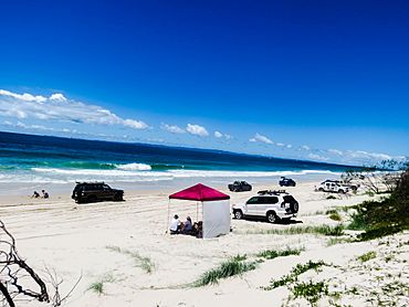
Off roading on eastern side of Welsby with Moreton Island on the horizon
|
|||||||||||||||
| Population | 0 (2021 census) | ||||||||||||||
| • Density | 0/km2 (0/sq mi) | ||||||||||||||
| Postcode(s) | 4507 | ||||||||||||||
| Area | 68.0 km2 (26.3 sq mi) | ||||||||||||||
| Time zone | AEST (UTC+10:00) | ||||||||||||||
| Location |
|
||||||||||||||
| LGA(s) | City of Moreton Bay | ||||||||||||||
| State electorate(s) | Glass House | ||||||||||||||
| Federal Division(s) | Longman | ||||||||||||||
|
|||||||||||||||
Welsby is a special kind of area called a locality. It is located on Bribie Island in Queensland, Australia. Welsby is part of the City of Moreton Bay. In 2021, very few people lived in Welsby, or sometimes no one at all.
Contents
What is Welsby Like?
Welsby is in the middle part of Bribie Island. It has water on both sides. The Pumicestone Channel is on its western side. This channel is also known as Pumicestone Passage. The Coral Sea is on its eastern side.
Most of Welsby is a protected area. This means it is part of the Bribie Island National Park or the Bribie Island State Forest. These areas help protect nature. There is only a small strip of land along the west coast that is not protected. This land is right next to the Pumicestone Channel.
Important Waterways and Points
Welsby has a few important points along its coast:
- Gallagher Point (27°00′50″S 153°05′57″E / 27.0140°S 153.0993°E)
- Mission Point (26°58′45″S 153°04′38″E / 26.9792°S 153.0772°E)
There are also several waterways near Welsby:
- Gallagher Gutter (27°01′28″S 153°06′40″E / 27.0245°S 153.1112°E) is a channel close to the western shore. It goes south into White Patch.
- Pumicestone Channel (26°56′47″S 153°04′30″E / 26.9463°S 153.0751°E) is further out on the western side. It stretches from Moreton Bay near Bongaree all the way to the northern tip of Bribie Island. It then connects to the Coral Sea near Caloundra.
- Skirmish Passage (26°58′45″S 153°10′03″E / 26.9793°S 153.1675°E) is close to the eastern shore. It runs from the north of Bribie Island down to Woorim in the south-east.
- North West Channel (26°55′14″S 153°11′38″E / 26.9205°S 153.1939°E) is further off the eastern shore. It goes past Welsby from Kings Beach at Caloundra to Woorim.
Poverty Creek (26°59′27″S 153°05′35″E / 26.9908°S 153.0931°E) is a creek that flows into the Pumicestone Channel.
There are also two lagoons on the eastern side of Welsby:
- Mermaid Lagoon (27°00′10″S 153°10′00″E / 27.0028°S 153.1667°E)
- Welsby Lagoon (26°57′49″S 153°09′12″E / 26.9637°S 153.1532°E)
History of Welsby
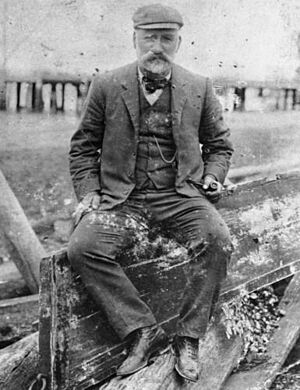
The name "Welsby" comes from a person named Thomas Welsby. He was a politician in Queensland. A politician is someone who helps make laws and decisions for a state or country. Thomas Welsby really enjoyed sailing and fishing in Moreton Bay.
Who Lives in Welsby?
In 2011, only 4 people lived in Welsby. By 2016, the population grew slightly to 5 people. However, in 2021, the area had "no people or a very low population." This means it's a very quiet place!
Schools Near Welsby
There are no schools directly in Welsby. The closest primary school for younger students is Banksia Beach State School. It is located in Banksia Beach, which is a nearby area to the south. For older students, the closest high school is Bribie Island State High School. This school is in Bongaree, also to the south of Welsby.
Fun Things to See and Do
One interesting attraction near Welsby is Wild Banks. This is a large artificial reef in the Moreton Bay Marine Park. An artificial reef is a human-made structure placed on the seabed. It helps create new habitats for marine life.
Wild Banks (26°54′31″S 153°17′34″E / 26.9086°S 153.2927°E) has special "fish cages." These cages are designed to attract large fish that swim in open waters. Some of these fish include mackerel, dolphin fish, and wahoo. It's a great spot for fishing!
 | Delilah Pierce |
 | Gordon Parks |
 | Augusta Savage |
 | Charles Ethan Porter |


