Woorim, Queensland facts for kids
Quick facts for kids WoorimBribie Island, Queensland |
|||||||||||||||
|---|---|---|---|---|---|---|---|---|---|---|---|---|---|---|---|

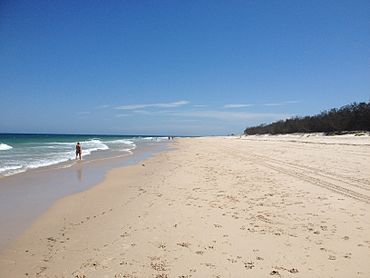
Woorim Beach
|
|||||||||||||||
| Population | 1,843 (2021 census) | ||||||||||||||
| • Density | 70.61/km2 (182.9/sq mi) | ||||||||||||||
| Postcode(s) | 4507 | ||||||||||||||
| Area | 26.1 km2 (10.1 sq mi) | ||||||||||||||
| Time zone | AEST (UTC+10:00) | ||||||||||||||
| Location |
|
||||||||||||||
| LGA(s) | City of Moreton Bay | ||||||||||||||
| State electorate(s) | Pumicestone | ||||||||||||||
| Federal Division(s) | Longman | ||||||||||||||
|
|||||||||||||||
Woorim is a lovely town and suburb located on Bribie Island in Queensland, Australia. It's part of the City of Moreton Bay. In 2021, about 1,843 people called Woorim home.
Contents
Exploring Woorim's Location
Woorim is found on the south-eastern side of Bribie Island. The beautiful Coral Sea is to its east, and Moreton Bay is to its south. You can find a spot called Bald Point on the southern beach.
Most of the northern and western parts of Woorim are inside the Bribie Island National Park. This park also stretches into nearby areas like Bongaree and Welsby.
First Avenue is the main road that connects Woorim to Bongaree. From Bongaree, you can cross the Bribie Island Bridge to reach the mainland.
Bribie Island Research Centre
There's a special place called the Bribie Island Research Centre here. It's run by the Queensland Department of Agriculture and Fisheries. This center focuses on aquaculture, which is like farming fish and other water creatures. You can find it on North Street.
Beach Challenges
The beach at Woorim sometimes faces a problem with erosion. This means the sand is slowly washed away over time. To help with this, the local council made a plan in 2007. It's called the Shoreline Erosion Management Plan.
Woorim's Past
The name Woorim might come from an old language called Kabi language. In that language, wurama means red backed sea eagle.
World War II Fortifications
During Second World War, some important defenses were built on Bribie Island. These were called the Bribie Island Fortifications. They were constructed between 1939 and 1943. Their main job was to protect southeast Queensland. They also helped train Australian soldiers for fighting overseas.
Other similar defenses were also set up around Moreton Bay. These included sites at Caloundra and on Moreton Island. All these fortifications worked together to protect the region.
Who Lives in Woorim
In 2011, Woorim had about 1,765 people living there. The average age of people in Woorim was 55 years old. This was a bit older than the national average age of 37.
Most people, about 70.5%, were born in Australia. Other people came from countries like England, New Zealand, and Bhutan. Most residents, 86.3%, spoke only English at home.
By 2016, the population grew slightly to 1,829 people. The average age was 57 years. In the most recent count in 2021, Woorim's population was 1,843 people.
Important Heritage Sites
Woorim has some places that are important to its history. These are called heritage sites.
- The Bribie Island Second World War Fortifications are one of these sites. They remind us of the island's role in protecting Australia during the war.
Learning in Woorim
There are no schools directly in Woorim. However, students can easily go to nearby schools. The closest primary school is Bribie Island State School. The nearest high school is Bribie Island State High School. Both of these schools are located in Bongaree.
Fun Things to Do in Woorim
Woorim offers several fun things for residents and visitors.
- It has a beautiful beach where you can relax and play.
- There's a small shopping centre for your needs.
- You can also enjoy the parklands right next to the beach.
Bribie Island Golf Club
If you like golf, you can visit the Bribie Island Golf Club. It has a large 18-hole course. It's a great place to play a round of golf.
 | Sharif Bey |
 | Hale Woodruff |
 | Richmond Barthé |
 | Purvis Young |


