Bonners Ferry, Idaho facts for kids
Quick facts for kids
Bonners Ferry
|
|
|---|---|
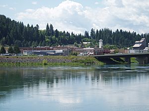
Bonners Ferry and the Kootenai River
|
|
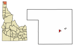
Location of Bonners Ferry in Boundary County, Idaho.
|
|
| Country | United States |
| State | Idaho |
| County | Boundary |
| Area | |
| • Total | 2.51 sq mi (6.50 km2) |
| • Land | 2.35 sq mi (6.10 km2) |
| • Water | 0.15 sq mi (0.40 km2) |
| Elevation | 1,896 ft (578 m) |
| Population
(2020)
|
|
| • Total | 2,543 |
| • Density | 1,120.22/sq mi (432.59/km2) |
| Time zone | UTC-8 (Pacific (PST)) |
| • Summer (DST) | UTC-7 (PDT) |
| ZIP code |
83805
|
| Area codes | 208, 986 |
| FIPS code | 16-09370 |
| GNIS feature ID | 2409879 |
Bonners Ferry is the biggest city and the main town of Boundary County, Idaho, in the United States. In 2010, about 2,543 people lived there.
Bonners Ferry is connected to Canada by two border crossings. The Porthill-Rykerts Border Crossing links it to Creston, British Columbia, Canada, along the Kootenay River. The Eastport–Kingsgate Border Crossing connects it to Yahk, British Columbia, Canada, on the Moyie River.
Contents
History of Bonners Ferry
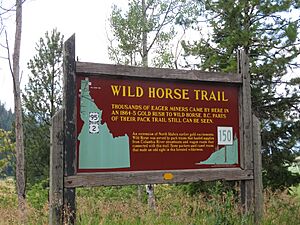
In 1863, gold was found in British Columbia. Many gold seekers traveled north on a path called the Wildhorse Trail. In 1864, a merchant named Edwin Bonner started a ferry service where this trail crossed the wide Kootenai River. Later, in 1875, Richard Fry and his wife, Justine Su-steel Fry, took over the ferry. However, the place kept the name of its first founder, and that's how Bonners Ferry got its name.
Before the gold rush, only a few people visited this area. One of the first was David Thompson, an explorer and mapmaker. He came in 1808 with four other fur traders to trade with the local Kootenai people. The Kootenai natives gave Thompson's group dried fish and moss bread. Thompson came back the next year and set up a trading post near Lake Pend Oreille. Later, in 1846, Jesuit Priest Father DeSmet visited as a missionary to the Kootenai Tribe.
The border between the United States and British North America was set in 1846 by the Oregon Treaty. Surveyors came in 1858 to mark the exact border.
In the 1880s, Bonners Ferry grew because of the mines to the north. A steamer called the Midge started service in 1883. It carried people and goods between Bonners Ferry and British Columbia for 25 years. In 1892, the Great Northern Railway was built, followed by other railway lines.
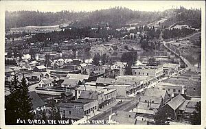
The town of Bonners Ferry was officially started in 1893, on the south bank of the Kootenai River. There were also some farms nearby. Many mines opened in the mountains, and the lumber industry grew quickly. Bonners Ferry was built on stilts to avoid the yearly spring floods.
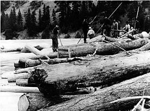
As the 20th century began, Bonners Ferry became a center for lumber and farming. The valley land was drained, and walls were built to prevent floods. The rich Kootenai Valley became known as the "Nile of the North." The Bonners Ferry Lumber Company grew to be one of the biggest lumber mills in the world. Downtown Bonners Ferry changed as brick buildings replaced the older ones on stilts. The Libby Dam was finished in 1975, which helped reduce the risk of serious floods. Today, many buildings on Main Street are from this time of strong, lasting construction.
On September 20, 1974, the Kootenai Tribe, led by chairwoman Amy Trice, took a stand for their rights. They set up a toll on the highway passing through town, asking people to pay to drive on what used to be their land. The money would help care for older tribal members. Unlike most tribes, the Kootenai Tribe had never signed a treaty with the U.S. government. This situation led to the United States government giving the Kootenai Tribe 10.5 acres (42,000 m2) of land, which is now the Kootenai Reservation.
Geography and Climate in Bonners Ferry
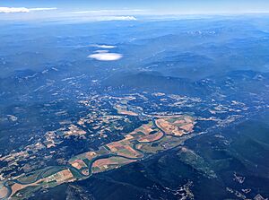
Bonners Ferry is located about 27 miles (43.5 km) south of the Canada-United States border. The city covers about 2.61 square miles (6.76 sq km), with most of it being land and a small part being water.
Bonners Ferry has a climate with cold, snowy winters and dry summers. Summers have hot days and cool nights. It snows quite a bit, with more than 10 inches (25 cm) of snow on average for about 23 days each year.
| Climate data for Bonners Ferry, Idaho, 1991–2020 normals, extremes 1907–present | |||||||||||||
|---|---|---|---|---|---|---|---|---|---|---|---|---|---|
| Month | Jan | Feb | Mar | Apr | May | Jun | Jul | Aug | Sep | Oct | Nov | Dec | Year |
| Record high °F (°C) | 55 (13) |
63 (17) |
75 (24) |
89 (32) |
95 (35) |
108 (42) |
107 (42) |
105 (41) |
97 (36) |
84 (29) |
67 (19) |
59 (15) |
108 (42) |
| Mean maximum °F (°C) | 45.7 (7.6) |
50.1 (10.1) |
62.0 (16.7) |
74.3 (23.5) |
83.1 (28.4) |
89.8 (32.1) |
96.0 (35.6) |
96.3 (35.7) |
86.7 (30.4) |
71.5 (21.9) |
54.8 (12.7) |
46.4 (8.0) |
97.5 (36.4) |
| Mean daily maximum °F (°C) | 33.7 (0.9) |
38.6 (3.7) |
48.4 (9.1) |
59.2 (15.1) |
69.4 (20.8) |
74.6 (23.7) |
84.8 (29.3) |
84.7 (29.3) |
73.3 (22.9) |
56.3 (13.5) |
41.5 (5.3) |
33.1 (0.6) |
58.1 (14.5) |
| Daily mean °F (°C) | 28.7 (−1.8) |
31.6 (−0.2) |
39.0 (3.9) |
47.3 (8.5) |
56.3 (13.5) |
61.9 (16.6) |
69.0 (20.6) |
68.3 (20.2) |
58.9 (14.9) |
45.9 (7.7) |
35.6 (2.0) |
28.5 (−1.9) |
47.6 (8.7) |
| Mean daily minimum °F (°C) | 23.7 (−4.6) |
24.6 (−4.1) |
29.7 (−1.3) |
35.5 (1.9) |
43.1 (6.2) |
49.2 (9.6) |
53.2 (11.8) |
52.0 (11.1) |
44.5 (6.9) |
35.6 (2.0) |
29.7 (−1.3) |
23.8 (−4.6) |
37.1 (2.8) |
| Mean minimum °F (°C) | 3.4 (−15.9) |
8.3 (−13.2) |
16.5 (−8.6) |
25.7 (−3.5) |
30.8 (−0.7) |
37.8 (3.2) |
42.9 (6.1) |
42.2 (5.7) |
32.4 (0.2) |
21.8 (−5.7) |
13.8 (−10.1) |
7.5 (−13.6) |
−2.2 (−19.0) |
| Record low °F (°C) | −29 (−34) |
−25 (−32) |
−12 (−24) |
12 (−11) |
17 (−8) |
23 (−5) |
32 (0) |
28 (−2) |
15 (−9) |
8 (−13) |
−13 (−25) |
−33 (−36) |
−33 (−36) |
| Average precipitation inches (mm) | 2.63 (67) |
1.83 (46) |
2.01 (51) |
1.26 (32) |
1.78 (45) |
1.92 (49) |
0.64 (16) |
0.53 (13) |
1.02 (26) |
1.73 (44) |
2.55 (65) |
3.17 (81) |
21.07 (535) |
| Average snowfall inches (cm) | 15.0 (38) |
10.8 (27) |
3.7 (9.4) |
0.4 (1.0) |
0.0 (0.0) |
0.0 (0.0) |
0.0 (0.0) |
0.0 (0.0) |
0.0 (0.0) |
0.2 (0.51) |
6.4 (16) |
17.3 (44) |
53.8 (135.91) |
| Average precipitation days (≥ 0.01 in) | 12.9 | 8.5 | 10.7 | 9.4 | 9.7 | 10.2 | 5.6 | 4.3 | 6.7 | 10.1 | 13.0 | 12.9 | 114.0 |
| Average snowy days (≥ 0.1 in) | 7.8 | 3.8 | 1.9 | 0.3 | 0.0 | 0.0 | 0.0 | 0.0 | 0.0 | 0.1 | 2.9 | 8.4 | 25.2 |
| Source 1: NOAA | |||||||||||||
| Source 2: National Weather Service | |||||||||||||
People Living in Bonners Ferry
| Historical population | |||
|---|---|---|---|
| Census | Pop. | %± | |
| 1900 | 349 | — | |
| 1910 | 1,071 | 206.9% | |
| 1920 | 1,236 | 15.4% | |
| 1930 | 1,418 | 14.7% | |
| 1940 | 1,345 | −5.1% | |
| 1950 | 1,776 | 32.0% | |
| 1960 | 1,921 | 8.2% | |
| 1970 | 1,909 | −0.6% | |
| 1980 | 1,906 | −0.2% | |
| 1990 | 2,193 | 15.1% | |
| 2000 | 2,515 | 14.7% | |
| 2010 | 2,543 | 1.1% | |
| 2020 | 2,687 | 5.7% | |
| 2019 (est.) | 2,637 | 3.7% | |
| U.S. Decennial Census | |||
2010 Census Information
In 2010, Bonners Ferry had 2,543 people living in 1,117 households. Most people (94.3%) were White. About 2% were Native American, and other groups made up smaller percentages. About 4.7% of the population was Hispanic or Latino.
About 27.6% of households had children under 18. Many households (39.1%) were married couples living together. The average age in the city was 41.9 years. About 23.7% of residents were under 18, and 19.5% were 65 or older.
Getting Around Bonners Ferry
The Boundary County Airport is a public airport located northeast of Bonners Ferry.
Railroads came to Bonners Ferry in 1892 with the Great Northern Railroad. Another railroad, the Spokane International Railroad, was built in 1910, connecting the U.S. to Canada. While Amtrak's Empire Builder train passes through town, the closest station is in Sandpoint, Idaho.
Local News and Radio
Bonners Ferry has its own radio station, KBFI AM 1450, which started in 1983. Another station, KSBF 88.9 FM, began broadcasting in 2024. The main local newspaper is the weekly Bonners Ferry Herald.
Sports in Bonners Ferry
Bonners Ferry High School offers many sports programs. These include wrestling, football, baseball, soccer, cheerleading, dance, golf, and basketball. Younger kids can also play Little League baseball, working with teams from nearby Sandpoint.
Education in Bonners Ferry
There is one school district in Boundary County, called Boundary County School District 101. The area is also served by North Idaho College, though residents don't pay taxes for it directly.
Other Languages Spoken
Some members of the Kootenai Tribe of Idaho have a name for Bonners Ferry in their language, Ktunaxa: k̓akanmituk ʔa·kaq̓ǂaʔhaǂ, ʔaq̓anqmi.
Notable People from Bonners Ferry
- Claire Du Brey, silent film actress
- Johnny James, baseball player
- Denis Johnson, author, journalist
- Rita La Roy, silent film actress
See also
 In Spanish: Bonners Ferry para niños
 | Audre Lorde |
 | John Berry Meachum |
 | Ferdinand Lee Barnett |


