Bottesford, Lincolnshire facts for kids
Quick facts for kids Bottesford |
|
|---|---|
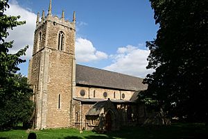
 St Peter's Church, Bottesford |
|
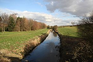
 Bottesford Beck The southern parish boundary |
|
| Population | 11,038 (2011) |
| OS grid reference | SE895079 |
| • London | 145 mi (233 km) S |
| Unitary authority | |
| Ceremonial county | |
| Region | |
| Country | England |
| Sovereign state | United Kingdom |
| Post town | Scunthorpe |
| Postcode district | DN16, DN17 |
| Police | Humberside |
| Fire | Humberside |
| Ambulance | East Midlands |
| EU Parliament | Yorkshire and the Humber |
| UK Parliament |
|
Bottesford is a town located in North Lincolnshire, England. It is part of the larger county of Lincolnshire. Once a small farming village, Bottesford has grown over time. It now forms a continuous urban area with the nearby town of Scunthorpe.
In 2011, the population of Bottesford was recorded as 11,038 people. The town is situated directly south of Scunthorpe. It lies west of Brigg and north of Gainsborough and Kirton in Lindsey.
Contents
Exploring Bottesford's Past and Places
Bottesford's Early History
Bottesford is mentioned in the Domesday Book as "Budlesford." The Domesday Book was a huge survey of England completed in 1086. For many centuries, Bottesford remained a small village focused on farming. Another nearby area, Yaddlethorpe, also appears in the Domesday Book as "Laudltorp."
St. Peter's Church: A Historic Landmark
The local Church of England parish church is called St. Peter ad Vincula. It is a very old and important building, listed as Grade I. This means it has special historical or architectural importance. The church is built in the Early English style, which was popular in the 13th century. It has a cruciform shape, meaning it looks like a cross from above.
The church was built on the site of an even older Saxon church. In 1870, the church was restored. During this work, two ancient Saxon sundials were found. These sundials were then placed into the church's south porch.
Local Natural and Historical Sites
Two other important local landmarks are Bottesford Beck and Bottesford Preceptory. Bottesford Beck is a stream that forms the southern boundary of the parish.
The Bottesford Preceptory was a base for the Knights Templar. They were a famous Christian military order from the Middle Ages. Later, the Knights of St John also used this site. These orders were like groups of warrior monks. They owned land and had special bases called preceptories.
Schools and Community Facilities
Education in Bottesford
Bottesford has several schools for young people. There are two junior schools: Bottesford Junior and Leys Farm Junior School. For younger students, Holme Valley Primary is the local primary school.
The main secondary school in the area is the Frederick Gough School. It first opened in 1960. The school became a comprehensive school in 1969. This means it accepts students of all abilities. Some students also attend the nearby Melior Community Academy in Scunthorpe.
Community Hubs and Activities
Bottesford has a library and a medical centre. Both are located on Cambridge Avenue. These facilities provide important services for the community.
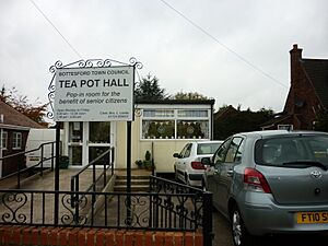
The town also has a civic hall. This hall is managed by the town council and is used for various social events. Next to the football and cricket pitches in Birch Park, there is a sports hall. This hall provides a place for local sports teams and residents to play and exercise.
Places of Worship
The main church, St. Peter's, is part of the Bottesford with Ashby Team Ministry. While two older Methodist chapels have closed, a new Baptist church opened in Chancel Road in 2002. This Baptist church had been meeting in the Civic Hall since 1978.
 | Victor J. Glover |
 | Yvonne Cagle |
 | Jeanette Epps |
 | Bernard A. Harris Jr. |


