Bottleneck Peak facts for kids
Quick facts for kids Bottleneck Peak |
|
|---|---|
 |
|
| Highest point | |
| Elevation | 6,235 ft (1,900 m) |
| Prominence | 455 ft (139 m) |
| Isolation | 0.65 mi (1.05 km) |
| Parent peak | Point 6403 |
| Geography | |
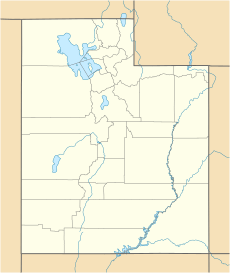
| Location | Emery County, Utah, U.S. |
| Parent range | San Rafael Swell Colorado Plateau |
| Topo map | USGS Bottleneck Peak |
| Type of rock | sandstone |
| Climbing | |
| First ascent | June 23, 1973 by Jim Langdon |
| Easiest route | class 5.11- climbing |
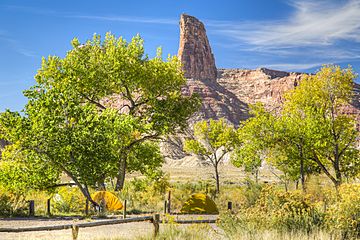
Bottleneck Peak is a tall, natural rock tower, also known as a monolith. It stands on the eastern side of Sids Mountain in the Utah San Rafael Swell wilderness area. This amazing peak is about 2.1 miles (3.4 km) northwest of Window Blind Peak. Rainwater and melted snow, called runoff, flow from Bottleneck Peak north into the San Rafael River.
Contents
What is Bottleneck Peak?
Bottleneck Peak is a striking natural landmark. It is part of the San Rafael Swell, a large, dome-shaped area of rock in Utah. This area is known for its unique rock formations and deep canyons. The peak gets its name because its shape looks a bit like a bottle.
How Tall is Bottleneck Peak?
Bottleneck Peak reaches an elevation of 6,235 feet (1,900 meters) above sea level. This makes it a significant feature in the landscape of Emery County, Utah.
What is the Peak Made Of?
The peak is made of sandstone, a type of rock formed from layers of sand pressed together over millions of years. Sandstone often has beautiful colors, like red, orange, and brown, which are common in the Utah desert.
Exploring Bottleneck Peak
Many people enjoy visiting the San Rafael Swell to see its natural beauty. Bottleneck Peak is a popular spot for adventurers.
First Climb to the Top
The first recorded climb to the very top of Bottleneck Peak happened on June 23, 1973. A climber named Jim Langdon was the first person to successfully reach its summit.
Climbing Routes
For experienced climbers, the easiest way to climb Bottleneck Peak is a route rated as class 5.11-. This rating is part of the Yosemite Decimal System, which describes how difficult a rock climb is. A 5.11- climb is considered quite challenging and requires good climbing skills.
Gallery
See also
 In Spanish: Pico Cuello de Botella para niños
 | Emma Amos |
 | Edward Mitchell Bannister |
 | Larry D. Alexander |
 | Ernie Barnes |


