Window Blind Peak facts for kids
Quick facts for kids Window Blind Peak |
|
|---|---|

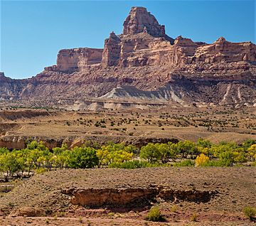
Northeast aspect
|
|
| Highest point | |
| Elevation | 7,030 ft (2,140 m) |
| Prominence | 1,410 ft (430 m) |
| Isolation | 8.99 mi (14.47 km) |
| Parent peak | Cedar Mountain (7,665 ft) |
| Geography | |
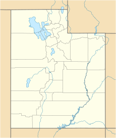
| Location | Emery County, Utah, U.S. |
| Parent range | San Rafael Swell Colorado Plateau |
| Topo map | USGS Bottleneck Peak |
| Geology | |
| Age of rock | Late Triassic to Jurassic |
| Type of rock | sandstone, siltstone, shale |
| Climbing | |
| First ascent | 1973 |
| Easiest route | class 5.7 climbing |
Window Blind Peak is a tall mountain in Utah, U.S. It stands 7,030 feet (2,140 meters) high. This peak is located in the San Rafael Swell area of Emery County.
It is the highest point in the Mexican Mountain Wilderness Study Area. The peak rises 1,800 feet above the land around it. The Bureau of Land Management takes care of this area. Window Blind Peak is near Bottleneck Peak and Cedar Mountain. Rain and snowmelt from the peak flow into the nearby San Rafael River. The first people to climb this peak were Jim Langdon, Dale Black, and Dave Palmer in 1973.
The Rocks of Window Blind Peak
Window Blind Peak is made of different kinds of rock. The main part is Wingate Sandstone. This rock formed from ancient sand dunes about 200 million years ago. These dunes were from the Late Triassic period.
On top of the Wingate Sandstone is the Kayenta Formation. The very top of the peak is covered by Navajo Sandstone from the Jurassic period. You can also see lighter-colored Chinle Formation rocks at the bottom of the mountain.
Weather at Window Blind Peak
The best times to visit Window Blind Peak are spring and fall. The area has a Cold semi-arid climate. This means winters are cold, with average temperatures below 32 °F (0 °C).
Most of the yearly rain and snow falls during spring and summer. This desert climate gets less than 10 inches (250 mm) of rain each year. Snowfall in winter is usually light.
 | Delilah Pierce |
 | Gordon Parks |
 | Augusta Savage |
 | Charles Ethan Porter |


