
Bow, New Hampshire facts for kids
Quick facts for kids
Bow, New Hampshire
|
||
|---|---|---|

Bow Town Hall
|
||
|
||

Location in Merrimack County and the state of New Hampshire
|
||
| Country | United States | |
| State | New Hampshire | |
| County | Merrimack | |
| Incorporated | 1727 | |
| Villages |
|
|
| Area | ||
| • Total | 28.55 sq mi (73.94 km2) | |
| • Land | 28.17 sq mi (72.96 km2) | |
| • Water | 0.37 sq mi (0.97 km2) 1.32% | |
| Elevation | 597 ft (182 m) | |
| Population
(2020)
|
||
| • Total | 8,229 | |
| • Density | 292/sq mi (112.8/km2) | |
| Time zone | UTC-5 (Eastern) | |
| • Summer (DST) | UTC-4 (Eastern) | |
| ZIP code |
03304
|
|
| Area code(s) | 603 | |
| FIPS code | 33-06500 | |
| GNIS feature ID | 0873548 | |

Bow is a town located in Merrimack County, New Hampshire, in the United States. It's known as a "New England town." In 2020, about 8,229 people lived here. This was an increase from 7,519 people in 2010, showing the town is growing!
Contents
History of Bow
Bow was officially created by the New Hampshire government in 1727. It was first planned to be about 9 square miles. Interestingly, another group from Massachusetts had already claimed much of this land two years earlier. They called their area "Pennacook," which is now Concord.
For many years, Massachusetts and New Hampshire argued over their borders. This made it tricky to figure out who owned what land. Finally, in 1741, the border was set. New Hampshire ended up with more land than it had originally claimed.
Even though Concord was planned before Bow, Bow was given official preference by New Hampshire. Bow had to give up a lot of its land to Concord, Pembroke, and Hopkinton between 1759 and 1765.
The town got its name "Bow" because it's located along a bend, or "bow," in the Merrimack River. The first count of people in Bow was in 1790, and it showed 568 residents.
In 1874, a railroad called the Concord Railroad started running through the eastern part of Bow. Today, this railroad is known as the New England Southern Railroad.
More recently, in September 2019, many climate activists gathered in Bow. They were protesting against Merrimack Station, which is one of the last power plants in New England that uses coal. About 67 people were arrested during this protest.
Geography of Bow
Bow covers a total area of about 73.9 square kilometers (28.5 square miles). Most of this area, about 73.0 square kilometers (28.2 square miles), is land. The rest, about 1.0 square kilometer (0.4 square miles), is water. Water makes up about 1.32% of the town's total area.
The highest point in Bow is Picked Hill, which is 915 feet (279 meters) above sea level. You can find it in the southern part of town. Other hills nearby, like Wood Hill and Brown Hill, are also over 900 feet (274 meters) high. All the water in Bow flows into the Merrimack River watershed. The Merrimack River itself forms the northeastern border of the town.
Population in Bow
| Historical population | |||
|---|---|---|---|
| Census | Pop. | %± | |
| 1790 | 568 | — | |
| 1800 | 719 | 26.6% | |
| 1810 | 729 | 1.4% | |
| 1820 | 935 | 28.3% | |
| 1830 | 1,065 | 13.9% | |
| 1840 | 1,001 | −6.0% | |
| 1850 | 1,055 | 5.4% | |
| 1860 | 909 | −13.8% | |
| 1870 | 745 | −18.0% | |
| 1880 | 734 | −1.5% | |
| 1890 | 725 | −1.2% | |
| 1900 | 617 | −14.9% | |
| 1910 | 676 | 9.6% | |
| 1920 | 568 | −16.0% | |
| 1930 | 780 | 37.3% | |
| 1940 | 942 | 20.8% | |
| 1950 | 1,062 | 12.7% | |
| 1960 | 1,340 | 26.2% | |
| 1970 | 2,479 | 85.0% | |
| 1980 | 4,015 | 62.0% | |
| 1990 | 5,500 | 37.0% | |
| 2000 | 7,138 | 29.8% | |
| 2010 | 7,519 | 5.3% | |
| 2020 | 8,229 | 9.4% | |
| U.S. Decennial Census | |||
According to the 2000 census, there were 7,138 people living in Bow. These people lived in 2,304 homes, and 2,045 of those homes were families. The average household had about 3.10 people.
Many homes had children under 18 living there, about 49.1%. Most households, 81.0%, were married couples living together. The median age of people in Bow was 39 years old.
Education in Bow
Bow built its first high school, Bow High School, in 1997. It is located near Turee Pond. The town also has a middle school, Bow Memorial School, and an elementary school, Bow Elementary School. Both of these schools are on Bow Center Road, close to the high school.
Transportation in Bow
Several important roads pass through Bow. These include two New Hampshire State Routes: NH 3A and NH 13. Also, two major Interstate Highways, Interstate 93 and Interstate 89, cross through the town.
Notable People from Bow
Many interesting people have connections to Bow:
- Jamie Aube (born 1953), a NASCAR race car driver.
- Henry M. Baker (1841-1912), who served as a U.S. representative.
- Mary Baker Eddy (1821–1910), the person who started the Church of Christ, Scientist; she was born in Bow.
- Sam Knox (1910–1981), an American football player.
- John Ordway (1775–1817), a member of the famous Lewis and Clark Expedition.
- Caleb Scofield (1978–2018), a musician who played bass and sang for bands like Cave In and Old Man Gloom.
- Dick Swett (born 1957), a former U.S. representative.
Images for kids
-
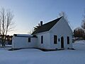
Bow Center School (1894)

See also
 In Spanish: Bow (Nuevo Hampshire) para niños
