
Bridge Mountain (Nevada) facts for kids
Quick facts for kids Bridge Mountain |
|
|---|---|

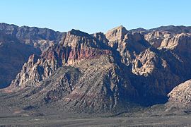
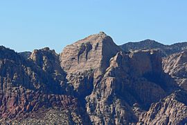
Bridge Mountain from the Red Rock Canyon Overlook
|
|
| Highest point | |
| Elevation | 6958+ ft (2121+ m) |
| Prominence | 1,991 ft (607 m) |
| Listing | Desert Peak Section List |
| Geography | |
| Location | Clark County, Nevada, U.S. |
| Parent range | Spring Mountains |
| Topo map | USGS La Madre Mountain |
| Climbing | |
| Easiest route | Scramble, class 3 |
Bridge Mountain is a cool mountain in the Spring Mountains of southern Nevada. It's part of the amazing Red Rock Canyon National Conservation Area. This area is like a huge outdoor park managed by the United States Bureau of Land Management.
Bridge Mountain gets its name from a special natural feature. Near the top, there's a natural rock bridge made of sandstone. It looks just like a bridge!
Contents
Exploring Bridge Mountain

Hiking Bridge Mountain is an exciting adventure. The journey takes you through beautiful landscapes. You can see wide views of the Red Rock Escarpment, which is a huge cliff face.
Starting Your Hike
There are a couple of ways to start your hike up Bridge Mountain. One way is to begin at the Rocky Gap Summit Trailhead. You'll need a 4WD vehicle to reach this spot.
Another option is to park at the north Willow Springs campground. From there, you can walk about 5 miles (8 km) to the mountain's summit. Or, you can drive about 7.5 miles (12 km) north on Lovell Canyon Road from Highway 160. Park where the paved road ends. This path is about 3.3 miles (5.3 km) long and has less climbing.
The Journey Up
As you hike, you'll climb over the top of the Spring Mountain Ranges. These mountains are made of a type of rock called shale. From the top, you get amazing views all around!
The trail then goes down towards the sandstone cliffs. Here, you'll find a steep section that you can climb down without special gear. This part leads you to a narrow strip of rock. This strip separates two canyons: Pine Creek to the south and Icebox Canyon to the north.
Finding the Natural Bridge
Look for piles of rocks called cairns. These cairns show you the way. They guide you up towards the base of a cliff. You'll angle left, just above the northern drop-off.
The path then goes up a smooth rock face through a crack. After climbing about 150 feet (46 meters), you'll reach a wide, flat ledge. Continue a few more feet to the left. Here, a wider gully climbs to the top of the cliff. This path leads you right to the natural bridge!
The bridge itself is what's left of an old "tinaja." A tinaja is a natural water tank that has worn away over time. What's left is this cool bridge-like shape.
Reaching the Summit
To get to the very top of Bridge Mountain, you'll need to climb over a fallen tree. This brings you close to some small pools of water and the natural bridge. It's also near a special place called the Hidden Forest.
From there, you'll head south for a bit. You'll climb along a steep ridge. Once you reach the top, you'll find a small metal box. Inside is a sign-in book where hikers can write their names!
The Hidden Forest
In a crack on Bridge Mountain's summit, there's a secret little forest. It's filled with Ponderosa pine trees. From the eastern side of this hidden forest, you can see wide views of the Las Vegas Valley far below. It's a truly unique spot!
Gallery
-
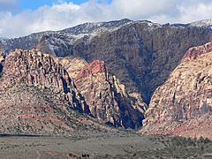
Pine Creek Canyon with the south side of the Bridge Mountain on the left
-
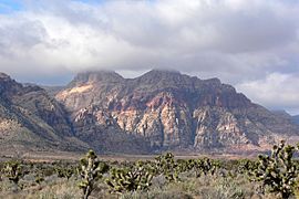
View from South East with entrance to Pine Creek Canyon on the left
-
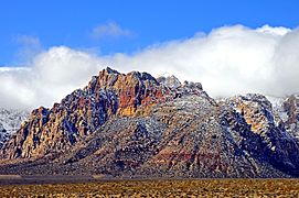
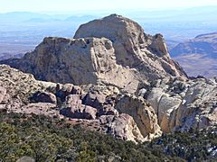
View from East
-
View from North East with entrance to Icebox Canyon on the right
-
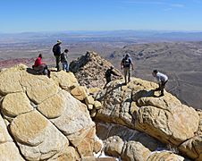
Summit
-
Summit from Turtlehead Peak to the North East
-
Summit from the West


