Brussels Peak facts for kids
Quick facts for kids Brussels Peak |
|
|---|---|

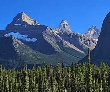
Brussels Peak centered between Mount Christie (left) and Mount Lowell (right)
|
|
| Highest point | |
| Elevation | 3,161 m (10,371 ft) |
| Prominence | 671 m (2,201 ft) |
| Parent peak | Mount Fryatt |
| Listing | Mountains of Alberta |
| Geography | |
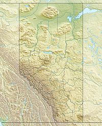
| Location | Alberta, Canada |
| Parent range | Canadian Rockies |
| Topo map | NTS 83C/12 |
| Climbing | |
| First ascent | 1948 by R. Garner and J. Lewis |
Brussels Peak is a towering mountain in Jasper National Park, Alberta, Canada. It stands at 3,161 meters (about 10,371 feet) tall. This impressive peak is part of the Canadian Rockies mountain range. It is located in the beautiful Athabasca River valley.
The closest higher mountain is Mount Fryatt. It is about 6.75 kilometers (4.2 miles) to the northwest. You can easily spot Brussels Peak from the famous Icefields Parkway. This is a scenic road that winds through the Canadian Rockies.
Brussels Peak was named after a ship called the SS Brussels.
What's the Climate Like?
Brussels Peak experiences a subarctic climate. This means it has very cold and snowy winters. The summers are usually mild. Temperatures can often drop below -20 degrees Celsius (or -4 degrees Fahrenheit). With the wind chill, it can feel even colder, sometimes below -30 degrees Celsius (-22 degrees Fahrenheit).
All the rain and melting snow from Brussels Peak flows into the Athabasca River. This river is an important part of the park's ecosystem.
 | John T. Biggers |
 | Thomas Blackshear |
 | Mark Bradford |
 | Beverly Buchanan |


