Mount Christie (Alberta) facts for kids
Quick facts for kids Mount Christie |
|
|---|---|

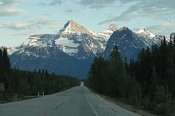
Mount Christie centered above the Icefields Parkway with Brussels Peak to its right and Mount Lowell furthest to right
|
|
| Highest point | |
| Elevation | 3,103 m (10,180 ft) |
| Prominence | 303 m (994 ft) |
| Parent peak | Brussels Peak (3161 m) |
| Listing | Mountains of Alberta |
| Geography | |
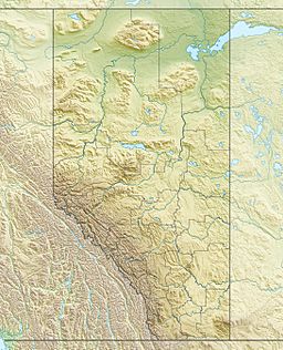
| Location | Alberta, Canada |
| Parent range | Canadian Rockies |
| Topo map | NTS 83C/12 |
| Type of rock | Sedimentary |
| Climbing | |
| First ascent | 1930 by W.R. Hainsworth, J.F. Lehmann, M.M. Strumia, N.D. Waffl |
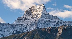
Mount Christie is a tall mountain in Jasper National Park, Canada. It stands about 3,103 meters (10,180 feet) high! You can find it in the beautiful Athabasca River valley, within the amazing Canadian Rockies in Alberta. This mountain is a fantastic sight, especially if you're driving along the scenic Icefields Parkway. The mountain closest to Mount Christie, and a bit taller, is Brussels Peak, located about 1.67 kilometers (1 mile) to the south-southwest.
Contents
Mountain's Story
How Mount Christie Got Its Name
The name "Mount Christie" was given by James Hector in 1859. He named it after William J. Christie, an important Canadian explorer and politician. William Christie was a "Chief Factor" for the Hudson's Bay Company. This meant he was a main manager at one of their trading posts, like a boss in charge of a big business location.
Early Explorers and Climbers
William Christie was in charge of the Hudson's Bay Company post at Fort Edmonton. This was where James Hector and his team, known as the Palliser expedition, stayed during the winter of 1858–1859. The very first time people successfully climbed Mount Christie was in 1930. The climbers were W.R. Hainsworth, J.F. Lehmann, M.M. Strumia, and N.D. Waffl. The mountain's name became official in 1947, approved by the Geographical Names Board of Canada.
Rock Formations
Mount Christie is made of sedimentary rock. This type of rock forms over a very long time from layers of sand, mud, and tiny bits of sea creatures. These layers were laid down in shallow seas during ancient times, from the Precambrian to Jurassic periods. Later, during a huge event called the Laramide orogeny, these rock layers were pushed up and folded. This movement created the mountains we see today.
Weather and Climate
Mount Christie is in a subarctic climate zone. This means it has very cold, snowy winters and mild summers. Temperatures can drop below -20 °C (-4 °F). With the wind, it can feel even colder, sometimes below -30 °C (-22 °F). All the rain and melting snow from Mount Christie flows into the Athabasca River.
 | May Edward Chinn |
 | Rebecca Cole |
 | Alexa Canady |
 | Dorothy Lavinia Brown |


