Mount Lowell facts for kids
Quick facts for kids Mount Lowell |
|
|---|---|

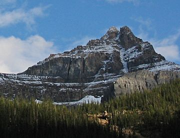
Mount Lowell seen from Fryatt Valley area
|
|
| Highest point | |
| Elevation | 3,150 m (10,330 ft) |
| Prominence | 370 m (1,210 ft) |
| Parent peak | Brussels Peak (3161 m) |
| Listing | Mountains of Alberta |
| Geography | |
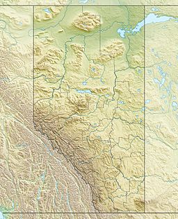
| Location | Alberta, Canada |
| Parent range | Canadian Rockies |
| Topo map | NTS 83C/12 |
| Type of rock | Sedimentary |
| Climbing | |
| First ascent | 1927 Alfred Ostheimer |
| Easiest route | Mountaineering via South Ridge |
Mount Lowell is a tall mountain in Jasper National Park, Alberta, Canada. It stands about 3,150 meters (10,335 feet) high. This mountain is part of the amazing Canadian Rockies.
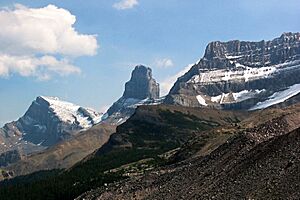
You can find Mount Lowell in the Athabasca River valley. It's close to other big peaks like Mount Christie, Xerxes Peak, and Brussels Peak. Brussels Peak is the closest taller mountain, just 2 kilometers (1.2 miles) north.
Even though it's a big mountain, its name "Mount Lowell" isn't official yet. You can often spot Mount Lowell from the famous Icefields Parkway.
Contents
The History of Mount Lowell
Who First Climbed Mount Lowell?
The first time someone successfully climbed to the top of Mount Lowell was in 1927. An explorer named Alfred Ostheimer made this climb. He was helped by two guides, Hans Fuhrer and J. Weber.
How Mount Lowell Got Its Name
Alfred Ostheimer decided to name the peak after a very important person. He chose to honor A. Lawrence Lowell. At that time, A. Lawrence Lowell was the president of Harvard University. He was also known for his love of mountain climbing.
How Mount Lowell Was Formed
The Story of the Rocks
Mount Lowell is made mostly of sedimentary rock. This type of rock forms over a very long time from layers of sand, mud, and tiny bits of plants and animals. These layers get pressed together and harden.
From Ancient Seas to Mountains
The rocks in Mount Lowell were laid down during ancient times. This includes periods from the Precambrian era all the way to the Jurassic period. Imagine these rocks forming at the bottom of old seas!
Later, a huge event called the Laramide orogeny happened. This was when massive forces in the Earth pushed the rocks east. They were even pushed up and over younger rocks. This process slowly created the tall mountains we see today, like Mount Lowell.
Weather and Climate
What Kind of Climate Does Mount Lowell Have?
Mount Lowell is located in a subarctic climate zone. This means it has very long, cold, and snowy winters. The summers are usually short and mild.
Temperatures and Water
During winter, temperatures can drop below -20°C (-4°F). With the wind chill, it can feel even colder, sometimes below -30°C (-22°F).
The snow and ice on Mount Lowell melt when it gets warmer. This water then flows into Fryatt Creek and Lick Creek. Both of these creeks eventually join the larger Athabasca River.
 | Janet Taylor Pickett |
 | Synthia Saint James |
 | Howardena Pindell |
 | Faith Ringgold |


