Buccan, Queensland facts for kids
Quick facts for kids BuccanLogan City, Queensland |
|||||||||||||||
|---|---|---|---|---|---|---|---|---|---|---|---|---|---|---|---|

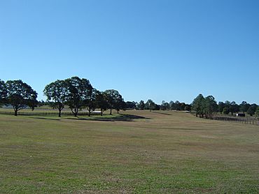
Newstead Park, 2014
|
|||||||||||||||
| Population | 2,134 (2021 census) | ||||||||||||||
| • Density | 117.3/km2 (304/sq mi) | ||||||||||||||
| Postcode(s) | 4207 | ||||||||||||||
| Area | 18.2 km2 (7.0 sq mi) | ||||||||||||||
| Time zone | AEST (UTC+10:00) | ||||||||||||||
| Location |
|
||||||||||||||
| LGA(s) | Logan City | ||||||||||||||
| State electorate(s) | Logan | ||||||||||||||
| Federal Division(s) | Forde | ||||||||||||||
|
|||||||||||||||
Buccan is a quiet, rural area in Queensland, Australia. It is part of Logan City. In 2021, about 2,134 people lived there. Buccan is known for its larger blocks of land and natural bushland.
Contents
Exploring Buccan's Geography
Buccan is located just south of Waterford. It sits to the east of the Logan River. This area has a lot of open space. You will find big blocks of land with plenty of bushland.
Buccan does not have its own main shopping area. Residents usually go to nearby towns like Logan Village, Waterford, or Beenleigh for shops and services.
A special part of Buccan is the Buccan Conservation Park. This is a nature area. It is looked after by the Queensland Parks and Wildlife Service. The main road, Waterford-Tamborine Road (State Route 95), runs through Buccan from north to south.
Buccan's Past: A Look at History
The first European settlers came to Buccan around 1863. James Williamson and his brother-in-law, Mr. A. Fraser, were among them. They tried to grow cotton, but it was difficult.
However, growing sugar cane was much more successful. One of the biggest sugar cane farms was on the land where Newstead Park is today. Dairy farming was also an important industry for the local farms.
Buccan also had a railway station. It was part of the old Beaudesert railway line. This line opened in 1885. It connected Bethania to Beaudesert. The railway station in Buccan closed in 1996.
For a long time, Buccan remained mostly farmland. Then, in the 1970s, larger blocks of land were sold. This changed the area a bit. Buccan used to be part of the Shire of Beaudesert. In 2008, it became part of Logan City. This happened when local governments joined together.
Who Lives in Buccan?
Buccan has grown over the years. In 2011, about 1,575 people lived there. By 2016, the population grew to 1,818 people. The latest count in 2021 showed 2,134 residents.
Most people in Buccan were born in Australia. In 2021, about 78.9% of residents were born here. Other people came from countries like New Zealand and England. Most people in Buccan speak English at home. Some also speak other languages like Romanian or Khmer. The average age of people in Buccan is 39 years old.
Learning and Fun in Buccan
Buccan does not have its own schools. Students usually go to schools in nearby towns.
- For primary school, options include Logan Village State School, Waterford State School, and Windaroo State School.
- For high school, students might attend Windaroo Valley State High School, Loganlea State High School, or Yarrabilba State Secondary College.
There are several parks in Buccan where people can enjoy nature and outdoor activities:
- Buccan Conservation Reserve 27°45′10″S 153°09′10″E / 27.7528°S 153.1529°E
- Newstead Park 27°43′49″S 153°07′00″E / 27.7303°S 153.1167°E
- Samuel and Agnes Smith Park 27°44′28″S 153°07′25″E / 27.7411°S 153.1235°E
 | Emma Amos |
 | Edward Mitchell Bannister |
 | Larry D. Alexander |
 | Ernie Barnes |


