
Buckton Castle facts for kids
Quick facts for kids Buckton Castle |
|
|---|---|
_(28563211972).jpg)
The view across the entrance causeway across the ditch, with the site of the castle behind
|
|
| General information | |
| Architectural style | Enclosure castle |
| Town or city | Carrbrook, Stalybridge, Greater Manchester |
| Country | England |
| Coordinates | 53°30′40″N 2°01′04″W / 53.5112°N 2.0178°W |
| Completed | 12th century |
| Technical details | |
| Material | Sandstone |
| Size | 730 square metres (7,900 sq ft) |
Buckton Castle was a medieval castle built from stone. You can find its remains near Carrbrook in Stalybridge, Greater Manchester, England. It was surrounded by a strong stone wall, called a curtain wall, about 2.8-metre-wide (9 ft). There was also a large ditch around it, 10 metres (33 ft) wide and 6 metres (20 ft) deep.
Buckton Castle is one of the first stone castles ever built in North West England. Today, only its buried foundations remain, covered by heather and peat. It was probably built and then taken down in the 12th century. The first time anyone wrote about it was in 1360, when it was already a ruin. Archaeologists have found very few items there. This suggests that Buckton Castle might never have been fully finished.
In the 16th century, the castle site might have been used as a beacon. This was a signal fire for events like the Pilgrimage of Grace. Later, in the 18th century, people looked for treasure there. They heard stories about gold and silver being found. During the Second World War, the site was used as a fake target to trick enemy planes. Between 1996 and 2010, archaeologists studied Buckton Castle. Over 60 volunteers helped with this project. The castle is now a Scheduled Ancient Monument. This means it is a protected historical site.
Contents
Where is Buckton Castle Located?
Buckton Castle sits on Buckton Hill, a steep ridge made of sandstone. It is about 335 metres (1,099 ft) above sea level. To the south and west are the valleys of the Carr Brook and River Tame. The Buckton Vale Quarry is close to the east. The town of Stalybridge is about four kilometres (2 mi) to the south-west.
North and north-east of the castle are open moorlands. These areas are covered with heather and peat. The castle's location was likely chosen to help its soldiers guard the Tame Valley. In the Middle Ages, Buckton Castle was at the eastern edge of Cheshire. This county shared its western border with Wales. The castle and valley were part of the medieval manor of Tintwistle. A manor was a piece of land managed by a local lord. Tintwistle was part of the larger area called Longdendale.
Cheshire has fewer castles than other areas near the Anglo-Welsh border. Most of its castles are closer to the western border. This is where the richer parts of Cheshire were. Beeston Castle is the only other castle in the area that stands out as much. Experts believe hilltop castles like Buckton showed great power. They were important symbols in these landscapes.
-
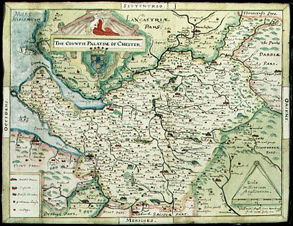
A map from the late 1500s showing Cheshire. Buckton Castle is in the north-east.
-
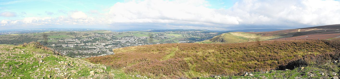
The view north-west from Buckton Castle. The castle is on a hill 335 metres (1,099 ft) above sea level.

_(28053449473).jpg)
Building and Using the Castle

The first castles in England were usually made of wood. Building with stone was much more expensive. Evidence shows that the area around Buckton Castle was cleared of trees long ago. This might explain why stone was used for building here. Stone castles became more common in the 12th century. Buckton is one of the earliest stone castles in North West England.
Buckton Castle was probably built in the 12th century. There were three main periods of activity at the site. First, the ditch was dug, and the stone wall and gatehouse were built. Second, the ditch was dug deeper, and more building work happened. Finally, the castle was deliberately torn down. Very few items have been found that can be accurately dated. A few pottery pieces suggest the late 12th century.
We don't know exactly how much Buckton Castle cost to build. However, we can compare it to other castles. For example, the main tower at Peveril Castle cost about £184 in the late 12th century. Experts guess that Buckton Castle might have cost around £100. This was a large sum of money back then. It was almost the average yearly income for a powerful lord in 1200.
The Earls of Chester likely built the castle. They were powerful lords who controlled who could build castles in Cheshire. Cheshire had fewer castles than other border counties. This suggests the Earls limited castle building. The castle might have been built during a civil war called the Anarchy. This war happened during King Stephen's reign in the mid-12th century. It could also have been built during the Revolt of 1173–74 against King Henry II.
During the Anarchy, a Scottish king took control of northern England. Buckton Castle might have been built to protect Cheshire. After the Anarchy, many castles were destroyed. This was to return England to how it was before the war. This could explain why Buckton was taken down. Another idea is that it was destroyed after the 1173–74 revolt. This would have been a punishment for the Earl of Chester.
Very few items have been found at Buckton Castle. Also, the stonework isn't finely finished. This suggests the castle was never fully completed. However, the ditch was dug deeper at one point. This could mean people lived there for a while. Or, it was abandoned and then repaired.
Later History and Discoveries


In 1360, a survey mentioned "one ruined castle called Buckeden." This is the oldest record of the castle. At that time, the castle was a ruin and belonged to Edward, the Black Prince. The castle site might have been used as a beacon in the 1500s. This was during the Pilgrimage of Grace and when Spain threatened England. It might have been used again in 1803.
In the 1700s, people started looking for treasure at Buckton Castle. Most searches didn't find anything. But in 1767, someone found a gold necklace and a silver pot. These items are now lost. This made local historians interested. Several visited the site and drew maps of the castle. Since 1924, Buckton Castle has been a Scheduled Ancient Monument. This protects it from damage, especially from the nearby quarry.
During the Second World War, fake targets were built to trick enemy bombers. One was near Buckton Castle. A brick hut was built over part of the castle ditch then. This fake target was no longer used after 1943.
In the 1900s, some thought Buckton Castle might be an Iron Age hillfort. But studies showed it was different from other hillforts. So, it was unlikely to be from the Iron Age. Digging in 1998 proved it was medieval. There was no sign of earlier activity. Experts used to think it was a "ringwork." This is a type of fort where earthworks are the main defence. But later digging showed it was an enclosure castle. This means stone walls were its main defence.
The Tameside Archaeology Survey began in 1990. It was carried out by the University of Manchester. They received a lot of money from the local council. A big part of this money went to digging at Buckton Castle. In 1996 and 1998, they surveyed the land and did small digs. They wanted to map the castle and check for an outer area. This outer area turned out to be from the 20th century, likely related to mining.
Illegal digging by unknown people happened in 1999 and 2002. This meant repairs were needed. In 2007, full-scale digging began. The goal was to find out when and how the castle was used. Over three seasons (2007, 2008, and 2010), they dug in different areas. They explored the ditch, the entrance, a gap in the wall, and inside the castle.
The archaeology work at Buckton Castle moved to the University of Salford in 2009. Brian Grimsditch led the digs. More than 60 volunteers helped with the excavations. These included people from local archaeology groups and university students.
How the Castle Was Designed
Buckton was a small enclosure castle built on high ground. It had a 2.8-metre-thick (9 ft) curtain wall made of sandstone. Nothing of the wall stands above ground today. The castle was roughly oval shaped. It measured about 35.6 by 26.2 metres (117 by 86 ft) and covered an area of 730 square metres (0.18 acres).
A 10-metre-wide (33 ft) ditch surrounded the castle. The only part without a ditch was the south-west. This area had a very steep hill, so a ditch wasn't needed. When the ditch was dug, some of the soil was used to raise the inside of the castle by 1.5 metres (4 ft 11 in).
Buckton Castle is similar in size to the inner part of Clitheroe Castle. Clitheroe is also oval and has a thick curtain wall. Clitheroe was also built on a rocky peak. Its small main tower might be because it was naturally easy to defend. Also, it was in an area that wasn't very rich.
You entered Buckton Castle through a gatehouse in the north-west. This gatehouse measured 9.3 by 7.5 metres (31 by 25 ft). The east side had the gate passage. The west side had a room. The gatehouse no longer stands, but it was probably at least two stories tall. Buckton's gatehouse was built in the 12th century. It was one of the earliest stone gatehouses in North West England. Other similar gatehouses were at Egremont, Brough, Clitheroe, Carlisle, and Chester. They were all similar in size. They had a passage through a single tower with rooms above. Buckton's gatehouse was a bit different because its passage was off to one side.
In the 1770s, a historian named Thomas Percival wrote about a well inside the castle. It was near the south wall. He also said that walls of buildings inside the castle were still 2 metres (7 ft) high. A map from 1842 showed a ruined building inside the south-east area. It also showed the well Percival mentioned.
Later digs inside the castle did not find these buildings. But finding a posthole shows there was activity there. A gap in the southern wall was probably made in the 1800s. There is also a pile of sandstone pieces. This might be leftover material from building the castle. Today, nothing of Buckton Castle remains above ground. Until recently, plants covered up any sign of the stone structure.
-
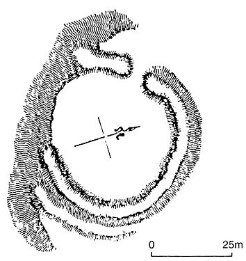
A plan drawn by George Ormerod in 1817.
-
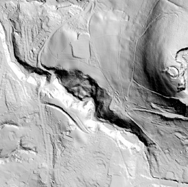
An aerial map of the area west of the castle.
-
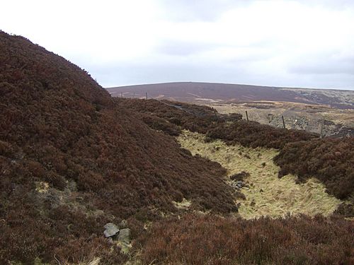
Part of the ditch surrounding the castle.


