Bull Valley Mountains facts for kids
Quick facts for kids Bull Valley Mountains |
|
|---|---|
| Highest point | |
| Peak | Lost Peak (Bull Valley Mountains) |
| Elevation | 7,516 ft (2,291 m) |
| Dimensions | |
| Length | 30 mi (48 km) WSW-ENE |
| Geography | |
| Country | United States |
| Settlements | Enterprise, Central, Veyo and Gunlock |
| Range coordinates | 37°28′31″N 113°54′42″W / 37.4753°N 113.9116°W |
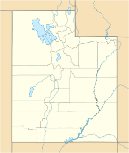
The Bull Valley Mountains are a mountain range in southwest Utah. They are about 30 miles (48 km) long and are found in the northwest part of Washington County. These mountains are right next to the Utah border. They even connect to the Clover Mountains in southeast Nevada.
A very important line called the Great Basin Divide runs across the tops of these mountains. This divide separates where water flows. North of the Bull Valley Mountains, water flows into the Escalante Desert. South of the mountains, water flows towards the Colorado River. Specifically, the Santa Clara River starts here and flows southeast from a steep slope on the mountains' side.
Contents
Where Are the Bull Valley Mountains?
The Bull Valley Mountains sit on a major water divide. This means they help decide which way water flows. To the north, water goes into the Escalante Valley, where the town of Enterprise is located. This area is part of the Great Basin. To the south, water flows towards the Colorado River. The city of Saint George, Utah is about 25 miles southeast of these mountains.
Getting Around the Mountains
Utah Route 18 is a road that runs along the base of the mountains' southeast side, near the Santa Clara River. This route then heads north through the eastern part of the Bull Valley Mountains towards Enterprise. If you go south from the mountains on Route 18, you'll pass through Snow Canyon State Park before reaching Saint George.
Another road starts in Veyo and follows the Santa Clara River to Gunlock. The southwestern part of the Bull Valley Mountains drains into the Beaver Dam Wash. This wash is west of the Beaver Dam Mountains.
Water and Nature Spots
The Bull Valley Mountains are home to some interesting natural features and water sources.
Lower Enterprise Reservoir
The Lower Enterprise Reservoir is located in the northern part of the mountains, on Little Pine Creek. This reservoir is just southwest of Enterprise and about 5 miles south of Hebron. It has an old pioneer dam that was built over 100 years ago in the early 1900s. Grassy Creek is the only creek that flows into the reservoir all year long.
Pine Park
Pine Park is a beautiful area southwest of Enterprise. It's also east of Beaver Dam State Park (Nevada). This park is known for its unique white rock formations called hoodoos. It also has a small creek, a campground, and a picnic area where you can relax. The creek from Pine Park eventually flows into Beaver Dam State Park, which is just a few miles to the west.
Mountain Peaks
Many peaks rise up in the Bull Valley Mountains, most of them around 5,000 feet (1,524 meters) tall. The highest point is called Lost Peak, which reaches 7,516 feet (2,291 meters) high. It's located in the west-central part of the range. Another notable peak, Gutz Peak, is 7,447 feet (2,270 meters) tall and is about 2 miles northwest of Lost Peak.
 | Selma Burke |
 | Pauline Powell Burns |
 | Frederick J. Brown |
 | Robert Blackburn |


