
Bundaberg Central, Queensland facts for kids
Quick facts for kids Bundaberg CentralBundaberg, Queensland |
|||||||||||||||
|---|---|---|---|---|---|---|---|---|---|---|---|---|---|---|---|
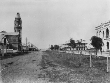
Bourbong Street Bundaberg, circa 1890
|
|||||||||||||||

Bundaberg Central
Location in Queensland
|
|||||||||||||||
| Population | 162 (2021 census) | ||||||||||||||
| • Density | 125/km2 (320/sq mi) | ||||||||||||||
| Postcode(s) | 4670 | ||||||||||||||
| Area | 1.3 km2 (0.5 sq mi) | ||||||||||||||
| Time zone | AEST (UTC+10:00) | ||||||||||||||
| Location | 363 km (226 mi) N of Brisbane CBD | ||||||||||||||
| LGA(s) | Bundaberg Region | ||||||||||||||
| State electorate(s) | Bundaberg | ||||||||||||||
| Federal Division(s) | Hinkler | ||||||||||||||
|
|||||||||||||||
Bundaberg Central is the main suburb and business heart of Bundaberg in Queensland, Australia. It's where many shops, offices, and important buildings are located.
In 2021 census, 162 people lived in Bundaberg Central.
Contents
What is Bundaberg Central Like?
Bundaberg Central is surrounded by water and a railway line. The Burnett River is to the north, Bundaberg Creek to the east, and Saltwater Creek to the south. The North Coast railway line forms its western border.
A Look Back at Bundaberg Central's History
Early Days and Cemeteries
In 1869, the first cemetery in Bundaberg was set up. But it was soon clear that this spot wasn't big enough for the future. So, a new, larger cemetery was created in 1873. By 1882, all the burials from the old cemetery were moved to the new one. This made space for the town to grow.
Schools in Bundaberg Central
Bundaberg South State School first opened its doors on 6 February 1875. Over time, it grew and changed names. In 1885, it split into two schools: one for boys and one for girls and infants. By 1894, both were renamed Bundaberg Central Boys State School and Bundaberg Central Girls and Infants State School. Finally, in 1926, they joined back together to become the Bundaberg Central State School we know today.

Churches in the Area
Methodist Church History
The first Methodist church services in Bundaberg started in 1875. A simple church was built on Walla Street. Later, a "handsome" new church replaced it. In 1902, different Methodist groups joined together. Their two church buildings were physically moved and joined on Barolin Street in 1904. A new, larger brick church was built there in 1937. This church is now part of the Uniting Church in Australia.

.jpg)

Anglican Church History
The first Anglican church in Bundaberg was finished in 1876 on Quay Street. It was called Christ Church Anglican. In 1899, the church building was moved to a more central spot. A new, bigger church building was started in 1920 and officially opened in 1927.
St Joseph's Catholic School
St Joseph's Catholic School began in June 1876. It was started by two Sisters of St Joseph of the Sacred Heart. The school moved locations a few times, finally settling on its current site on Barolin Street in 1918.
Buss Park and Bert Hinkler Memorial
Buss Park officially opened in 1930. Before that, it was a less attractive market square. A local businessman, Horace Buss, donated money to turn it into a beautiful public park, and it was named after him.
After the famous Bundaberg-born aviator Bert Hinkler passed away in 1933, people wanted to honor him. A monument was built in the center of Buss Park. It was made from about 40 tons of granite and was officially revealed in 1936 to a crowd of 3,000 people.

Bundaberg Library and School Museum
The Bundaberg Library opened in 1994 and was updated in 2012. In 2015, Bundaberg Central State School opened a small museum in an old storeroom, showing items from its history.
Important Places in Bundaberg Central
Bundaberg Central has several places that are listed for their historical importance. These include:
- Bourbong Street: Bourbong Street Weeping Figs (trees)
- Bourbong Street: Bundaberg War Memorial
- Bourbong Street: Kennedy Bridge
- 155a Bourbong Street: Bundaberg Post Office
- 184 Bourbong Street: Bundaberg School of Arts
- 191–193 Bourbong Street: Commercial Bank
- 13 Crofton Street: Bundaberg Central State School
- 1 Maryborough Street: Fallon House
- Corner of Maryborough and Woongarra Streets: St Andrews Uniting Church
- Quay Street: Bundaberg Police Station
- Quay Street: Burnett Bridge
- Quay Street: Saltwater Creek Railway Bridge
- 55 Woongarra Street: 4BU Radio Station
- Corner of Woongarra and Maryborough Streets: Christ Church Anglican
Learning in Bundaberg Central
Bundaberg Central has two main schools:
- Bundaberg Central State School is a government primary school for students from Prep to Year 6. It is located at 13 Crofton Street. In 2018, it had 75 students.
- St Joseph's Catholic Primary School is a Catholic primary school for students from Prep to Year 6. It is at the corner of Barolin and Woondooma Streets. In 2018, it had 162 students.
There isn't a government high school right in Bundaberg Central. The closest one is Bundaberg State High School in the nearby suburb of Bundaberg South.
What Can You Do in Bundaberg Central?
- The Bundaberg Regional Council runs a public library at 49 Woondooma Street. It's a great place to find books and learn.
- The Queensland Country Women's Association (QCWA) has branches that meet here. They are groups that support women and communities.
- Christ Church Anglican holds services on the corner of Woongarra and Maryborough Streets.
- Bundaberg Uniting Church is at 34 Barolin Street.
- Buss Park is a lovely park on the corner of Bourbong Street and Maryborough Street. It's a nice place to relax and see the memorial to Bert Hinkler.
