Burlington, New York facts for kids
Quick facts for kids
Burlington, New York
|
|
|---|---|

Burlington, Otsego County, New York
|
|
| Country | United States |
| State | New York |
| County | Otsego |
| Area | |
| • Total | 45.01 sq mi (116.58 km2) |
| • Land | 44.89 sq mi (116.27 km2) |
| • Water | 0.12 sq mi (0.32 km2) |
| Elevation | 1,959 ft (597 m) |
| Population
(2010)
|
|
| • Total | 1,140 |
| • Estimate
(2016)
|
1,084 |
| • Density | 24.15/sq mi (9.32/km2) |
| Time zone | UTC-5 (Eastern (EST)) |
| • Summer (DST) | UTC-4 (EDT) |
| ZIP code |
13315
|
| Area code(s) | 607 |
| FIPS code | 36-11209 |
| GNIS feature ID | 0978766 |
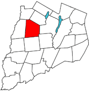
Burlington is a small town in Otsego County, New York, United States. It is located in the northwestern part of the county. In 2010, about 1,140 people lived there. Burlington is north of the city of Oneonta.
Contents
Exploring Burlington's Geography
Burlington covers a total area of about 45 square miles (116.5 square kilometers). Most of this area is land, with only a small part being water.
Roads and Waterways
Two main highways cross Burlington:
- New York State Route 51 runs north-south.
- New York State Route 80 runs east-west.
These highways meet at a spot called Barrett Corners. Another important intersection is at Burlington Green, where county route 16 meets New York State Route 80.
Two important streams flow through the town:
- Butternut Creek
- Wharton Creek
A Look at Burlington's History
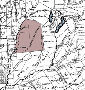
Early settlers came to Burlington from New England. The town was named after Burlington, New Jersey. This name was chosen by William Cooper and Andrew Craig, who owned land patents here. For a while, Butternut Creek was even called "Burlington Creek."
How Burlington Was Formed
Burlington was officially created on April 10, 1792. It was formed from a larger area called the Town of Otsego. Over time, parts of Burlington were used to create other towns:
- In 1797, Pittsfield and New Lisbon were set off.
- In 1808, Edmeston was also formed from Burlington.
Life in Burlington Green
In 1878, the community of Burlington Green was a busy place. It had two churches and an inn that served as a stop for stage coaches. There was also a doctor's office, a general store, and a lawyer's office. The town had places for making things, like a gristmill and a creamery. There were also blacksmith shops and wagon shops. Many Scottish immigrants came to Burlington. They helped establish the United Presbyterian Church in 1835.
Famous People from Burlington
Many notable people have connections to Burlington.
- Benjamin F. Angel (1815–1894): Born in Burlington, he later became an ambassador for the United States.
- William Hulbert (1832–1882): He was born in Burlington Flats. William Hulbert became the president of the Chicago White Stockings baseball club. He also led the National League and is in the Baseball Hall of Fame.
- Jedediah Peck (1748–1821): Known as "Ploughjogger," he was a Revolutionary War soldier. Peck was the first town supervisor and a member of the New York State Assembly. He worked to create public schools and end debtors' prison in New York. He believed common people should rule, not just the elite. He was arrested for protesting against the Alien and Sedition Acts. His arrest helped Thomas Jefferson win the presidential election.
- Parley P. Pratt (1807–1857): Born in Burlington, he was an early leader of the Latter Day Saint movement. His writings helped explain the faith in the 1800s.
- Daniel H. Richards (1808–1877): Born in Burlington, he became a legislator and newspaper editor in Wisconsin.
- Anna Peck Sill (1816-1889): An important educator, she founded the Rockford Female Seminary.
- George Eaton Sutherland (1847–1899): He was a legislator and judge in Wisconsin.
Burlington's Population and People
| Historical population | |||
|---|---|---|---|
| Census | Pop. | %± | |
| 1820 | 2,457 | — | |
| 1830 | 2,459 | 0.1% | |
| 1840 | 2,154 | −12.4% | |
| 1850 | 1,835 | −14.8% | |
| 1860 | 1,818 | −0.9% | |
| 1870 | 1,476 | −18.8% | |
| 1880 | 1,599 | 8.3% | |
| 1890 | 1,334 | −16.6% | |
| 1900 | 1,263 | −5.3% | |
| 1910 | 1,108 | −12.3% | |
| 1920 | 999 | −9.8% | |
| 1930 | 913 | −8.6% | |
| 1940 | 956 | 4.7% | |
| 1950 | 959 | 0.3% | |
| 1960 | 809 | −15.6% | |
| 1970 | 803 | −0.7% | |
| 1980 | 1,045 | 30.1% | |
| 1990 | 1,036 | −0.9% | |
| 2000 | 1,085 | 4.7% | |
| 2010 | 1,140 | 5.1% | |
| 2016 (est.) | 1,084 | −4.9% | |
| U.S. Decennial Census | |||
In 2000, Burlington had 1,085 people living there. There were 392 households, and 301 of these were families. The population density was about 24 people per square mile. Most residents (97.14%) were White. A small percentage were from other racial backgrounds. About 1.66% of the population was Hispanic or Latino.
Household Information
- 36.2% of households had children under 18.
- 65.1% were married couples.
- The average household had 2.76 people.
- The average family had 3.08 people.
Age Distribution
The population in Burlington was spread out by age:
- 26.5% were under 18.
- 7.7% were 18 to 24.
- 29.3% were 25 to 44.
- 22.6% were 45 to 64.
- 13.9% were 65 or older.
The average age in the town was 38 years.
Income Levels
In 2000, the median income for a household was $36,823. For families, the median income was $42,500. About 11.8% of the population lived below the poverty line. This included 11.5% of those under 18.
Communities and Locations in Burlington
Burlington has several smaller communities and interesting spots:
- Barrett Corners – A small community south of Burlington Flats. It's where NY-51 and NY-80 meet.
- Basswood Pond – An artificial lake built around 1961. It's a day-use area in Basswood Pond State Park.
- Beverly Inn Corners – A community north of Burlington Flats on NY-51.
- Briar Hill – A raised area (elevation) east of Burlington.
- Burlington Flats – A community in the western part of town on route NY-51. It was once called "Walbridge Flats."
- Burlington – The main community, also known as "Burlington Green" or "The Green." It's located on NY-80.
- Chapinville – A community south of Burlington Flats on NY-51.
- Cranberry Bog – A wetland area in the southeast part of town.
- Gardner Pond – A small pond southwest of West Burlington.
- Klock Hill – A raised area southwest of Burlington.
- Methodist Hollow – A location near the southern border of the town.
- Patent – A community near the southeastern corner of town.
- Pecktown – A community near the northern town line. It was also known as Wharton.
- Pigeon Hill – A raised area in the northeastern corner of the town. Part of it is in the Town of Exeter.
- Rice Hill – A raised area east of West Burlington.
- Round Top – A hill north of NY-80.
- West Burlington – A community near the western town line. It's on both NY-51 and NY-80.
- Wharton – A historic location in the northwestern part of the town.
- Wharton Creek – A stream that flows through the western part of the town.
See also
 In Spanish: Burlington (Nueva York) para niños
 | Laphonza Butler |
 | Daisy Bates |
 | Elizabeth Piper Ensley |


