
Bybrook River facts for kids
Quick facts for kids Bybrook |
|
|---|---|

The Bybrook at Box, Wiltshire, England
|
|
| Other name(s) | By Brook |
| Country | England |
| Region | West Country |
| District | South Gloucestershire |
| Physical characteristics | |
| Main source | Lower Lapdown Farm Tormarton, South Gloucestershire, England 574 ft (175 m) 51°29′54″N 2°20′34″W / 51.4983°N 2.3429°W |
| 2nd source | Folly Farm, South Gloucestershire Cold Ashton, South Gloucestershire, England 623 ft (190 m) 51°27′23″N 2°21′44″W / 51.4565°N 2.3621°W |
| River mouth | Bristol Avon Batheaston, Bath and North East Somerset, England 66 ft (20 m) 51°24′06″N 2°18′37″W / 51.4016°N 2.3102°W |
| Length | 12 mi (19 km), south |
| Basin features | |
| River system | Bristol Avon |
The Bybrook, also known as the By Brook, is a small river in England. It flows into the Bristol Avon. The Bybrook is about 12 miles (19 km) long.
It starts from two smaller streams. These streams are the Burton Brook and the Broadmead Brook. They begin in South Gloucestershire at Tormarton and Cold Ashton. The two streams then join together just north of Castle Combe in Wiltshire. The river supports many plants and animals. This includes the rare white-clawed crayfish. Long ago, there were 20 watermills along the river. Today, none of them are still working.
Contents
The River's Journey
The Burton Brook starts near Lower Lapdown Farm in Tormarton. It flows east towards Burton village. This village is on the border between Gloucestershire and Wiltshire.
The Broadmead Brook begins at Folly Farm in Cold Ashton. It also flows east, south of the Burton Brook. These two streams meet below Gatcombe Hill. This is just north of Castle Combe village. Here, the river enters a steep valley.
The Bybrook then flows south towards Ford village. Before Ford, two more streams join it. These are the Danscombe Brook and another unnamed stream. They join from North Wraxall and Colerne Airfield. The Bybrook continues through Slaughterford. It then turns south again. The Lid stream joins it near Drewett's Mill, north of Box.
Near Weavern Farm, people often call the Bybrook the Weavern. The river then flows southwest through a flatter valley. It passes Shockerwick House. Finally, it joins the Bristol Avon at Bathford. This meeting point is next to the main railway line from London and the A4 road.
History of Mills
Many years ago, the Bybrook was a busy place for mills. There were at least 20 mill sites along the river. Many of these mills only worked when there was enough water.
In Roman times, mills were used to grind corn into flour. But by the late 1100s, this part of Wiltshire became important for making wool. So, many mills changed to process wool. This process was called "fulling." It helped clean and thicken the wool.
Fulling mills were set up by Sir John Fastolf in Castle Combe. This helped the wool industry grow in the 1200s and 1300s.
Later, the wool industry slowed down. This happened because of the Civil War and a terrible plague. Many mills went back to grinding grain. When the Industrial Revolution started, cloth-making moved north. This was because of new steam power. So, fulling mills stopped working.
In the 1700s and 1800s, there was a high demand for paper. This was especially true from nearby Bristol. So, many mills changed again, this time to make paper.
Today, no mills on the Bybrook are still in use. Chapps Mill paper mill was one of the last. It kept making paper until the 1990s.
Famous Mills Along the Bybrook
Many mills along the Bybrook have interesting stories.
- Goulters Mill: This mill was also called Littleton Mill. It was a corn mill mentioned in the very old Domesday Book from 1086!
- Lower Long Dean Mill: This mill was built in 1635 to make paper. It was still making paper in the 1700s and 1800s. Later, it became a corn mill. A local story says it was destroyed by fire in the 1800s. A boiler exploded, throwing a young worker across the Bybrook! You can still see the well for the water wheel. There's also a unique stone toilet for two adults and one child over the millstream!
- Ford Mill: In 1725, this mill did many things. It was a fulling mill, a gig mill (for finishing cloth), and a grist mill (for grinding grain). It also had racks for drying cloth. In 1784, a paper mill was added.
- Doncombe Mill: This mill likely started as a fulling mill. In the late 1700s, it started making paper. Later, in 1847, it became a corn mill. The stream here didn't always have enough water. So, the mill used a large reservoir to keep water flowing. This reservoir is now a pond behind the mill house.
- Rag Mill: This mill in Slaughterford processed old rags. It turned them into fibers called "stuff." This "stuff" was then taken to Chapps Mill to make paper. The mill was taken down in 1964. But you can still see parts of the old machinery, like the rag boiler.
- Chapps Mill: This mill was a fulling mill until 1790. Then it was changed to make paper. In 1805, the owner got into trouble for making paper without paying taxes. The mill later went back to making cloth, then paper again. It finally closed in 1994. The Bybrook near the mill was made wider and higher by people. This created a reservoir of water for the mill.
- Weavern Mill: This mill was first a fulling mill. Then it became a corn mill, and later a paper mill. It stopped working in 1834. The name "Weavern" comes from "Wavering," which described the winding path of the Bybrook here.
- Box Mill: This mill was part of a brewery in 1864. It was also a corn mill and malthouse. In 1987, the musician Peter Gabriel bought the mill. He turned it into his famous Real World recording studios.
River's Geology
The Bybrook is in the middle of the River Avon area. A long time ago, the Bybrook was actually the main part of the Avon river. Other rivers in the area flowed into the River Thames.
Then, a big shift happened along a crack in the Earth (a fault line). This caused the water from those other rivers to join the River Avon instead. This sudden increase in water carved out deep valleys near Bristol and Bath. It also uncovered deep springs, like Bath's famous hot springs. This change made the Bybrook flow deeper and steeper. It created the valley we see today. Now, the Bybrook is a smaller stream that flows into the larger River Avon.
Wildlife and Nature
The Bybrook is home to many interesting plants and animals. You can find lots of water crowfoot plants. There are also native white-clawed crayfish. These crayfish are special but are threatened by the invasive species American signal crayfish. You might also spot otters!
Other creatures in the water include Miller's thumbs and lampreys. Near Box, you might see birds like Grey wagtails, kingfishers, and reed buntings.
Just south of Slaughterford, the river flows between two special nature areas. These are Colerne Park and Monk's Wood and Honeybrook Farm. These places have many rare meadow and water plants. Some examples are meadowsweet, common meadow-rue, hemlock water-dropwort, and golden-saxifrage.
River Flow
The Environment Agency measures how fast the Bybrook flows. They do this at Middlehill, near Box. The average flow rate is about 57.25 cubic feet per second (1.621 m3/s).
The highest flow ever recorded was on January 2, 2003. It was 487.6 cubic feet per second (13.81 m3/s). The lowest flow was on September 18, 1990, at 4.95 cubic feet per second (0.140 m3/s).
Even though some water runs off the M4 motorway into the river, the Bybrook's water quality is very good along its entire length.
Images for kids
-
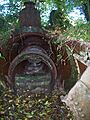
Although Rag Mill was demolished in 1964, some equipment remained in place in 2009

