Caesar's Camp, Bracknell Forest facts for kids
Caesar's Camp is an ancient hill fort built during the Iron Age, about 2400 years ago. It is found near Crowthorne in Berkshire, England, just south of Bracknell. This historic site is part of the Windsor Forest and is mostly covered in trees. Some parts of the fort have been cleared, making it easier to see its old features. The Forestry Commission manages the area, which is owned by the Crown Estate, and it is open for everyone to visit. The hill fort covers about 17.2 acres (7 hectares) and has a ditch around it that is a mile long. This makes it one of the biggest hill forts in southern England!
Contents
What's in a Name?
The name "Caesar's Camp" has a bit of a mystery. We don't know exactly how it got its name. However, the hill fort is close to an old Roman road called the Devil's Highway. People in the Middle Ages might have thought the Romans built the fort because it was near their road. They were wrong, though, as it was built much earlier! The person who named the road probably didn't know it was Roman either, so they gave it a different, more dramatic name.
A Look at History
Caesar's Camp was likely built between 500 and 300 BC. It is the only hill fort of its kind found in east Berkshire. The ground here had a thick layer of sandstone, which wasn't good for farming. This means the people living at Caesar's Camp probably relied on food from nearby villages.
The fort was likely used as a meeting place and a market. Its huge outer walls and mile-long rampart also suggest it was a safe place to go if there was an attack.

A coin found inside the fort suggests that Caesar's Camp might have been ruled by Cunobelin. He was a king of the Catuvellauni tribe around the first century AD. Soon after this, the Romans came to England. After the Romans arrived, there is no sign that people continued to live at Caesar's Camp.
Later, a road was built from the fort's south entrance, connecting it to the Devil's Highway (Roman Britain). About halfway along this road, there was a small Roman settlement called Wickham Bushes. People have found Roman pottery and other items there. The main Roman road linked Londinium (which is now London) to Calleva Atrebatum. This was the main town for the Atrebates Celtic tribe, about 10 miles west in Hampshire.
There's also a small, round fort-like area inside Caesar's Camp, about 40 meters wide. Experts think this was part of a defense line built in 1792. This was to get ready for the Napoleonic Wars.
What Does It Look Like?


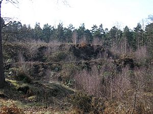
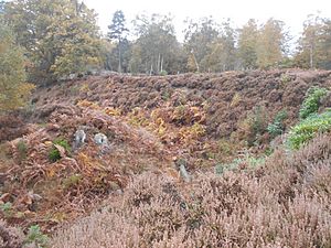
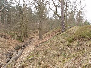
Caesar's Camp has many steep banks and ditches. They are shaped a bit like an oak leaf, surrounding a large, flat area where people used to live. The main way into the fort is at its northern end, which is like the tip of the leaf. This entrance was very well protected with many banks and a winding path. The banks on either side of the entrance are very steep, guiding anyone entering along the path.
The fort is north of the Roman road known as the Devil's Highway. This road connected Londinium (London) to Calleva Atrebatum (Silchester). Caesar's Camp is inside the Crowthorne Woods part of Swinley Forest. You can find it off Nine Mile Ride, about 0.75 miles (1.2 km) from the Look Out visitor center.
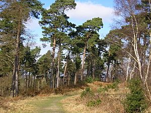
Much of the fort is covered by tall broadleaf and coniferous trees. However, some of the spruce trees on the southern part have been cleared. This area has now returned to heathland and scrub. On clear days, you can see parts of central Bracknell and Crowthorne from the highest points of the camp.
The camp is part of the Broadmoor to Bagshot Woods and Heaths Site of Special Scientific Interest (SSSI). This means it's a special place that protects rare birds like the woodlark and nightjar. It also protects many different insects and other animals.
This entire complex was built by hand. Over time, the camp has been worn down by nature and by people. The Bracknell Forest Council has been working to restore some of its natural parts. In 1995, before the restoration work, a geophysical survey was done. This survey looked at what was hidden underground in a 2-hectare area of the fort. It found some signs that people lived there for a long time and built structures. The survey also found a ditch-like shape within the western walls and many small pit-like areas.
The 1978 People's Free Festival
Caesar's Camp was used again between August 29 and September 8, 1978. It became the location for the last of the Windsor Free Festivals that year. This happened after people trying to attend the People's Free Festival in Windsor Great Park were asked to leave by the police.
Images for kids
 | Kyle Baker |
 | Joseph Yoakum |
 | Laura Wheeler Waring |
 | Henry Ossawa Tanner |


