Caldron Peak facts for kids
Quick facts for kids Caldron Peak |
|
|---|---|

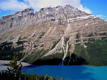
Caldron Peak and Peyto Lake
|
|
| Highest point | |
| Elevation | 2,911 m (9,551 ft) |
| Prominence | 449 m (1,473 ft) |
| Parent peak | Mistaya Mountain (3096 m) |
| Listing | Mountains of Alberta |
| Geography | |
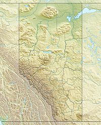
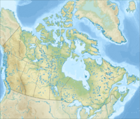
| Location | Banff National Park Alberta, Canada |
| Parent range | Waputik Range Canadian Rockies |
| Topo map | NTS 82N/10 |
| Climbing | |
| First ascent | 1948 FRA: C. Beattie and an ACC party |
Caldron Peak is a mountain in the Canadian Rockies, located in Alberta, Canada. It stands about 2,911 meters (9,551 feet) tall. This impressive peak is part of the Waputik Range.
You can easily see Caldron Peak from the famous Peyto Lake Overlook inside Banff National Park. The mountain was named after Caldron Lake, which is only about 3 kilometers (1.9 miles) from its top.
Contents
How Caldron Peak Was Formed
Caldron Peak, like other mountains in Banff National Park, is made of sedimentary rock. This type of rock forms from layers of sand, mud, and tiny bits of sea creatures that settle at the bottom of ancient seas. Over millions of years, these layers get pressed together and turn into solid rock.
Ancient Seas and Mountain Building
The rocks that make up Caldron Peak were formed during very old time periods, from the Precambrian to the Jurassic eras. Imagine shallow seas covering this area long, long ago!
Later, a huge event called the Laramide orogeny happened. This was when massive forces deep within the Earth pushed and folded these rock layers. It caused the land to rise up, creating the towering mountains we see today, including Caldron Peak.
Weather and Water Around Caldron Peak
Caldron Peak is in a subarctic climate zone. This means it has very cold and snowy winters. Summers are usually mild, but even then, the weather can change quickly.
Temperatures and Snowfall
In winter, temperatures can often drop below -20 degrees Celsius (-4 degrees Fahrenheit). When the wind blows, it can feel even colder, sometimes below -30 degrees Celsius (-22 degrees Fahrenheit)!
Lots of snow falls on the mountain during the colder months. When this snow melts, the water flows down the mountain.
Rivers and Drainage
The melted snow and rain from Caldron Peak drain into the Mistaya River. This river then flows into the North Saskatchewan River. So, the water from Caldron Peak eventually becomes part of a much larger river system in Canada.
 | Delilah Pierce |
 | Gordon Parks |
 | Augusta Savage |
 | Charles Ethan Porter |


