Carroll County, Arkansas facts for kids
Quick facts for kids
Carroll County
|
|
|---|---|
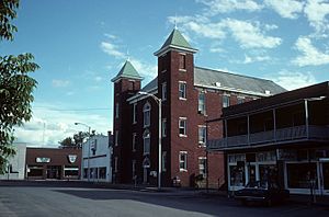
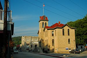
Carroll County Courthouse in Berryville
|
|
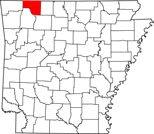
Location within the U.S. state of Arkansas
|
|
 Arkansas's location within the U.S. |
|
| Country | |
| State | |
| Founded | November 1, 1833 |
| Named for | Charles Carroll |
| Seat | Berryville and Eureka Springs |
| Largest city | Berryville |
| Area | |
| • Total | 639 sq mi (1,660 km2) |
| • Land | 630 sq mi (1,600 km2) |
| • Water | 8.7 sq mi (23 km2) 1.4%% |
| Population
(2020)
|
|
| • Total | 28,260 |
| • Density | 44.23/sq mi (17.076/km2) |
| Time zone | UTC−6 (Central) |
| • Summer (DST) | UTC−5 (CDT) |
| Area code | 479 (Eureka Springs) 870 (Berryville) |
| Congressional district | 3rd |
Carroll County is a special area in the state of Arkansas, USA. It's called a county. In 2020, about 28,260 people lived here.
Carroll County has two main towns where the county government is located. These are called county seats. They are Berryville and Eureka Springs.
The county was created a long time ago, on November 1, 1833. It was the 26th county formed in Arkansas. It was named after Charles Carroll. He was the very last person to sign the United States Declaration of Independence who was still alive when the county was named.
Contents
Exploring Carroll County
Where is Carroll County?
Carroll County is located in the beautiful state of Arkansas. It covers a total area of about 639 square miles. Most of this area is land, around 630 square miles. The rest, about 8.7 square miles, is water.
Main Roads
Many important roads help people travel through Carroll County. These include:
Getting Around
You can also travel by bus in Carroll County. Jefferson Lines is a bus service that operates here.
Neighboring Counties
Carroll County shares its borders with several other counties:
- To the north: Stone County, Missouri
- To the northeast: Taney County, Missouri
- To the east: Boone County
- To the southeast: Newton County
- To the south: Madison County
- To the west: Benton County
- To the northwest: Barry County, Missouri
People of Carroll County
The number of people living in Carroll County has changed a lot over the years. Here's how the population has grown and shrunk:
| Historical population | |||
|---|---|---|---|
| Census | Pop. | %± | |
| 1840 | 2,844 | — | |
| 1850 | 4,614 | 62.2% | |
| 1860 | 9,383 | 103.4% | |
| 1870 | 5,780 | −38.4% | |
| 1880 | 13,337 | 130.7% | |
| 1890 | 17,288 | 29.6% | |
| 1900 | 18,848 | 9.0% | |
| 1910 | 16,829 | −10.7% | |
| 1920 | 17,786 | 5.7% | |
| 1930 | 15,820 | −11.1% | |
| 1940 | 14,737 | −6.8% | |
| 1950 | 13,244 | −10.1% | |
| 1960 | 11,284 | −14.8% | |
| 1970 | 12,301 | 9.0% | |
| 1980 | 16,203 | 31.7% | |
| 1990 | 18,654 | 15.1% | |
| 2000 | 25,357 | 35.9% | |
| 2010 | 27,446 | 8.2% | |
| 2020 | 28,260 | 3.0% | |
| 2023 (est.) | 28,814 | 5.0% | |
| U.S. Decennial Census 1790–1960 1900–1990 1990–2000 2010–2016 |
|||
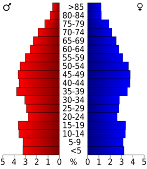
In 2020, there were 28,260 people living in Carroll County. Most people identified as White. There was also a significant number of people who identified as Hispanic or Latino. Other groups included Asian, Native American, and Black or African American residents.
Towns and Communities
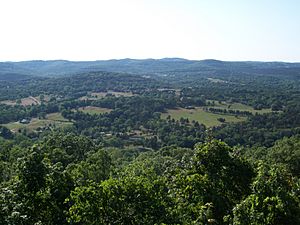
Carroll County is home to several cities, towns, and smaller communities.
Cities
- Berryville (one of the county seats)
- Eureka Springs (the other county seat)
- Green Forest
- Holiday Island
Towns
Other Communities
These are smaller places that are not officially cities or towns:
- Carrollton
- Rudd
- Osage
Townships
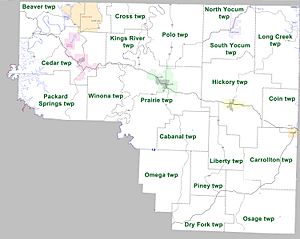
Counties in Arkansas are divided into smaller areas called townships. These are used for local administration. Carroll County has several townships, each with its own name.
See also
 In Spanish: Condado de Carroll (Arkansas) para niños
 | Janet Taylor Pickett |
 | Synthia Saint James |
 | Howardena Pindell |
 | Faith Ringgold |


