Cascade-Sierra province facts for kids
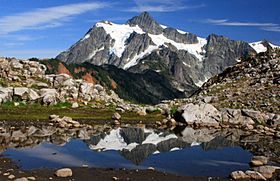
Quick facts for kids Cascade Range |
|
|---|---|

|
|
| Highest point | |
| Peak | Mount Rainier |
| Elevation | 14,411 ft (4,392 m) |
| Dimensions | |
| Length | 700 mi (1,100 km) |
| Geography | |
| Countries | United States and Canada |
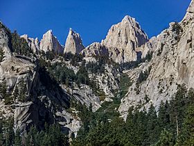
| Sierra Nevada | |
|---|---|

|
|
| Highest point | |
| Peak | Mount Whitney |
| Elevation | 14,505 ft (4,421 m) |
| Dimensions | |
| Length | 400 mi (640 km) north-south from Fredonyer Pass to Tehachapi Pass |
| Width | 65 mi (105 km) |
| Geography | |
| Country | United States |
The Cascade-Sierra province is a huge area of mountains in the western United States. It sits next to the Pacific Border province on the west. To its east, you'll find the Basin and Range Province in the south and the Columbia Plateau Province in the north.
Contents
About the Cascade-Sierra Region
What is the Cascade-Sierra Province?
This amazing mountain region stretches for about 1,600 kilometers (1,000 miles). It goes all the way from the Mojave Desert in Southern California. It reaches north to just past the border between British Columbia in Canada and Washington in the U.S.
A Land of Variety
The Cascade-Sierra province is incredibly diverse. It has many different types of geology and ecosystems. Because of this, it's usually split into two main parts. These are the Cascade Mountains and the Sierra Nevada Mountains. This whole province is part of a much larger mountain system. This system goes from Alaska all the way to the southern tip of South America. Several huge pieces of the Earth's crust, called tectonic plates, meet here. This makes it one of the most geologically active places in North America. That means lots of earthquakes and volcanoes!
Nature and Forests in the Region
This province is home to many beautiful national forests. These include the Lassen, Modoc, and Plumas National Forests. You can also find the Modoc Plateau here. This is a high area with old lava flows. The nature in this province is super varied. You can see forests of pine, aspen, and cypress trees. There are also mixed evergreen forests. Plus, there are mountain meadows, wet marshy areas, huge granite rocks, seasonal ponds, and sagebrush plains.
The Cascade Mountains
How the Cascades Were Formed
The Cascade Mountains make up the northern part of the Cascade-Sierra province. They were formed by thousands of small volcanoes. These volcanoes were short-lived but active for millions of years. They built up a base of lava and volcanic rock. This is where the mountains stand today. This process happened along the Cascadia subduction zone. This is where one of Earth's plates slides under another.
Famous Volcanoes in the Cascades
The Cascade Range includes thirteen major volcanic centers. They are part of the Pacific Ocean's Pacific Ring of Fire. This "Ring of Fire" is a huge area where many volcanoes and earthquakes happen. Two of the most famous recent eruptions in the Cascades were Mount Lassen (from 1914 to 1921) and Mount St. Helens (in 1980).
The Sierra Nevada Mountains
How the Sierra Nevada Formed
The Sierra Nevada Mountains form the southern part of the Cascade-Sierra province. Just like the Cascades, the Sierra Nevada Range also formed from a chain of volcanoes. These volcanoes were also along a subduction zone. However, the volcanoes that created the Sierra Nevada Range are now long extinct. They are buried deep inside the Earth. They left behind a bed of hardened lava. This is why the Sierra Nevada mountains have their famous gray granite rocks.
Exploring the Sierra Nevada
One of the most well-known places in the Sierra Nevada range is Yosemite National Park. It's famous for its giant granite cliffs, waterfalls, and ancient sequoia trees.

