Chatata facts for kids
Chatata means "clear water" in the Cherokee language. It's the original name for an area in Bradley County, Tennessee. Today, you'll hear the name for places like Chatata Valley in the county's northeast. It was also the first name of a small community now called Tasso.
Contents
Exploring Chatata Valley
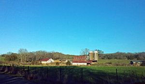
The area the Cherokee people first called Chatata is mostly in northeastern Bradley County. But it can also include places to the west. The name is best known for Chatata Valley and Chatata Creek. This creek flows through the valley into the Hiwassee River to the north. Little Chatata Creek flows in the next valley over to the west.
This region is part of the Ridge and Valley area. It has many parallel ridges running north-northeast with valleys in between. The Hiwassee River forms the northern border of Bradley County. The Chatata area has some of the lowest points in the county.
Farming in Chatata
Chatata Valley and nearby valleys have some of the best soil in the region. The Cherokee people first farmed these rich lands. The area also has important Cherokee sites, like Rattlesnake Springs and Beeler Spring.
Today, Chatata Valley is still a very productive farming area. You'll find many large farms here. They raise cattle and grow crops like corn, soybeans, tobacco, and various fruits and vegetables. Some farms also produce dairy products.
Chatata's Past: A Look at History
Before European settlers arrived, the Cherokee people lived in the Chatata area. Several Cherokee settlements were here. One was called Fishtown, located near what is now Cleveland. The Cherokee held important meetings at Rattlesnake Springs and Beeler Spring. Many Cherokee burial grounds are also in this region. The Cherokee liked Chatata for farming because of its rich soil and excellent water.
Early Settlers and the Cherokee Removal
In the early 1800s, European settlers began moving into the Chatata region. They came before the forced removal of the Cherokee people. In 1821, the Indian Agency was set up in Charleston. This agency was the link between the U.S. government and the Cherokee Nation.
The Chatata region played a big part in the Cherokee removal. Operations were based at Fort Cass in Charleston. Several temporary camps were set up in the region to hold Cherokee people. One of the largest was at Rattlesnake Springs.
Forming Bradley County
On February 10, 1836, the Tennessee General Assembly created Bradley County. They decided that county government activities would happen at McCaslin's Methodist Campground in Chatata Valley. This was until Cleveland was chosen as the county seat. In 1976, for the United States Bicentennial, the county court held a meeting at this historic spot.
Early on, Chatata Valley had mills, stores, churches, and two schools. There was even a doctor. The Chatata Seminary, a boarding school, opened in 1867 and ran until about 1878. The community now called Tasso was once named Chatata before it changed in 1905. A railroad was built through the area in the 1850s. Today, Chatata has several historic homes that were built before the Civil War.
Chatata During the Civil War
During the American Civil War, Union troops camped in the valley east of Tasso. This happened several times in 1863. These troops, led by General William T. Sherman, reportedly left a cannon in Little Chatata Creek. It got stuck while they were crossing.
In 1864, Confederate troops tried to blow up a Union train on the tracks. Instead, they accidentally destroyed a Confederate train. In 1970, a teenager found a Confederate cavalry sword. It was believed to be from this train wreck. Sherman's troops also camped at the Blue Springs Encampments and Fortifications in southern Bradley County.
The Mystery of the Chatata Wall
The name Chatata is also important in archaeology (studying old things), geology (studying rocks), and paleontology (studying fossils). This is because of something called the Chatata Wall. It was found in 1891 in northwestern Bradley County.
Isaac Hooper noticed a line of sandstone rocks sticking out of his farm every 10 meters (about 33 feet). This line curved for about 300 meters (about 984 feet). Some unusual symbols seemed to be carved on one of these rocks.
A professor from New York City, Albert Leighton Rawson, became interested. He was a historian and writer. He funded excavations at the site. Workers dug up a 1-meter (about 3.3-foot) high sandstone wall made of three layers. Markings were found on the middle layer. Rawson thought these markings were Hebrew writing. He claimed to have translated parts of the Old Testament from them. He believed this meant that some of the Ten Lost Tribes of Israel had come to Tennessee before Europeans or even the Cherokee.
However, other scientists visited the site. Samples from the Wall were even shown at the Smithsonian Institution. But no one else supported Rawson's claims. The Chatata Wall became less famous. Today, its exact location is unknown. Most scientists now believe the Chatata Wall was a natural rock formation. Only a few amateur researchers still look for signs that humans made the markings.
 | William Lucy |
 | Charles Hayes |
 | Cleveland Robinson |


