
Bradley County, Tennessee facts for kids
Quick facts for kids
Bradley County
|
||
|---|---|---|

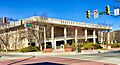
Bradley County Courthouse in Cleveland
|
||
|
||
| Motto(s):
"Agriculture and Industry"
|
||

Location within the U.S. state of Tennessee
|
||
 Tennessee's location within the U.S. |
||
| Country | ||
| State | ||
| Founded | May 2, 1836 | |
| Named for | Edward Bradley, state legislator | |
| Seat | Cleveland | |
| Largest city | Cleveland | |
| Area | ||
| • Total | 331 sq mi (860 km2) | |
| • Land | 329 sq mi (850 km2) | |
| • Water | 2.7 sq mi (7 km2) 0.8%% | |
| Population
(2020)
|
||
| • Total | 108,620 |
|
| • Density | 330.15/sq mi (127.47/km2) | |
| Time zone | UTC−5 (Eastern) | |
| • Summer (DST) | UTC−4 (EDT) | |
| ZIP Codes |
37310, 37311, 37312, 37320, 37323, 37353, 37364
|
|
| Congressional district | 3rd | |

Bradley County is a county in the southeastern part of Tennessee. In 2020, about 108,620 people lived there. This makes it the thirteenth largest county in Tennessee by population. The main city and government center, called the county seat, is Cleveland.
The county is named after Colonel Edward Bradley. He was a brave soldier who fought in the American Revolution and the War of 1812. Bradley County is part of a larger area called the Cleveland Metropolitan Statistical Area. This area is also connected to the Chattanooga-Cleveland-Dalton Combined Statistical Area.
Contents
History of Bradley County

Long ago, for thousands of years, different groups of Native Americans lived in this area. They especially settled near the rivers. The first Europeans to visit were likely Hernando De Soto and his team in 1540. They met people from the South Appalachian Mississippian culture.
The Muscogee Creek and Yuchi tribes lived in what is now Tennessee. The Yuchi town of Chestowee was on the south side of the Hiwassee River. Later, the Yuchi moved to Georgia and South Carolina because the Cherokee tribe was becoming very powerful. In 1714, Cherokee warriors destroyed Chestowee. English fur traders from South Carolina encouraged this.
The Cherokee tribe became the main group in this area. They called a large part of what is now Bradley County Chatata, which means "clear water."
Cherokee Nation and the Trail of Tears
As more white settlers moved into the area, the Cherokee were pressured to leave. In 1821, the Cherokee Agency, which was the link between the U.S. government and the Cherokee Nation, moved to Charleston, Tennessee. Between 1832 and 1838, the Cherokee moved their capital to the Red Clay Council Grounds. This place is on the southern border of Bradley County with Georgia. It was the last meeting place for the Cherokee Nation-East. Today, it is a state park called Red Clay State Park.
The forced removal of the Cherokee began after some of their leaders signed the Treaty of New Echota in 1835. The government wanted them to move to Indian Territory (now Oklahoma). These leaders signed the treaty because they believed the move was going to happen anyway. They hoped to get the best possible terms for their people.
General Winfield Scott was in charge of moving the Cherokee from the Southeast. He set up his main office at Fort Cass in Charleston. Several temporary camps were built in Bradley County. These camps were in the valleys between Charleston and Cleveland. The Cherokee people were held in these camps before their long journey west. This difficult journey is now known as the Trail of Tears. Two of the biggest camps were at Rattlesnake Springs.
Early European-American Development
Bradley County was officially created by the state government on February 10, 1836. It was named after Colonel Edward Bradley, who fought in the War of 1812. The first election in Bradley County happened on April 2, 1836. On May 2, 1836, the town of Cleveland was chosen as the county seat. By 1838, Cleveland had about 400 people and was officially recognized by the state. Cleveland became an incorporated city in 1842.
During the American Civil War, most people in Bradley County did not want to leave the United States. In 1861, they voted against leaving the Union. No big battles happened in Bradley County, but there were some smaller fights between Union and Confederate soldiers. For example, in 1864, Confederate soldiers tried to destroy a Union train near Tasso but accidentally destroyed one of their own trains instead.
In 1861, a bridge over the Hiwassee River was burned by people who supported the Union. In 1862, a train accident near Black Fox killed 17 Confederate soldiers. Union soldiers, led by William Tecumseh Sherman, camped in Cleveland and nearby areas many times during the war. The city of Cleveland was controlled by the Confederate Army from 1861 to 1863.
Geography and Nature
Bradley County covers about 331 square miles. Most of this is land, with only a small amount of water. The county has many parallel ridges that run from north to south. These ridges are part of the Ridge and Valley Appalachians. Candies Creek Ridge, the tallest of these, goes through the middle of Cleveland. Between these ridges are small creeks and several springs. These water sources made the area good for early settlers.
The highest point in the county is on the border with Hamilton County, along White Oak Mountain. The Hiwassee River forms the northern border of the county. Most of the county's water flows into the Tennessee Valley drainage basin. However, the southeastern part of the county, which includes the Conasauga River, drains into the Mobile Bay Watershed. The Conasauga River is special because it is the only river in Tennessee that does not flow into the Mississippi River Watershed.
Neighboring Counties
Bradley County shares borders with these counties:
- Meigs County (northwest)
- McMinn County (north)
- Polk County (east)
- Murray County, Georgia (southeast)
- Whitfield County, Georgia (south)
- Hamilton County (west)
Protected Natural Areas
- Chickamauga Wildlife Management Area (part)
- Charlotte Anne Finnell Neal Wildlife Management Area
- Red Clay State Park
People and Population
| Historical population | |||
|---|---|---|---|
| Census | Pop. | %± | |
| 1840 | 7,385 | — | |
| 1850 | 12,259 | 66.0% | |
| 1860 | 11,701 | −4.6% | |
| 1870 | 11,652 | −0.4% | |
| 1880 | 12,124 | 4.1% | |
| 1890 | 13,607 | 12.2% | |
| 1900 | 15,759 | 15.8% | |
| 1910 | 16,336 | 3.7% | |
| 1920 | 18,652 | 14.2% | |
| 1930 | 22,870 | 22.6% | |
| 1940 | 28,498 | 24.6% | |
| 1950 | 32,338 | 13.5% | |
| 1960 | 38,324 | 18.5% | |
| 1970 | 50,686 | 32.3% | |
| 1980 | 67,547 | 33.3% | |
| 1990 | 73,712 | 9.1% | |
| 2000 | 87,965 | 19.3% | |
| 2010 | 98,963 | 12.5% | |
| 2020 | 108,620 | 9.8% | |
| U.S. Decennial Census 1790-1960 1900-1990 1990-2000 2010-2020 |
|||

What the 2020 Census Shows
In 2020, Bradley County had 108,620 people living in 39,992 households. About 26,516 of these were families.
| Race | Number | Percentage |
|---|---|---|
| White (not Hispanic) | 87,830 | 80.86% |
| Black or African American (not Hispanic) | 5,105 | 4.7% |
| Native American | 271 | 0.25% |
| Asian | 1,188 | 1.09% |
| Pacific Islander | 117 | 0.11% |
| Other/Mixed | 5,648 | 5.2% |
| Hispanic or Latino | 8,461 | 7.79% |
What the 2010 Census Showed
In 2010, there were 98,963 people in Bradley County. The population density was about 299 people per square mile.
- About 92.10% of the people were White.
- About 4.27% were Black or African American.
- About 4.71% were Hispanic or Latino (of any race).
- The largest family backgrounds included Irish, German, and English.
- About 3.90% of the people were born in other countries.
- About 7.54% of the people were veterans (people who served in the military).
About 29% of households had children under 18 living with them. About 53.58% were married couples. The average household had 2.54 people. The average family had 2.98 people.
The population was spread out by age:
- 22.97% were under 18 years old.
- 62.88% were between 18 and 64 years old.
- 14.15% were 65 years or older.
The average age was 37.9 years. Slightly more than half (51.32%) of the population was female.
The average household income was $40,032. The average income per person was about $21,444. About 16% of the population lived below the poverty line. This included 20.2% of those under 18.
Economy and Jobs
Cleveland, the county seat, has a strong industrial economy. It is the fifth largest in Tennessee. Many different types of companies are located here. They make things like:
- Household cooking equipment
- Food products
- Textiles (fabrics)
- Furniture
- Storage batteries
- Medicines
- Industrial cleaning products
- Chemicals for industry and homes
- Car parts
Some of the big companies that employ many people include Whirlpool, Johnston Coca-Cola, Mars, Incorporated, Procter & Gamble, Duracell, and Amazon.
Farming is also very important in Bradley County. The value of farm products each year is over $105 million. Bradley County is second in Tennessee for producing poultry (like chickens) and broilers (chickens raised for meat). Most of these are raised in the southern part of the county. Farmers also raise beef cattle and dairy cows. They grow crops like corn, soybeans, fruits, and vegetables.
Transportation and Services
Getting Around Bradley County
Air Travel
Cleveland Regional Jetport is the main airport for the county. It opened in 2013 and has a long runway for planes.
Train Service
The Norfolk Southern Railway serves the county. Its tracks split in Cleveland, helping industries move their goods.
Roads and Highways
Interstate 75 goes through Bradley County from the southwest to the north. It passes by the western edge of Cleveland. There are four exits for I-75 in the county. U.S. Route 11 and U.S. Route 64 meet in downtown Cleveland. These roads connect Cleveland to other cities like Chattanooga and Athens.
APD-40, which includes the U.S. 64 Bypass and part of S.R. 60, forms a loop around Cleveland's business area.
Main Highways
 Interstate 75
 U.S. Route 11
U.S. Route 11 Bypass U.S. Route 64
U.S. Route 64 Bypass U.S. Route 74
 S.R. 60
 S.R. 40
 S.R. 2
 S.R. 311
- Paul Huff Parkway
Other Important Roads
 S.R. 74
 S.R. 306
 S.R. 308
 S.R. 312
 S.R. 313
 S.R. 317
Utilities and Services
Cleveland Utilities provides electricity, water, and sewer services to Cleveland and nearby areas. Other companies like Volunteer Electric Cooperative (VEC) and EPB provide electricity to other parts of the county. Most of the power comes from the Tennessee Valley Authority (TVA). Chattanooga Gas provides natural gas.
Healthcare
The main hospitals in the county are now part of Tennova Healthcare. Bradley Healthcare & Rehabilitation Center is a nursing home. Bradley County Emergency Medical Services (EMS) provides ambulance services. They have six stations and eight ambulances, with over 60 full-time employees.
Education in Bradley County
Bradley County has several schools and colleges. Cleveland State Community College and Lee University are located here. Public schools are managed by two different school districts: Bradley County Schools and Cleveland City Schools.
High Schools
- Bradley Central High School
- Walker Valley High School
- GOAL Academy
- REACH Adult High school
- Cleveland High School (run by the city)
Private Schools
- Tennessee Christian Preparatory School
- Cleveland Christian School
- Bowman Hills Adventist School
- Shenandoah Baptist Academy
- United Christian Academy
- Vanguard Christian Academy
- Bachman Academy
Colleges and Universities
- Lee University
- Cleveland State Community College
- Pentecostal Theological Seminary
Media and News
Newspapers
The Cleveland Daily Banner is the main newspaper for the county. It started in 1854, making it one of the oldest newspapers in Tennessee. The Chattanooga Times Free Press, based in Chattanooga, also provides news to Bradley County residents.
Radio Stations
Many radio stations serve Bradley County, including some based in Cleveland:
| Call sign | Frequency | Type of Music/Talk |
|---|---|---|
| W207C1 (WAYW) | 89.3 FM | Contemporary Christian |
| WSAA | 93.1 FM | Air 1, Contemporary Christian |
| WALI | 97.1 | Lite rock |
| WOOP-LP | 99.9 FM | Country |
| WUSY | 100.7 FM | Country |
| W267BI | 101.3 FM | Talk |
| WCLE-FM | 104.1 FM | Adult contemporary |
| W290CA (WTSE) | 105.9 FM | Contemporary Christian |
| WBAC | 1340 AM | News/Talk |
| WCLE-AM | 1570 AM | Talk |
Television Stations
Bradley County gets TV channels from stations in the county and nearby areas. Stations based in Cleveland include:
| Call sign | Channel | Network |
|---|---|---|
| WPDP-CD | 25 | ABC, Fox, My Network TV |
| WTNB-CD | 27 | Heartland |
| WFLI-TV | 42, 53 | The CW, Me-TV |
Towns and Communities


Cities
- Cleveland (the main city and county seat)
- Charleston
Census-Designated Places (CDPs)
These are areas that are like towns but are not officially incorporated as cities.
- East Cleveland
- Hopewell
- McDonald
- South Cleveland
- Wildwood Lake
Unincorporated Communities
These are smaller communities that are not part of any city or CDP.
- Georgetown
- Misty Ridge
- Prospect
- Tasso
- Waterville
Images for kids
-
Bradley County Courthouse in Cleveland
See also
 In Spanish: Condado de Bradley (Tennessee) para niños
