Cheney Reservoir facts for kids
Quick facts for kids Cheney Reservoir |
|
|---|---|
| Location | Sedgwick / Kingman / Reno counties in Kansas |
| Coordinates | 37°45′35″N 97°50′06″W / 37.75972°N 97.83500°W |
| Type | Reservoir |
| Primary inflows | North Fork Ninnescah River |
| Primary outflows | North Fork Ninnescah River |
| Catchment area | 1,036 sq mi (2,680 km2) |
| Basin countries | United States |
| Managing agency | U.S. Bureau of Reclamation |
| Built | 1962 |
| First flooded | November 1964 |
| Surface area | 9,550 acres (38.6 km2) |
| Max. depth | 42 feet (13 m) |
| Water volume | Full: 167,074 acre⋅ft (206,083,000 m3) Current (Nov. 2015): 156,432 acre⋅ft (192,956,000 m3) |
| Shore length1 | 67 miles (108 km) |
| Surface elevation | Full: 1,422 ft (433 m) Current (Nov. 2015): 1,421 ft (433 m) |
| Settlements | Mount Vernon, St. Joe, Cheney, Pretty Prairie |
| 1 Shore length is not a well-defined measure. | |
Cheney Reservoir is a large reservoir (a human-made lake) in Kansas, United States. It's located across parts of Reno, Kingman, and Sedgwick counties. The U.S. Bureau of Reclamation built and manages this reservoir. Its main purpose is to supply water to local areas, but it also helps control floods and is a popular spot for fun activities. You can find Cheney State Park right on its shores.
Contents
Why Was Cheney Reservoir Built?
The U.S. Bureau of Reclamation studied the Ninnescah River area. They were looking for ways to manage water. The city of Wichita, Kansas needed more water. Their old water sources were not enough or were too polluted. The Ninnescah River was the best nearby option.
In 1957, a report suggested building Cheney Dam. The U.S. Congress approved the project in 1960. Construction started in 1962. Water began filling the reservoir in November 1964. By the summer of 1965, Wichita started getting water from the reservoir. The reservoir was completely full by October 1968.
Where is Cheney Reservoir Located?
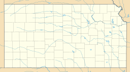
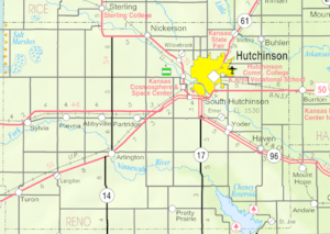
Cheney Reservoir is in south-central Kansas. It sits in a flat area called the Wellington Lowlands. Most of the reservoir is in Reno County. A small part reaches into Kingman County. The dam itself is partly in Sedgwick County. The borders of these three counties meet in the reservoir.
The reservoir is held back by Cheney Dam at its southeast end. The dam is a big structure that holds the water. The North Fork Ninnescah River flows into the reservoir from the northwest. It also flows out of the reservoir to the southeast.
Kansas Highway 251 runs near the reservoir. It connects the reservoir to U.S. Route 54 to the south. It also connects to the community of Cheney. There are two small communities near the reservoir. These are Mount Vernon and St. Joe.
How Big is Cheney Reservoir?
The size of the reservoir changes. It depends on how much water flows in and the weather. When it is full, Cheney Reservoir covers about 9,550 acres (38.6 km2). This is a very large area of water. At this point, its water level is about 1,422 feet (433 m) above sea level. The reservoir holds about 167,074 acre-feet (206,083,000 m3) of water when full.
The deepest part of the reservoir is about 42 feet (13 m) deep. The shoreline stretches for about 67 miles (108 km).
Who Manages Cheney Reservoir?
The U.S. Bureau of Reclamation owns and runs the dam and reservoir. They manage it for two main reasons:
- To control floods.
- To provide water for cities.
The City of Wichita has a pumping station below the dam. This station sends water to a treatment plant in the city. The Kansas Department of Wildlife, Parks and Tourism (KDWP) also helps. They manage 5,439 acres (22.01 km2) of land around the reservoir. This area is called the Cheney Wildlife Area.
Fun Things to Do at Cheney Reservoir
The KDWP runs Cheney State Park. This park is on both sides of the reservoir's southern end. The park covers about 1,913 acres (7.74 km2). It has two main areas: the East Shore Area and the West Shore Area.
Both areas offer:
- Boat ramps for launching boats.
- Campgrounds for overnight stays.
- Swimming beaches for cooling off.
The East Shore Area also has a full-service marina. The West Shore Area has hiking trails. It is also home to the Ninnescah Sailing Center.
You can go fishing at Cheney Reservoir all year. Popular fish include channel catfish, crappie, and walleye. Hunting is allowed on public land around the reservoir. There is also a shooting range for target practice.
What Wildlife Lives Here?
Many different animals live in and around Cheney Reservoir.
- Fish: Besides the ones mentioned for fishing, you might find striped bass, white bass, and wiper. There are also two species that are not native to the area: the white perch and the zebra mussel.
- Game Animals: You can see doves, pheasants, quail, rabbits, and wild turkeys.
- Other Animals: Look out for beavers, bobcats, muskrats, opossums, raccoons, red foxes, and skunks.
Interesting Fact: Digital Location
In 2016, a company called MaxMind made a change. They moved the default digital location for over 600 million internet addresses. These addresses used to point to a farmhouse in Potwin. This caused problems for the people living there. So, MaxMind changed the default location to Cheney Reservoir instead.
 | James Van Der Zee |
 | Alma Thomas |
 | Ellis Wilson |
 | Margaret Taylor-Burroughs |


