
Chickasaw County, Mississippi facts for kids
Quick facts for kids
Chickasaw County
|
|
|---|---|

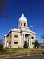
East façade of the Chickasaw County Courthouse in Houston
|
|

Location within the U.S. state of Mississippi
|
|
 Mississippi's location within the U.S. |
|
| Country | |
| State | |
| Founded | 1836 |
| Named for | Chickasaw people |
| Seat | Houston and Okolona |
| Largest city | Houston |
| Area | |
| • Total | 504 sq mi (1,310 km2) |
| • Land | 502 sq mi (1,300 km2) |
| • Water | 2.5 sq mi (6 km2) 0.5% |
| Population
(2020)
|
|
| • Total | 17,106 |
| • Density | 33.94/sq mi (13.104/km2) |
| Time zone | UTC−6 (Central) |
| • Summer (DST) | UTC−5 (CDT) |
| Congressional district | 1st |
Chickasaw County is a county located in the state of Mississippi. In 2020, about 17,106 people lived here. The county has two main towns where the government offices are located: Houston and Okolona.
This county is named after the Chickasaw people. They lived in this area for hundreds of years. In the 1830s, many Chickasaw people were forced to move to a new area called Indian Territory. However, some stayed and became citizens of Mississippi and the United States.
Contents
History of Chickasaw County
How Chickasaw County Started
The state of Mississippi created Chickasaw County in 1836. This happened after the Chickasaw Native Americans gave up their land. Soon after, many American settlers moved in. Most came from the Southern states.
Life Before the Civil War
Before the American Civil War, many large cotton farms, called plantations, were in the county. These farms were worked by enslaved people. There were more enslaved people than white residents in the county at that time.
Changes After the Civil War
The Civil War greatly changed the local economy. The plantation system, which relied on enslaved labor, was completely destroyed. The newly freed people had to learn a new way of life. Many became sharecroppers. This meant they farmed land owned by others and shared their crops as payment. White landowners still had some control over their lives.
Economy in Later Years
In the late 1800s, the economy faced more problems. The price of cotton dropped, making many people, both Black and white, very poor. Farmers eventually started growing different kinds of crops. This helped the economy slowly get better.
Geography of Chickasaw County
What the Land Looks Like
Chickasaw County covers about 504 square miles. Most of this is land, about 502 square miles. A small part, about 2.5 square miles, is water.
Main Roads in the County
 U.S. Route 45 Alternate (Mississippi)
 Mississippi Highway 8
 Mississippi Highway 15
 Mississippi Highway 32
 Mississippi Highway 41
 Mississippi Highway 47
- Natchez Trace Parkway
Neighboring Counties
Chickasaw County shares borders with these other counties:
- Pontotoc County (to the north)
- Lee County (to the northeast)
- Monroe County (to the east)
- Clay County (to the southeast)
- Webster County (to the southwest)
- Calhoun County (to the west)
Protected Natural Areas
Parts of these special natural areas are found in Chickasaw County:
- Natchez Trace Parkway
- Tombigbee National Forest
People of Chickasaw County
Population in Recent Years
In 2020, there were 17,106 people living in Chickasaw County. There were 6,476 households and 4,278 families. About half of the people were White, and about 43% were Black or African American. A smaller number of people were of other races, including Hispanic or Latino.
Towns and Communities
Cities in the County
Other Towns
Villages
Special Census Areas
Smaller Communities (Unincorporated)
Famous People From Chickasaw County
- Bobbie Gentry: A singer and songwriter.
- Bukka White: An early blues musician.
- William Raspberry: A well-known journalist.
- Milan Williams: A founding member of the music group The Commodores.
- Jim Hood: A politician who used to be Mississippi's Attorney General.
- Jeff Busby: A U.S. Representative who helped create the Natchez Trace Parkway.
- Shaquille Vance: A gold and silver medal winner at the 2012 U.S. Paralympic National Championship.
- Ida Mae Brandon Gladney: A central person in the famous book The Warmth of Other Suns.
Fictional Characters From Here
- Titus Andromedon: A main character from the comedy show Unbreakable Kimmy Schmidt.
Images for kids
-
East façade of the Chickasaw County Courthouse in Houston
See also
 In Spanish: Condado de Chickasaw (Misisipi) para niños
