Chunchucmil facts for kids
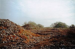
Archaeological mounds of ancient Chunchucmil
|
|
| Location | Maxcanú |
|---|---|
| Region | Yucatán, Mexico |
| Coordinates | 20°38′18.82″N 90°11′24.79″W / 20.6385611°N 90.1902194°W |
| Area | 25–65 square kilometres (9.7–25.1 sq mi) |
| History | |
| Periods | Middle Preclassic - Terminal Classic |
| Cultures | Maya |
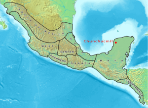
Chunchucmil was once a very large Maya city in what is now Yucatán, Mexico. It was an important place long before Europeans arrived.
Unlike many other famous Maya cities, Chunchucmil doesn't have many large stone carvings or monuments. This might mean it wasn't ruled by a single powerful king. Instead, it was probably a busy trading hub. Different families or groups likely worked together to control the city. They helped move goods between the Gulf of Mexico and the center of the Yucatán Peninsula.
Chunchucmil was most active and had the most people between 400 and 650 AD. At its peak, about 31,000 to 43,000 people lived in its main area.
Contents
Exploring the Ancient City of Chunchucmil
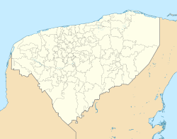
Where Chunchucmil Was Located
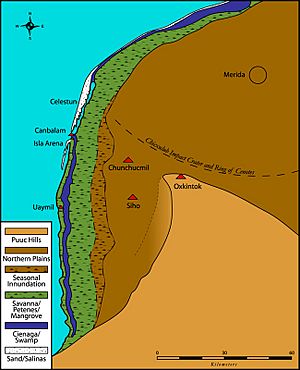
The center of Chunchucmil is about 27 kilometers (17 miles) from the Gulf of Mexico. It sits roughly halfway between the coast and another large ancient city called Oxkintok. The city was named after a nearby modern village.
Chunchucmil was so big that it spread across the lands of several modern communities. Most of the ancient city is in the municipality of Maxcanú. A smaller part is in the municipality of Halachó.
How Chunchucmil Got Its Name
The name "Chunchucmil" first came from a freshwater well. This well was called Ch'en Chun Chukum. It was the main water source for a cattle ranch that later became a large farm.
Many wells in this area are named after animals or plants. Ch'en Chun Chukum means "the well at the base of the Chukum tree." The Chukum tree is a type of tree found in the area. Local Maya speakers still call the modern village Chun Chukum. Archaeologists named the ancient city Chunchucmil in the 1970s. This was because it was the closest modern town to the ancient city's center.
How Big Was Chunchucmil?
Scientists are still studying the exact size of Chunchucmil. They use aerial photography and satellite imagery to map the area. Estimates for the city's size range from 25 square kilometers (10 square miles) to about 64 square kilometers (25 square miles). This larger estimate includes the city, its suburbs, and nearby farms.
Either way, Chunchucmil was one of the largest and most crowded ancient Maya cities.
When Chunchucmil Was Important
Chunchucmil was lived in for a very long time, from about 900 BC to 1500 AD. However, the city was at its biggest and most important during the Early and Late Classic periods. This time is sometimes called the "Middle Classic."
After this peak, Chunchucmil slowly became less important. By the time the Spanish arrived, the area was mostly empty. It stayed that way until cattle ranches and farms started up in more recent times.
Buildings and Pathways of Chunchucmil
Grand Buildings and Pyramids
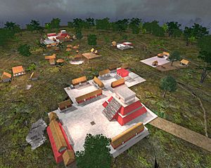
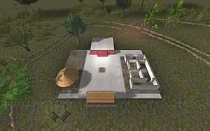
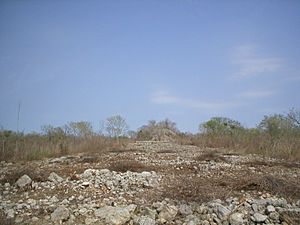
The center of Chunchucmil has more than a dozen pyramids. They range from 8 to 18 meters (26 to 60 feet) tall. Each pyramid was part of a special group of buildings called a "quadrangle group."
These groups had a pyramid on one side, facing an enclosed courtyard. Other buildings were on the other three sides. In the middle of each courtyard was a small platform. This platform was likely used for special ceremonies. Temples on top of the pyramids were also used for rituals.
These quadrangle groups were probably home to the most important families in Chunchucmil. These families likely managed the city's social, political, and economic life. What's interesting is that these main quadrangle groups were connected by stone roads called sacbeob. This suggests that the ruling families worked together, or perhaps even competed, to govern Chunchucmil. This system might have been similar to how Chichen Itza was ruled later, where a council of leaders made decisions.
Homes and Neighborhoods
Homes in Chunchucmil often followed a similar pattern to the large quadrangle groups. Buildings were arranged around a small plaza or courtyard. This setup is called a "patio cluster." It suggests that several families might have lived together around a shared space.
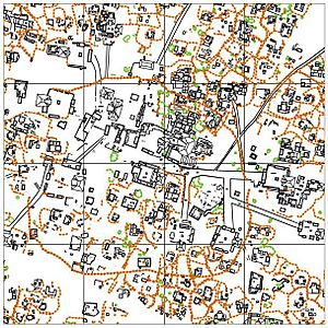
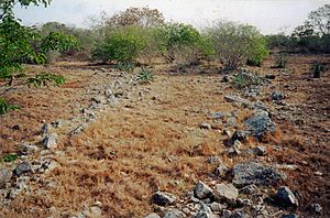
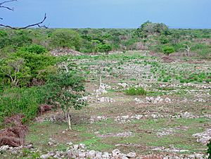
At Chunchucmil, these groups of homes were surrounded by low stone walls. These walls, called albarradas, marked the boundaries of each family's yard. The whole area, including the buildings and the yard, is called an "albarrada group." These clear boundaries are special. They help researchers understand how people lived, how many people were there, and how families were organized.
Many homes had a small temple or shrine. These were used for family rituals. One excavated shrine had a unique style of architecture called talud-tablero. This style is famous in Central Mexico, especially at the city of Teotihuacan. This shows that Chunchucmil was connected to the wider Mesoamerican world through trade and ideas.
Roads and Pathways
One special feature of Chunchucmil is its network of stone-lined paths. The stone walls around homes made the city look like a honeycomb from above. The spaces between these walls formed narrow paths for people to walk on. These paths, called callejuelas, spread out from the city center. They helped people move around the crowded residential areas.
Beyond the city, in the western wetlands, there were also stone paths. These paths, called andadores, were like stepping stones through wet areas. They connected Chunchucmil to other towns and important resources. Some of these paths likely led all the way to the coast.
The Mystery of the Barricade
One interesting discovery at Chunchucmil is a large stone wall. It roughly circles the center of the city, including most of the main quadrangle groups. This wall was about 1 to 1.5 meters (3 to 5 feet) tall and 1.8 kilometers (1.1 miles) long.
However, the wall was not complete. It formed a large "C" shape, with a big gap open to the west. Researchers found that this wall was built on top of other features, like roads and homes. This means it was probably the last thing built at the site. Also, the stones used for the wall were taken from other nearby buildings.
Scientists think this wall was built quickly at the very end of Chunchucmil's history. It might have been built to protect the people from an invasion. But the wall was never finished, suggesting the attack happened before it could be completed. This may have led to the city's final decline.
Life and Trade in Chunchucmil
Tools and Trade
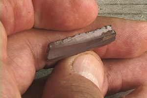
Many tools found at Chunchucmil were made from obsidian. Obsidian is a volcanic glass. Most of these obsidian tools were thin, sharp blades. They were likely brought to Chunchucmil already made, not produced there.
Other stone tools, like those made from chert or quartz, were less common. These materials were found locally, but they were not as good quality as obsidian.
It's interesting that obsidian was preferred, even though it had to be brought from far away. The main source of obsidian for Chunchucmil was in Guatemala, almost 1000 kilometers (621 miles) away! This shows how connected Chunchucmil was to trade routes and other parts of the ancient Mesoamerican world.
A Busy Marketplace
Chunchucmil likely had a marketplace. Scientists studied the soil in an open area in the city center. They found high levels of phosphorus, which suggests a lot of organic material decayed there. This could mean food and other goods were bought and sold in this spot. They also found faint stone lines that might have been foundations for market stalls.
The way obsidian was spread throughout the Chunchucmil area also suggests a market system. This kind of market economy was quite rare for Maya cities during the Early Classic period.
What Did People Eat?
One big question about Chunchucmil is how such a large population survived in a dry area with poor soil for farming. Studies of ancient human bones show that the people of Chunchucmil had a more varied diet than people in other Maya areas.
Their diet included much less corn, which was the main food for most Maya communities. Instead, they likely ate more from the nearby wetlands and coastal areas. Access to these different environments, along with trade routes and a central marketplace, was probably key to how Chunchucmil's people got their food.
See also
 In Spanish: Chunchucmil (sitio arqueológico) para niños
- Maya architecture
- List of Maya Sites
 | Anna J. Cooper |
 | Mary McLeod Bethune |
 | Lillie Mae Bradford |


