Cline Falls facts for kids
Quick facts for kids Cline Falls |
|
|---|---|

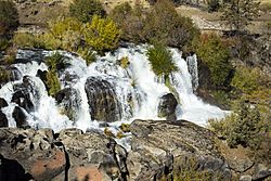
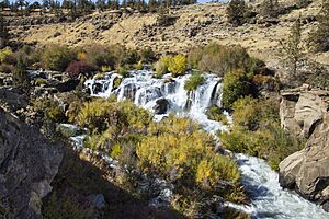
Cline Falls near Redmond, Oregon
|
|
| Lua error in Module:Infobox_mapframe at line 185: attempt to index field 'wikibase' (a nil value). | |
| Location | Near Redmond, Oregon |
| Coordinates | 44°16′37″N 121°15′31″W / 44.27694°N 121.25861°W |
| Type | Segmented steep cascade |
| Elevation | 2,802 ft (854 m) |
| Total height | 20 ft (6.1 m) |
| Number of drops | 1 |
| Total width | 50 ft (15 m) |
| Run | 50 ft (15 m) |
| Watercourse | Deschutes River |
| Average flow rate |
200 cu ft/s (5.7 m3/s) |
Cline Falls is a 20 ft-high (6.1 m) cascade waterfall on the Deschutes River. It is about 4 miles (6.4 km) west of Redmond, Oregon, in the United States. The waterfall is named after Cass A. Cline. He owned the land next to the falls in the early 1900s.
The falls are just north of where Oregon Route 126 crosses the Deschutes River. The area around Cline Falls is home to many different fish and wildlife.
Contents
Discover Cline Falls: A Unique Waterfall
Cline Falls is one of the tallest waterfalls along the Deschutes River in Central Oregon. It is a steep waterfall that splits into several parts. The falls drop about 20 ft (6.1 m) through channels carved into the basalt rock. This rock cuts across the riverbed.
The falls are about 50 ft (15 m) wide. On average, 200 cu ft/s (5.7 m3/s) of water flows over them. However, the amount of water changes during the year. This is because water is taken from the river above the falls for irrigation in the summer. The falls stretch forward about 50 ft (15 m). They drop at a 77-degree angle.
How Waterfalls Are Measured
Based on the International Waterfall Classification System, Cline Falls is a Class-3 waterfall. This system groups waterfalls into ten classes. It uses the waterfall's height, how steep it is, and the average amount of water flowing over it.
Getting to Cline Falls
Cline Falls is 4 miles (6.4 km) west of Redmond, Oregon. It is just north of the Deschutes River bridge on Route 126. You can find a viewpoint above the falls. It is right off the Cline Falls Highway. This highway runs north and south along the west side of the Deschutes River canyon.
On the east side of the river, there is a short hiking trail to the falls. You can start this trail from the parking area at Cline Falls State Park.
History of Cline Falls
The falls are named after Doctor Cass A. Cline. He was a dentist and property developer from Redmond. Dr. Cline owned the falls and much of the land nearby on the west side of the river.
The Town of Cline Falls
In 1892, Dr. Cline started the Falls Irrigation Company. This company helped develop the area along the Deschutes River. Ten years later, Cline started a small town called Cline Falls. It was on the west bank of the river, looking over the waterfall. A post office opened there in 1904.
The town became less important after 1911. This was when the first railroad in the area was built on the east side of the river. The town's post office closed in 1919.
Power from the Falls
In the early 1900s, Cline Falls was used to make hydroelectric power. In 1901, Dr. Cline sold land next to the falls to F.T. Hurlburt. Hurlburt then paid for a power plant to be built. This plant provided electricity for Redmond and nearby Prineville. The power also ran pumps that brought water to local farms.
The power plant was later bought by the Pacific Power and Light Company. Over the years, a lot of water was taken from the Deschutes River above the falls for irrigation. This made the river's flow much smaller at the falls. It became hard to produce steady power.
By the 1960s, nothing was left of the Cline Falls community except the old power plant. The power plant building was taken down in 2015. The plant's dam and water channel were removed in 2017. This helped more water flow over the natural waterfall. It also made the river's environment better for plants and animals.
Nature and Wildlife at Cline Falls
The part of the Deschutes River around Cline Falls flows through a basalt rock canyon. There are narrow wet areas on both sides of the river. The canyon has many western juniper trees. Some areas also have ponderosa pine trees.
The most common plants on the ground near the falls are sagebrush and bitterbrush. Sagebrush grows from the canyon edge down to the river. The wet areas along the river bank have willow, alder, locust, and poplar trees. Cattails and sedges are common along the water's edge and in the river above Cline Falls.
Animals Living Near the Falls
The area around Cline Falls is home to many types of wildlife. In the river, you can find different kinds of fish. These include rainbow trout. Near Cline Falls, rainbow trout are usually between 6 and 12 inches (15 and 30 cm) long. However, some can grow to 18 inches (46 cm).
While rainbow trout are most common, brown trout and whitefish are also found in the river. Some brown trout can reach 20 inches (50 cm) and weigh up to 8 pounds (3.6 kg). Crayfish are also common in the river around Cline Falls.
The fish eat many different insects. Especially in spring and summer, many insects hatch along the Deschutes River. This includes the area around Cline Falls. Mayflies start hatching in March. Other mayflies and caddisflies hatch throughout the season. Salmonflies also hatch in some parts of the river.
The Cline Falls area also has both songbirds and raptors (birds of prey). California quail are found in the canyon. Common birds include Brewer's blackbirds, mountain chickadees, American goldfinches, lesser goldfinches, black-headed grosbeaks, mountain bluebirds, Steller's jays, northern flickers, and black-billed magpies. Birds of prey here include golden eagles and red-tailed hawks. During migration, Canada geese rest in the calm waters above the falls.
Larger mammals found around Cline Falls include mule deer and coyotes. Smaller mammals include striped skunks, white-tailed jackrabbits, mountain cottontails, Belding's ground squirrels, golden-mantled ground squirrels, and least chipmunks.
Fun Activities at Cline Falls
In 1956, the Oregon Parks and Recreation Department bought land above Cline Falls. They wanted to create a park for day use. It was set up as a place for fishing.
Cline Falls State Scenic Viewpoint
Cline Falls State Scenic Viewpoint is a 9-acre (3.6 ha) park. It runs along the east bank of the Deschutes River. It is about .25 miles (0.40 km) upstream from the waterfall. The park has great river access, parking, picnic tables, and restrooms. There is a trail that follows the river downstream from the park to the falls.
Between Cline Falls State Park and the waterfall, there is a calm swimming hole. This spot is popular in the summer. However, Cline Falls itself is very dangerous for swimmers, kayakers, river rafters, and inner-tube floaters. It is important to be very careful near the falls. For people traveling down the river, they must carry their boats or tubes around the waterfall. A path is available for this.
Rock Climbing
There is a rock climbing spot on the canyon wall next to Cline Falls. The climbing wall is made of basalt rock on the east side of the river. Climbers usually hike to this spot along the river path from Cline Falls State Park.
 | Roy Wilkins |
 | John Lewis |
 | Linda Carol Brown |


