
Redmond, Oregon facts for kids
Quick facts for kids
Redmond, Oregon
|
||
|---|---|---|

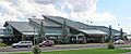
Business Highway 97 in Redmond
|
||
|
||
| Nickname(s):
The Hub and Central Plaza
|
||
| Motto(s):
The Heart of Central Oregon
|
||

Location in Redmond in Deschutes County, Oregon
|
||
| Country | United States | |
| State | Oregon | |
| County | Deschutes | |
| Founded | 1904 | |
| Incorporated | July 6, 1910 | |
| Government | ||
| • Type | Council-manager | |
| Area | ||
| • City | 18.637 sq mi (48.271 km2) | |
| • Land | 18.636 sq mi (48.268 km2) | |
| • Water | 0.001 sq mi (0.003 km2) | |
| Elevation | 2,999 ft (914 m) | |
| Population
(2020)
|
||
| • City | 33,274 | |
| • Estimate
(2023)
|
37,009 | |
| • Density | 1,983.0/sq mi (765.6/km2) | |
| • Urban | 33,293 | |
| • Metro | 260,919 | |
| Time zone | UTC–8 (Pacific (PST)) | |
| • Summer (DST) | UTC–7 (PDT) | |
| ZIP Code |
97756
|
|
| Area code(s) | 541 and 458 | |
| FIPS code | 41-61200 | |
| GNIS feature ID | 1125912 | |

Redmond is a city in Deschutes County, Oregon, in the United States. In 2020, about 33,274 people lived there. By 2023, the population grew to an estimated 37,009.
Redmond is located on the eastern side of Oregon's Cascade Range mountains. It's in a dry area called the High Desert in Central Oregon. The city offers many fun outdoor activities. Redmond is a fast-growing community with lots of homes and businesses.
History of Redmond, Oregon
Redmond became an official city on July 6, 1910.
How Redmond Got Its Name
The city is named after Frank T. Redmond. He was one of the first people to settle in this area in 1905.
Early Development and Growth
In 1906, a company planned out the city. This company later helped build a canal for the Central Oregon Irrigation District. Electricity and the Oregon Trunk Railway came to Redmond in 1911. The railway helped farmers and businesses sell their goods.
By 1930, about 1,000 people lived in Redmond. This number almost doubled by 1940. In the 1940s, Redmond had a U.S. Army Air base. After World War II, commercial flights started at Roberts Field.
From the 1950s to the 1980s, Redmond's population grew slowly. It had a small downtown area and some factories. But in the 1990s, the population started to grow much faster. Between 2000 and 2006, Redmond's population grew by 74.3%. This made it one of Oregon's fastest-growing cities. This growth continues because there are more jobs and the cost of living is lower.
Geography and Location
Redmond covers about 18.637 square miles (48.27 km2) (48.271 square kilometers). Most of this area is land, with a very small amount of water.
Where is Redmond?
Redmond is located about 17 miles (27 km) north of Bend. Bend is the main city in Deschutes County. Redmond is also about 146 miles (235 km) from Portland. It's 129 miles (208 km) from Salem, which is Oregon's capital. And it's 126 miles (203 km) from Eugene.
Natural Features
The Horse Lava Tube System is a series of underground tunnels formed by ancient lava flows. This system enters Redmond at the Redmond Caves. The lava flow then continues into the Redmond Canyon towards Crooked River Ranch.
Redmond's Climate
Redmond has a steppe climate. This means it's like a high desert, with cool nights and sunny days.
Rainfall and Snow
The city gets about 8 and 10 inches (200 and 250 mm) of rain each year. It also gets about 24 inches (61 cm) of snow on average every year.
Winter Weather
In winter, daytime temperatures are usually between 10 °F (−12 °C) and 40 °F (4 °C). Nighttime temperatures can range from 0 °F (−18 °C) to 40 °F (4 °C). The coldest temperatures usually fall between −5 °F (−21 °C) and −10 °F (−23 °C).
Summer Weather
Summers in Central Oregon are typically warm and sunny. Daytime temperatures are around 75 °F (24 °C) to 100 °F (38 °C). Nights are cooler, usually between 40 °F (4 °C) and Template:60. Sometimes, there can be a hard frost even in summer. July is the hottest month, with average high temperatures around 82.09 °F (27.83 °C).
Growing Season
Redmond has a short growing season for plants. This means the time between the last frost in spring and the first frost in fall is not very long.
| Climate data for Redmond, Oregon (Roberts Field) (1991–2020 normals, extremes 1898, 1948-present) | |||||||||||||
|---|---|---|---|---|---|---|---|---|---|---|---|---|---|
| Month | Jan | Feb | Mar | Apr | May | Jun | Jul | Aug | Sep | Oct | Nov | Dec | Year |
| Record high °F (°C) | 70 (21) |
74 (23) |
80 (27) |
89 (32) |
99 (37) |
112 (44) |
109 (43) |
119 (48) |
106 (41) |
95 (35) |
80 (27) |
72 (22) |
119 (48) |
| Mean maximum °F (°C) | 59.8 (15.4) |
62.2 (16.8) |
70.5 (21.4) |
78.6 (25.9) |
86.9 (30.5) |
93.4 (34.1) |
99.2 (37.3) |
98.7 (37.1) |
93.7 (34.3) |
82.0 (27.8) |
68.6 (20.3) |
57.4 (14.1) |
100.8 (38.2) |
| Mean daily maximum °F (°C) | 44.2 (6.8) |
48.0 (8.9) |
54.9 (12.7) |
60.2 (15.7) |
69.1 (20.6) |
77.2 (25.1) |
87.5 (30.8) |
86.5 (30.3) |
78.6 (25.9) |
64.5 (18.1) |
50.8 (10.4) |
42.3 (5.7) |
63.6 (17.6) |
| Daily mean °F (°C) | 34.8 (1.6) |
36.6 (2.6) |
41.3 (5.2) |
45.5 (7.5) |
53.4 (11.9) |
60.0 (15.6) |
68.0 (20.0) |
66.8 (19.3) |
59.6 (15.3) |
48.6 (9.2) |
39.1 (3.9) |
32.8 (0.4) |
48.9 (9.4) |
| Mean daily minimum °F (°C) | 25.3 (−3.7) |
25.3 (−3.7) |
27.7 (−2.4) |
30.7 (−0.7) |
37.8 (3.2) |
42.8 (6.0) |
48.5 (9.2) |
47.2 (8.4) |
40.6 (4.8) |
32.7 (0.4) |
27.5 (−2.5) |
23.3 (−4.8) |
34.1 (1.2) |
| Mean minimum °F (°C) | 5.6 (−14.7) |
6.3 (−14.3) |
13.3 (−10.4) |
17.4 (−8.1) |
23.1 (−4.9) |
29.2 (−1.6) |
35.9 (2.2) |
35.0 (1.7) |
26.5 (−3.1) |
15.4 (−9.2) |
7.3 (−13.7) |
1.8 (−16.8) |
−6.3 (−21.3) |
| Record low °F (°C) | −27 (−33) |
−19 (−28) |
−1 (−18) |
10 (−12) |
12 (−11) |
24 (−4) |
28 (−2) |
25 (−4) |
16 (−9) |
−3 (−19) |
−19 (−28) |
−28 (−33) |
−28 (−33) |
| Average precipitation inches (mm) | 0.98 (25) |
0.66 (17) |
0.58 (15) |
0.71 (18) |
1.20 (30) |
0.64 (16) |
0.40 (10) |
0.46 (12) |
0.37 (9.4) |
0.68 (17) |
0.81 (21) |
0.97 (25) |
8.46 (215.4) |
| Average snowfall inches (cm) | 4.5 (11) |
3.7 (9.4) |
1.6 (4.1) |
0.3 (0.76) |
0.0 (0.0) |
0.0 (0.0) |
0.0 (0.0) |
0.0 (0.0) |
0.0 (0.0) |
0.1 (0.25) |
0.8 (2.0) |
4.2 (11) |
15.1 (38) |
| Average precipitation days (≥ 0.01 in) | 8.7 | 7.3 | 8.2 | 8.1 | 7.8 | 5.5 | 2.9 | 2.8 | 3.4 | 6.5 | 8.1 | 8.7 | 78.0 |
| Average snowy days (≥ 0.1 in) | 2.1 | 1.7 | 1.0 | 0.3 | 0.0 | 0.0 | 0.0 | 0.0 | 0.0 | 0.2 | 0.8 | 2.7 | 8.7 |
| Source: NOAA | |||||||||||||
Population and People
| Historical population | |||
|---|---|---|---|
| Census | Pop. | %± | |
| 1910 | 216 | — | |
| 1920 | 585 | 170.8% | |
| 1930 | 994 | 69.9% | |
| 1940 | 1,876 | 88.7% | |
| 1950 | 2,956 | 57.6% | |
| 1960 | 3,340 | 13.0% | |
| 1970 | 3,721 | 11.4% | |
| 1980 | 6,452 | 73.4% | |
| 1990 | 7,163 | 11.0% | |
| 2000 | 13,481 | 88.2% | |
| 2010 | 26,215 | 94.5% | |
| 2020 | 33,274 | 26.9% | |
| 2023 (est.) | 37,009 | 41.2% | |
| U.S. Decennial Census 2020 Census |
|||
Redmond's Population in 2020
In 2020, Redmond had 33,274 people living in 12,686 households. About 8,673 of these were families. The city had about 1,822.4 inhabitants per square mile (703.6/km2) people per square mile.
Most people in Redmond were White (81.2%). About 14.0% of the population was Hispanic or Latino. About 22.8% of residents were under 18 years old. And 16.4% were 65 or older.
Redmond's Population in 2010
In 2010, Redmond had 26,215 people. There were 9,947 households. About 38.6% of households had children under 18. About 48.7% were married couples.
The average age in the city was 33.9 years. About 27.9% of residents were under 18. And 12.7% were 65 or older.
Economy and Jobs
Redmond has several important employers and businesses.
Major Employers
The Redmond Air Center at Redmond Airport is a big employer. It's a base for Forest Service smokejumpers and firefighters. They help fight wildfires and train here.
T-Mobile USA used to have a large call center in Redmond. It employed over 700 people. In 2013, another company called Consumer Cellular took over the call center. They hired many of T-Mobile's former employees. By 2012, Consumer Cellular had over 200 employees. They planned to grow to 650 employees.
Local Businesses
The Redmond Spokesman is the oldest business in the city. It's a newspaper that printed its first issue on July 14, 1910.
The Eagle Crest Resort is about 6 miles (10 km) west of Redmond. It's a large resort and a major employer in the area. It's also one of the biggest corporate taxpayers in Deschutes County.
Education in Redmond
Students in Redmond attend schools in the Redmond School District. There is also a campus of George Fox University for older students.
Sports and Recreation
Redmond is home to the Oregon Lightning team. They play in Arena Football One, which is a major arena football league.
Transportation Around Redmond

Air Travel
Redmond has the only commercial airport in the region, called Roberts Field. Several airlines fly from here. These include Avelo Airlines, Alaska Airlines, American Airlines, Delta Air Lines, and United Airlines. They offer nonstop flights to many cities. Some of these cities are Burbank, Portland, Seattle, Denver, and Los Angeles.
The U.S. Forest Service also has an air base here for firefighting. Butler Aircraft, a company that helps with planes, flies DC-7 aircraft for firefighting.
Roads and Highways
Redmond is where Oregon Route 126 and U.S. Route 97 meet. U.S. Route 97 goes through the city as an expressway. This part is known as the Redmond Parkway.
Train Service
A BNSF train line runs through Redmond from north to south. There are also smaller train tracks that serve local businesses. The closest Amtrak train station is in Chemult. This town is about 75 miles (121 km) south of Redmond. The Coast Starlight train route stops there.
Fun Places to Visit
- Deschutes County Fair & Expo Center
- Eagle Crest Resort
- Fairwell Festival
- First Interstate Bank Center
- Redmond Caves
- Smith Rock State Park
Natural History and Plants
Redmond's desert landscape has some special plants.
- The Juniper tree is common in the surrounding desert areas.
- The Sagebrush is a medium-sized bush that grows a lot in undeveloped areas.
Famous People from Redmond
- Les AuCoin: He was a member of the U.S. House of Representatives for nine terms. He grew up in Redmond.
- Denton G. Burdick: He was a lawyer and a state representative. He also served as the Speaker of the Oregon House of Representatives.
- Sam Johnson: He was a longtime member of the Oregon House of Representatives. He was elected mayor of Redmond in 1979 and served until he passed away in 1984.
- Tom McCall: He was the 30th Governor of Oregon from 1967 to 1975.
- James F. Short: He was a businessman, rancher, and state legislator.
- Arthur Tuck: He was an American track and field athlete who competed in the Olympics.
- Jill Twiss: She is an American actress, writer, and comedian.
Images for kids
-
Airport Passenger Terminal
See also
 In Spanish: Redmond (Oregón) para niños
