Clinton Township, New Jersey facts for kids
Quick facts for kids
Clinton Township, New Jersey
|
||
|---|---|---|
|
Township
|
||
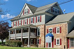
Jones Tavern near Annandale
|
||
|
||
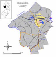
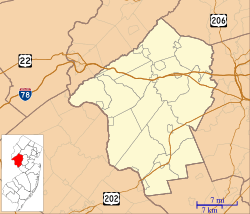
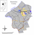
Location of Clinton Township in Hunterdon County highlighted in yellow (right). Inset map: Location of Hunterdon County in New Jersey highlighted in black (left).
|
||
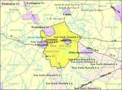
Census Bureau map of Clinton Township, New Jersey
|
||
| Country | ||
| State | ||
| County | ||
| Incorporated | April 12, 1841 | |
| Named for | DeWitt Clinton | |
| Government | ||
| • Type | Faulkner Act (small municipality) | |
| • Body | Township Council | |
| Area | ||
| • Total | 33.87 sq mi (87.72 km2) | |
| • Land | 29.87 sq mi (77.36 km2) | |
| • Water | 4.00 sq mi (10.36 km2) 11.81% | |
| Area rank | 72nd of 565 in state 5th of 26 in county |
|
| Elevation | 518 ft (158 m) | |
| Population
(2020)
|
||
| • Total | 13,505 | |
| • Estimate
(2023)
|
13,137 | |
| • Rank | 191st of 565 in state 3rd of 26 in county |
|
| • Density | 452.1/sq mi (174.6/km2) | |
| • Density rank | 446th of 565 in state 14th of 26 in county |
|
| Time zone | UTC−05:00 (Eastern (EST)) | |
| • Summer (DST) | UTC−04:00 (Eastern (EDT)) | |
| ZIP Code | ||
| Area code(s) | 908 | |
| FIPS code | 3401913750 | |
| GNIS feature ID | 0882177 | |
Clinton Township is a community in Hunterdon County, New Jersey. It's called a township, which is a type of local government area. In 2020, about 13,505 people lived here. This number was just a little higher than in 2010.
Contents
History of Clinton Township
Clinton Township became an official township on April 12, 1841. It was formed from parts of Lebanon Township. The township was named after DeWitt Clinton, who was a famous Governor of New York.
Over the years, some parts of Clinton Township became their own separate towns. For example, Clinton town and High Bridge township were once part of Clinton Township. In 1998, there was a suggestion to change the township's name to Reagan Township, but this idea was not carried out.
Geography and Nature in Clinton Township
Clinton Township covers about 33.87 square miles (87.72 square kilometers). Most of this area is land, but about 4 square miles (10.36 square kilometers) is water.
Communities within Clinton Township
Annandale is a well-known community located inside Clinton Township. Many other smaller communities and places are also found here. These include Allerton, Cokesbury, Hamden, and Potterstown.
Neighboring Towns and Unique Features
Clinton Township shares borders with several other towns. These include Clinton Town, Franklin Township, and Lebanon Township. Interestingly, the town of Lebanon is completely surrounded by Clinton Township. This makes it one of New Jersey's "doughnut towns," where one town wraps entirely around another!
Cushetunk Mountain and Round Valley Reservoir
Part of Cushetunk Mountain is located in Clinton Township. This mountain is shaped like a ring and was once an active volcano about 160 million years ago. The Lenape people, who lived here long ago, called it "Cushetunk," meaning "place of hogs." In the 1960s, the valley inside the mountain was filled with water. This created the Round Valley Reservoir, which is the second-deepest lake in New Jersey.
People of Clinton Township (Demographics)
| Historical population | |||
|---|---|---|---|
| Census | Pop. | %± | |
| 1850 | 2,369 | — | |
| 1860 | 2,951 | 24.6% | |
| 1870 | 3,134 | * | 6.2% |
| 1880 | 2,133 | * | −31.9% |
| 1890 | 913 | −57.2% | |
| 1900 | 2,296 | 151.5% | |
| 1910 | 2,108 | −8.2% | |
| 1920 | 1,987 | −5.7% | |
| 1930 | 1,856 | * | −6.6% |
| 1940 | 2,349 | 26.6% | |
| 1950 | 2,926 | 24.6% | |
| 1960 | 3,770 | 28.8% | |
| 1970 | 5,119 | 35.8% | |
| 1980 | 7,345 | 43.5% | |
| 1990 | 10,816 | 47.3% | |
| 2000 | 12,957 | 19.8% | |
| 2010 | 13,478 | 4.0% | |
| 2020 | 13,505 | 0.2% | |
| 2023 (est.) | 13,137 | −2.5% | |
| Population sources:1850–1920 1880–1890 1890–1910 1910–1930 1940–2000 2000 2010 2020 * = Lost territory in previous decade. |
|||
Population in 2010
In 2010, there were 13,478 people living in Clinton Township. Most people were White (about 86%). There were also groups of Black or African American, Asian, and people of two or more races. About 5.6% of the population identified as Hispanic or Latino.
The average age of people in Clinton Township was about 40.9 years old. About 24% of the population was under 18 years old.
Fun and Learning in Clinton Township
Parks and Recreation
Clinton Township has a part of the Columbia Trail. This trail was once a railroad line. It's a great place for outdoor activities. The trail also includes a beautiful area called the Ken Lockwood Gorge.
Education for Students
The Clinton Township School District serves students from pre-kindergarten through eighth grade. There are three schools in the district:
- Patrick McGaheran School (grades K-2)
- Round Valley School (grades 3-5)
- Clinton Township Middle School (grades 6-8)
Students from Lebanon Borough also attend Clinton Township Middle School for grades 7 and 8.
For high school, students go to North Hunterdon High School in Annandale. This high school also welcomes students from several nearby towns. There's also the Hunterdon County Vocational School District. This district offers special career and technical programs for high school students from all over Hunterdon County.
Immaculate Conception School is a private school in Annandale. It serves students from pre-kindergarten through eighth grade. In 2013, this school was recognized as a "National Blue Ribbon School." This is a very special award for schools that show excellent education.
Getting Around Clinton Township
Roads and Highways
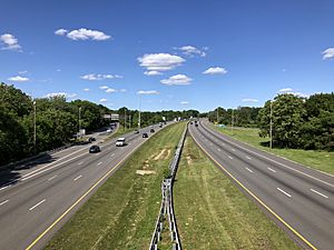
Several important roads pass through Clinton Township. These include Interstate 78, Route 22, and Route 31. These roads help people travel to and from the township.
Trains and Buses
The Annandale station is a train station in Clinton Township. It's part of the NJ Transit Raritan Valley Line. You can also find bus service here on the 884 route. A freight train line, the Norfolk Southern Railway's Lehigh Line, also runs through the township.
Famous People from Clinton Township
Many interesting people have lived in or are connected to Clinton Township, including:
- Matthew Acosta (born 2002), a soccer player.
- Walter Chandoha (1920–2019), a famous animal photographer, especially known for his cat pictures.
- Jason Knapp (born 1990), a professional baseball pitcher.
- Leonard Lance (born 1952), a former member of the U.S. House of Representatives.
Nearby Towns
 |
High Bridge | Lebanon Township | Tewksbury Township |  |
| Town of Clinton Union Township |
||||
| Franklin Township | Raritan Township | Readington Township |
Remember, the town of Lebanon is completely surrounded by Clinton Township!
Images for kids
See also
 In Spanish: Municipio de Clinton (Nueva Jersey) para niños


