Clontarf, Minnesota facts for kids
Quick facts for kids
Clontarf
|
|
|---|---|

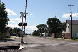
RR Crossing at Grace Avenue
|
|

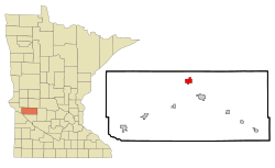
Location of Clontarf, Minnesota
|
|
| Country | United States |
| State | Minnesota |
| County | Swift |
| Area | |
| • Total | 2.13 sq mi (5.50 km2) |
| • Land | 2.08 sq mi (5.39 km2) |
| • Water | 0.04 sq mi (0.12 km2) |
| Elevation | 1,047 ft (319 m) |
| Population
(2020)
|
|
| • Total | 128 |
| • Density | 61.54/sq mi (23.76/km2) |
| Time zone | UTC-6 (Central (CST)) |
| • Summer (DST) | UTC-5 (CDT) |
| ZIP code |
56226
|
| Area code(s) | 320 |
| FIPS code | 27-12124 |
| GNIS feature ID | 2393574 |
Clontarf is a small city in Swift County, Minnesota, United States. In 2010, about 164 people lived there. By 2020, the population was 128.
Contents
History of Clontarf
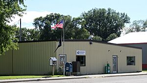
Clontarf was officially planned and marked out in 1876. It was named after a place called Clontarf in Ireland. Many of the first people who settled here came from Ireland. A post office has been open in Clontarf since 1876.
A special school, called St. Paul's Industrial School, was in Clontarf from 1877 to 1898. This school was for Native American children and also for white children who had lost their parents (called orphans). Bishop John Ireland moved the school to Clontarf in 1877. The Catholic church ran this school.
Geography of Clontarf
Clontarf is located in Minnesota. The United States Census Bureau says the city covers about 2.01 square miles (5.21 square kilometers) in total. Most of this area, about 1.96 square miles (5.08 square kilometers), is land. The rest, about 0.05 square miles (0.13 square kilometers), is water.
Minnesota State Highway 9 is the main road that goes through the community.
Clontarf Population Facts
| Historical population | |||
|---|---|---|---|
| Census | Pop. | %± | |
| 1910 | 153 | — | |
| 1920 | 223 | 45.8% | |
| 1930 | 180 | −19.3% | |
| 1940 | 230 | 27.8% | |
| 1950 | 206 | −10.4% | |
| 1960 | 139 | −32.5% | |
| 1970 | 147 | 5.8% | |
| 1980 | 196 | 33.3% | |
| 1990 | 172 | −12.2% | |
| 2000 | 173 | 0.6% | |
| 2010 | 164 | −5.2% | |
| 2020 | 128 | −22.0% | |
| U.S. Decennial Census | |||
Clontarf in 2010
According to the census from 2010, 164 people lived in Clontarf. There were 64 homes, and 46 of these were families. The population density was about 83.7 people for every square mile (32.3 people per square kilometer). There were 69 houses or apartments in total.
Most of the people in the city, 99.4%, were White. About 0.6% were Asian. Around 2.4% of the population were Hispanic or Latino.
Out of the 64 homes:
- 31.3% had children under 18 living there.
- 60.9% were married couples living together.
- 3.1% had a female head of the house with no husband.
- 7.8% had a male head of the house with no wife.
- 28.1% were not families.
About 20.3% of all homes had only one person living in them. And 4.7% of homes had someone living alone who was 65 years old or older. On average, there were 2.56 people in each home and 2.96 people in each family.
The average age of people in the city was 42.5 years old.
- 23.2% of residents were under 18.
- 10.9% were between 18 and 24.
- 19.5% were between 25 and 44.
- 34.1% were between 45 and 64.
- 12.2% were 65 years old or older.
More males lived in the city than females. About 57.9% of the population was male, and 42.1% was female.
See also
 In Spanish: Clontarf (Minnesota) para niños
 | May Edward Chinn |
 | Rebecca Cole |
 | Alexa Canady |
 | Dorothy Lavinia Brown |


