
Collingsworth County, Texas facts for kids
Quick facts for kids
Collingsworth County
|
|
|---|---|

Collingsworth County Courthouse in Wellington
|
|

Location within the U.S. state of Texas
|
|
 Texas's location within the U.S. |
|
| Country | |
| State | |
| Founded | 1890 |
| Named for | James Collinsworth |
| Seat | Wellington |
| Largest city | Wellington |
| Area | |
| • Total | 919 sq mi (2,380 km2) |
| • Land | 918 sq mi (2,380 km2) |
| • Water | 0.9 sq mi (2 km2) 0.1% |
| Population
(2020)
|
|
| • Total | 2,652 |
| • Density | 2.8857/sq mi (1.1142/km2) |
| Time zone | UTC−6 (Central) |
| • Summer (DST) | UTC−5 (CDT) |
| Congressional district | 13th |
Collingsworth County is a county located in the state of Texas in the United States. In 2020, about 2,652 people lived there. The main town and county seat is Wellington.
The county was created in 1876. It was officially set up in 1890. Collingsworth County is named after James Collinsworth. He was an important person who signed the Texas Declaration of Independence. He was also the first chief justice of the Republic of Texas. There was a small spelling mistake in the county's name when it was created, but it was never changed. For a long time, Collingsworth County was a "dry county," meaning you couldn't buy alcohol there. But in 2017, people voted to change that law.
Contents
History of Collingsworth County
Collingsworth County was formed in 1876. It was created from parts of the Bexar and Young land districts of Texas. The county was officially organized in 1890. Wellington was chosen as the county seat. From 1883 to 1896, a large ranch called the Rocking Chair Ranche was located here. It was owned by people from England.
Geography and Location
Collingsworth County covers about 919 square miles. Most of this area is land. Only a very small part, about 0.9 square miles, is water.
Main Roads in the County
These are the most important highways that go through Collingsworth County:
 U.S. Highway 83
 State Highway 203
Neighboring Counties
Collingsworth County shares its borders with several other counties:
- Wheeler County (to the north)
- Beckham County, Oklahoma (to the northeast)
- Harmon County, Oklahoma (to the southeast)
- Childress County (to the south)
- Hall County (to the southwest)
- Donley County (to the west)
- Gray County (to the northwest)
People of Collingsworth County
| Historical population | |||
|---|---|---|---|
| Census | Pop. | %± | |
| 1880 | 6 | — | |
| 1890 | 357 | 5,850.0% | |
| 1900 | 1,233 | 245.4% | |
| 1910 | 5,224 | 323.7% | |
| 1920 | 9,154 | 75.2% | |
| 1930 | 14,461 | 58.0% | |
| 1940 | 10,331 | −28.6% | |
| 1950 | 9,139 | −11.5% | |
| 1960 | 6,276 | −31.3% | |
| 1970 | 4,755 | −24.2% | |
| 1980 | 4,648 | −2.3% | |
| 1990 | 3,573 | −23.1% | |
| 2000 | 3,206 | −10.3% | |
| 2010 | 3,057 | −4.6% | |
| 2020 | 2,652 | −13.2% | |
| U.S. Decennial Census 1850–2010 2010 2020 |
|||
In 2000, there were 3,206 people living in Collingsworth County. The population density was about 4 people per square mile. Most people identified as White. About 20% of the population was Hispanic or Latino.
In 2000, about 29.8% of households had children under 18 living with them. The average household had 2.44 people. The median age for people in the county was 41 years old. About 26.4% of the population was under 18.
The median income for a household was $25,438. This means half of the households earned more than this, and half earned less. About 18.7% of all people in the county lived below the poverty line. This included 27.2% of children under 18.
Towns and Communities
Collingsworth County has several towns and communities:
Cities
- Wellington (This is the main town and county seat.)
Towns
Other Communities
These are places where people live, but they are not officially cities or towns:
- Quail
- Samnorwood
- Dozier
- Lutie
Old or "Ghost" Towns
Some communities that used to exist are now empty or "ghost towns":
- Aberdeen
- Fresno
- Marilla
- New Loco
- Rolla
- Swearingen
Images for kids
-
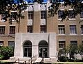
Collingsworth County Courthouse in Wellington
-
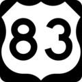
U.S. Highway 83 sign
-
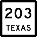
Texas State Highway 203 sign


See also
 In Spanish: Condado de Collingsworth para niños
