Conic Hill facts for kids
Quick facts for kids Conic Hill |
|
|---|---|
 |
|
| Highest point | |
| Elevation | 361 m (1,184 ft) |
| Prominence | 153 m (502 ft) |
| Listing | Marilyn, HuMP, TuMP |
| Geography | |
| Parent range | Grampian Mountains |
| OS grid | NS432923 |
| Topo map | OS Landranger 56 and Explorer 364 |
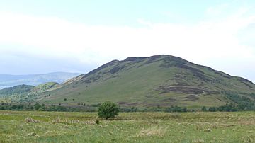
Conic Hill is a well-known hill located in Stirling, Scotland. Its name comes from the Gaelic word "coinneach," which means moss. This hill is a popular spot for walkers and offers amazing views.
Exploring Conic Hill
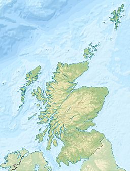
Conic Hill stands on the east side of Loch Lomond. It is right next to the small village of Balmaha. This hill is quite steep and sits directly on the Highland Boundary Fault. This fault line is a major geological feature that separates two different types of rock in Scotland.
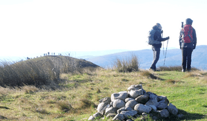
The highest point of Conic Hill is 361 meters (1,184 feet) tall. As of 2019, there are only a few stones marking the very top. Most visitors also stop at a slightly lower point, a sub-summit, which is 358 meters (1,175 feet) high.
Amazing Views from the Top
From the top of Conic Hill, you can see incredible sights. There are impressive views over Loch Lomond and towards the city of Glasgow. On a clear day, you might even spot Goat Fell on the Isle of Arran. This island is about 50 miles (80 kilometers) to the southwest.
Sometimes, you can also see the rounded shape of Ailsa Craig. This is a famous island in the Clyde Estuary. The wide-open views make the climb very rewarding.
Climbing Conic Hill
Conic Hill is a great place for walking and hiking. It is even part of the famous West Highland Way. This is a long-distance walking route that many people enjoy.
You can reach the hill easily by public transport. Buses and ferries arrive in Balmaha village. There is also a car park at the base of the hill. This makes it simple for people with cars to park before their climb.
- Dogs and Lambing Season: If you are walking with a dog, be aware of the lambing season. This usually happens for about three weeks in late April and early May. During this time, dogs are not allowed in two specific fields on the east side of the hill. This rule helps keep the young lambs safe. However, you can still access Conic Hill with a dog from the Balmaha direction.
- A Special Ascent: In August 2013, a group of eight members from Deafblind Scotland climbed Conic Hill. They received help from park rangers and guides. This showed that with support, many people can enjoy the hill.
 | James B. Knighten |
 | Azellia White |
 | Willa Brown |


