
Convent (Mesa) facts for kids
Quick facts for kids The Convent |
|
|---|---|

The Convent seen from Utah State Route 128
|
|
| Highest point | |
| Elevation | 5,955 ft (1,815 m) |
| Prominence | 495 ft (151 m) |
| Geography | |

The Convent
Location in Utah

The Convent
Location in the United States
|
|
| Location | Grand County, Utah United States |
| Parent range | Colorado Plateau |
| Topo map | USGS Big Bend |
| Type of rock | Wingate Sandstone |
| Climbing | |
| First ascent | 1965 |
| Easiest route | Climbing class 5.10 |
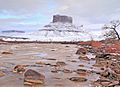
The Convent is a cool sandstone mountain in Utah, United States. It's also known as Convent Mesa. This amazing rock formation stands 5,955 feet (about 1,815 meters) tall.
You can find The Convent in Professor Valley, close to the city of Moab. It's a famous landmark in Grand County. The mountain is about 1,000 feet wide and 3,000 feet long. It has tall, straight walls made of Wingate Sandstone that are about 400 feet high.
The Convent is part of the Colorado Plateau. Water from the mountain flows into the nearby Colorado River. The first people to climb The Convent were Harvey Carter and Steve Miller. They reached the top in November 1965 using a route called Salvation Chimney.
Contents
Exploring The Convent's Location
The Convent is surrounded by other interesting rock formations. It sits northeast of Parriott Mesa. To its southwest, you'll find the Fisher Towers area.
The closest taller peak is Sister Superior, which is 6,037 feet tall. It's about 0.91 miles (1.46 kilometers) to the southeast. If you follow the ridge even further southeast, you'll see The Rectory and Castleton Tower.
Climbing Adventures at The Convent
The Convent is a popular spot for rock climbing. Many different routes lead to the top. These routes are rated by how difficult they are.
Here are some of the climbing routes on The Convent:
- W*** House - class 5.11- - This route has 5 sections, called pitches.
- The Value of Audacity - class 5.11+ - Another route with 5 pitches.
- West Face Dihedral - class 5.10 - This one has 6 pitches.
- Choir Boyz - class 5.12- - A challenging route with 5 pitches.
- Buddha's Delight - class 5.12 - This route has 6 pitches.
- The Middle Way - class 5.12 - A shorter route with 3 pitches.
- Salvation Chimney - class 5.10 - This was the first route ever climbed on The Convent.
Weather at The Convent
The best times to visit The Convent are in spring and fall. During these seasons, the weather is usually mild. High temperatures are around 60 to 80 °F (15 to 27 °C). Low temperatures are about 30 to 50 °F (-1 to 10 °C).
Summers can be very hot, often over 100 °F (38 °C). Winters are cold, with highs from 30 to 50 °F (-1 to 10 °C). Lows can drop to 0 to 20 °F (-18 to -7 °C).
This area is a high desert, so temperatures can change a lot in one day. The region gets less than 10 inches (25 cm) of rain each year.
Gallery
-
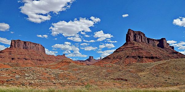
The Convent (left) and Parriott Mesa (right) seen from Utah State Route 128
-
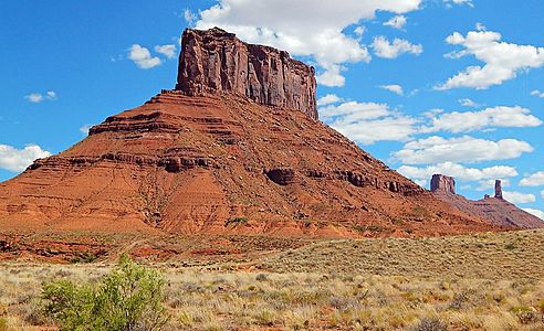
The Convent (with The Rectory and Castleton Tower to right)
-
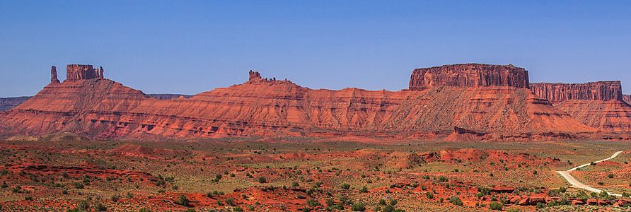
Left to right: Castleton Tower, The Rectory, Sister Superior, The Convent, Parriott Mesa
-
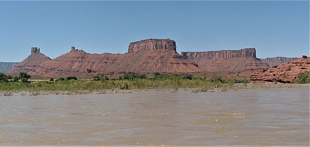
Convent Mesa from the Colorado River


Images for kids
-
Convent in winter

