
Cortlandt, New York facts for kids
Quick facts for kids
Cortlandt, New York
|
||
|---|---|---|
| Town of Cortlandt | ||

Croton Gorge waterfall
|
||
|
||

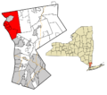
Location of Cortlandt, New York
|
||
| Country | United States | |
| State | New York | |
| County | Westchester | |
| Founded | 1788 | |
| Government | ||
| • Type | Manager-Council | |
| Area | ||
| • Total | 50.02 sq mi (129.54 km2) | |
| • Land | 39.26 sq mi (101.68 km2) | |
| • Water | 10.76 sq mi (27.86 km2) | |
| Elevation | 318 ft (97 m) | |
| Population
(2020)
|
||
| • Total | 42,545 | |
| • Density | 850.56/sq mi (328.431/km2) | |
| Time zone | UTC-5 (Eastern (EST)) | |
| • Summer (DST) | UTC-4 (EDT) | |
| FIPS code | 36-18410 | |
| GNIS feature ID | 0978871 | |

Cortlandt is a town in Westchester County, New York. It is located in the northwestern part of the county. The town is found at the eastern end of the Bear Mountain Bridge. In 2020, about 42,545 people lived here. Cortlandt includes the villages of Buchanan and Croton-on-Hudson.
Contents
History of Cortlandt
Cortlandt has a rich history from the American Revolutionary War. Important historical places here include the Bear Mountain Bridge Road and the Old Croton Dam. These sites are recognized on the National Register of Historic Places.
A very important spot during the war was Kings Ferry. This ferry helped George Washington's army cross the Hudson River. They used it in 1781 on their way to Yorktown, Virginia. This crossing was a key moment in the war. A famous painting by John Trumbull shows Washington at Verplanck's Point, which is part of Cortlandt.
Geography and Location
Cortlandt is located along the Hudson River on its western side. The city of Peekskill is also to its west. To the north, you'll find the towns of Philipstown and Putnam Valley. These towns are in Putnam County.
The town of Yorktown borders Cortlandt to the east. To the south are the towns of New Castle and Ossining.
Cortlandt covers a total area of about 129.5 square kilometers (50 square miles). Most of this area, about 101.7 square kilometers (39.3 square miles), is land. The rest, about 27.9 square kilometers (10.8 square miles), is water.
Population and People
The population of Cortlandt has grown a lot over the years. In 1790, there were only 1,932 people. By 2020, the population had reached 42,545.
Here's how the population has changed:
| Historical population | |||
|---|---|---|---|
| Census | Pop. | %± | |
| 1790 | 1,932 | — | |
| 1820 | 3,421 | — | |
| 1830 | 3,840 | 12.2% | |
| 1840 | 5,592 | 45.6% | |
| 1850 | 7,758 | 38.7% | |
| 1860 | 10,074 | 29.9% | |
| 1870 | 11,694 | 16.1% | |
| 1880 | 12,664 | 8.3% | |
| 1890 | 15,139 | 19.5% | |
| 1900 | 18,703 | 23.5% | |
| 1910 | 22,255 | 19.0% | |
| 1920 | 21,023 | −5.5% | |
| 1930 | 26,492 | 26.0% | |
| 1940 | 11,016 | −58.4% | |
| 1950 | 14,146 | 28.4% | |
| 1960 | 26,336 | 86.2% | |
| 1970 | 34,393 | 30.6% | |
| 1980 | 35,705 | 3.8% | |
| 1990 | 37,357 | 4.6% | |
| 2000 | 38,467 | 3.0% | |
| 2010 | 41,592 | 8.1% | |
| 2020 | 42,545 | 2.3% | |
| U.S. Decennial Census | |||
In 2000, there were 38,467 people living in Cortlandt. About 39% of homes had children under 18. Most homes, about 64%, were married couples living together. The average age of people in Cortlandt was 39 years old.
Getting Around Cortlandt
It's easy to travel from Cortlandt to New York City. You can take a train from the Cortlandt train station or the Croton-Harmon train station. These stations are served by Metro-North Railroad. The Croton-Harmon station also has Amtrak service.
U.S. Route 9 is a major road that runs through the town. It follows along the Hudson River.
The famous Appalachian Trail (AT) also passes through a small part of Cortlandt. This section is near and over the Bear Mountain Bridge. It is the only part of the AT in all of Westchester County, New York.
Communities and Neighborhoods
Cortlandt is made up of several smaller communities and neighborhoods. These include:
- Buchanan – a village within the town.
- Cortlandt Manor – a hamlet, which is a small community.
- Crompond – part of this hamlet is in Cortlandt.
- Croton-on-Hudson – another village in the town.
- Crugers – a hamlet in Cortlandt.
- Furnace Woods
- Montrose – a hamlet that includes the Cortlandt station.
- Mount Airy – a neighborhood.
- Oscawana – this area includes Oscawana Island.
- Pleasantside
- Roe Park
- Toddville
- Valeria
- Van Cortlandtville – This area has several historic sites. These include the John Jones Homestead, Old St. Peter's Church, and Van Cortlandtville School. They are all listed as historic places.
- Verplanck – a hamlet in Cortlandt.
- Woodybrook
Images for kids
-
Location of Cortlandt, New York
See also
 In Spanish: Cortlandt (Nueva York) para niños
