Cumberland County, New South Wales facts for kids
Quick facts for kids CumberlandNew South Wales |
|||||||||||||||
|---|---|---|---|---|---|---|---|---|---|---|---|---|---|---|---|
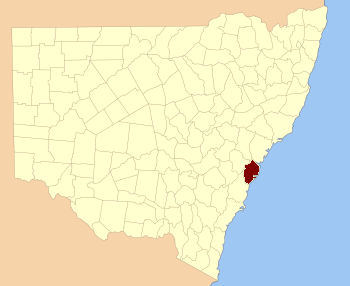
Location in New South Wales
|
|||||||||||||||
| Established | 4 June 1788 | ||||||||||||||
|
|||||||||||||||
Cumberland County is a special area in the Australian state of New South Wales. It's a type of land division called a county. Most of the big city of Sydney is located within Cumberland County.
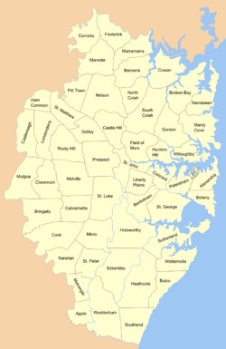
This county stretches from Broken Bay in the north to the Cataract River in the south-west. It also includes the northern parts of Wollongong. The famous Cumberland Plain is also found here.
History of Cumberland County
The name Cumberland was given by Governor Arthur Phillip on June 4, 1788. He chose this name to honour Prince Henry, the Duke of Cumberland and Strathearn. This was done during a celebration for the birthday of Prince Henry's brother, King George III.
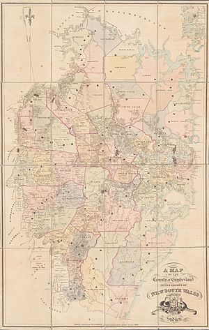
Cumberland County has been on maps since the very beginning of the colony. For example, a map from 1789 already showed Port Jackson (where Sydney is) as being part of Cumberland County.
How Cumberland County Was Divided
Hundreds
Long ago, Cumberland County was divided into smaller areas called "hundreds." Think of them like smaller sections of land. There were thirteen of these hundreds in Cumberland County.
These hundreds were officially announced in 1835. However, they were stopped being used in 1888. Unlike some other parts of Australia, these "hundreds" were only used in New South Wales within Cumberland County.
Here are the names of the old hundreds:
- Bringelly
- Campbelltown
- Dundas
- Evan
- Hardinge
- Liverpool
- Packenham
- Parramatta
- Richmond
- Southend
- Hundred of Sydney
- Windsor
- Woronora (sometimes called Heathcote on maps)
Parishes
In 1835, Cumberland County was divided even further into 57 "parishes." Before this, these smaller areas were just called "districts." Many of the parishes kept the names of these older districts.
Some parishes were named after important churches in the area. For example, in Sydney, the Parish of St Philip was named after St Philip's Church. The Parish of St James was named after St James Church. And the Parish of St Andrew got its name from St Andrew's Cathedral.
Other parishes, like Parish of St Lawrence, actually gave their name to a church, instead of the other way around! Further from the city, parishes like St John in Parramatta and St Luke in Liverpool also have churches with the same saint's names.
Districts
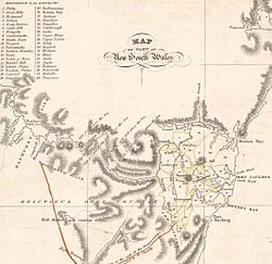
Even before hundreds and parishes, the county was divided into "districts." These were the very first ways the land was split up. Early maps, like one from 1810, showed 21 districts. A map from 1824 showed 37 districts. These old districts helped people understand where different parts of the colony were located.
 | Calvin Brent |
 | Walter T. Bailey |
 | Martha Cassell Thompson |
 | Alberta Jeannette Cassell |


