Cumberland Plain facts for kids
Quick facts for kids Cumberland Plain |
|
|---|---|
| Sydney Plain | |
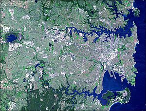
The Cumberland Plain covers the sweeping Greater Western Sydney area, from the Inner West to Penrith.
|
|
| Location | Greater Western Sydney, Inner West, St George |
| Coordinates | 33°45′S 151°00′E / 33.750°S 151.000°E |
| Area | 2,750 km2 (1,060 sq mi) |
| Rivers | Hawkesbury River, Nepean River, Parramatta River, Georges River, Woronora River |
The Cumberland Plain is a mostly flat area located west of Sydney's city centre in New South Wales, Australia. It's also known as the Cumberland Basin, which is a scientific name for this low-lying plain. It's part of the larger Sydney Basin and was formed millions of years ago.
This plain covers about 2,750 square kilometres. It stretches from about 10 km north of Windsor in the north, down to Picton in the south. To the west, it reaches the Nepean-Hawkesbury River, and in the east, it almost touches Sydney's Inner West. A large part of the Sydney metropolitan area (the city and its suburbs) is built on this plain. The Hornsby Plateau, with its steep valleys, is located to the north.
The land here is made up of Triassic shales and sandstones. The region has gentle rolling hills and wide valleys. It's in a "rain shadow" area near the Blue Mountains, which means it gets less rain. The yearly rainfall is usually around 700–900 mm, which is less than the higher areas around it. You'll often see eucalyptus trees growing here. The soils are typically red and yellow.
The plain gets its name from Cumberland County. This county was named by Governor Phillip to honour Ernest Augustus, Duke of Cumberland. The Cumberland Plain is one of Australia's fastest-growing areas in terms of population. It's also home to many Australian animal species that you can see even in urban areas.
Contents
Where is the Cumberland Plain?
The Cumberland Plain starts west of Sydney's Inner West. It spreads across south-western Sydney and into the wider Greater Western Sydney area. Many local government areas are part of the plain, including Blacktown, Camden, Campbelltown, Fairfield, Hawkesbury, Liverpool, Parramatta, and Penrith.
Other parts of Sydney, like the city centre, North Shore, Northern Beaches, and Eastern Suburbs, are not on the Cumberland Plain.
How was the Cumberland Plain formed?
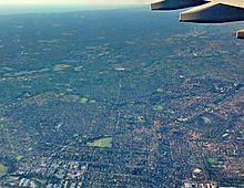
The Cumberland Plain was formed about 80 million years ago. It's not perfectly flat, but it's a low-lying area mostly made of shale and softer sandstone. It stands out because it's surrounded by higher lands made of harder sandstone, like the Hornsby and Blue Mountains Plateaus. Scientists are still studying exactly how this area became lower than its surroundings.
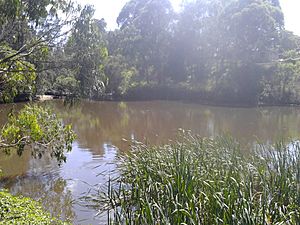
You can find volcanic rocks in low hills within the shale landscapes. There are also swamps and lagoons on the Nepean River's floodplain.
The Wianamatta Plain, which is part of the Cumberland Plain, has many rolling hills made of Wianamatta Group shales and sandstones. It's surrounded by the Woronora and Illawarra Plateaus to the south, the Blue Mountains Plateau to the west, and the Hornsby Plateau to the north.
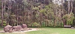
Prospect Hill in western Sydney is the largest collection of igneous rock (rock formed from cooled magma) on the Plain. This oval-shaped hill was created millions of years ago when volcanic material pushed up from deep inside the Earth. Over time, rain slowly wore away the layers of rock above, revealing the volcanic and metamorphic rocks of the hill.
Most of the western suburbs are on the flat, low parts of the Cumberland Plain. However, some areas are a bit higher. For example, Western Sydney Parklands and nearby suburbs like Cecil Hills and Horsley Park are on a ridge that is about 130 to 140 metres high.
Rivers of the Cumberland Plain
Rivers are a very important part of the Cumberland Plain.
- The Nepean River starts in the Woronora Plateau to the south and flows around the western edge of Sydney.
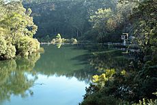
- The Parramatta River begins with several local creeks, including Toongabbie Creek and Hunts Creek. Hunt's Creek flows from Lake Parramatta, just north of Parramatta.
- The Warragamba River flows from the Warragamba Dam to join the Nepean River.
The south and southwest of Sydney are drained by the Georges River. It flows north from its source near Appin, past Liverpool, and then east towards Botany Bay. Another important river flowing into Botany Bay is the Cooks River. The Georges River estuary separates the main part of Sydney from the Sutherland Shire. The Woronora River, on the southern edge of the Sydney Plain, flows through a steep valley from the Woronora Dam to the Georges River.
Smaller waterways in Sydney's western suburbs include South Creek and Eastern Creek, which flow into the Hawkesbury River. Prospect Creek drains into the Georges River.
What kind of nature is found here?
Plants
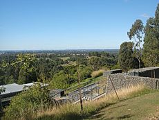
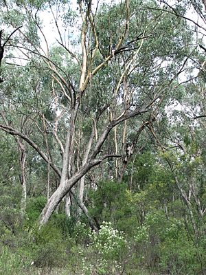
The most common plant communities in the Cumberland Plain are grassy sclerophyll woodlands. Sclerophyll forests have plants with hard, tough leaves, like eucalyptus trees. These trees usually grow in open woodlands with dry shrubs and scattered grass underneath.
In the 1820s, people described the land west of Parramatta and Liverpool as "fine timbered country" with no thick bush. They said you could easily drive a cart through it because the trees were spaced far apart, with little undergrowth.
Animals
The Cumberland Plain is home to many different animals. You can find various species of birds, insects, reptiles, and mammals, including bats. There are also spiders, amphibians (like frogs), and crustaceans (like yabbies).
About 40 different reptile species live in the Cumberland Plain. In urban areas, you'll see about 30 bird species, such as the Australian magpie, Australian raven, noisy miner, and pied currawong. Some birds that were brought from other countries, like the common mynah, common starling, and house sparrow, are also common.
There are 14 widespread mammal species, with bats and possums being common. Areas on the edge of the Cumberland Plain, especially near large parks, have a much wider variety of wildlife.
Woodlands and their protection
The sclerophyll woodlands grow on nutrient-poor soil that was deposited by the Nepean River. This soil comes from sandstone and shale rocks in the Blue Mountains. Even with this soil, these woodlands support a huge variety of plants and animals.
Sadly, most of the natural plant communities that once thrived on the plain are now considered endangered. This is because the land was first cleared for farming and then for building cities and towns.
Protecting the environment
Under Australian environmental laws, six of these plant communities are protected. They are grouped into four "matters of national environmental significance" because they are so important. These protected communities include:
- Blue Gum High Forest of the Sydney Basin Bioregion.
- Cumberland Plain Shale Woodlands and Shale-Gravel Transition Forest.
- Shale/Sandstone Transition Forest.
- Turpentine-Ironbark Forest in the Sydney Basin Bioregion.
- Western Sydney Dry Rainforest and Moist Woodland on Shale.
The plain has 300 different native plants and is home to over 20 threatened bird and animal species.
Many Cumberland Plain communities are protected in council reserves and national parks. These include Scheyville National Park, Windsor Downs Nature Reserve, and Mount Annan Botanic Garden. The Cumberland Plain Woodland was the first Australian plant community to be given special protected status. Only about six percent of it remains in small, separate areas.
Farming in the Cumberland Plain
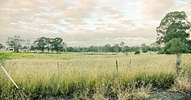
The western part of the Cumberland Plain has large, mostly rural grasslands with rolling hills and nice views. Western Sydney suburbs like Mount Vernon, Kemps Creek, Orchard Hills, Luddenham, Mulgoa, Bringelly, Silverdale, and Horsley Park are in this farming area. They are close to the Blue Mountains.
Some suburbs like Abbotsbury, Cecil Hills, and Glenmore Park were farms until the 1980s when they were developed for housing. The area around Regentville has mostly stayed rural, even though modern suburbs are nearby.
In the 1800s, John Blaxland built a wooden dam at "Grove Farm" (now Wallacia). This dam powered a flour mill and a brewery. The land was also used for wheat farming until 1861, when a disease called wheat rust destroyed all the crops.
During the 19th century, the rural areas were mainly used for dairying (producing milk and cheese) and grazing animals. In the early 20th century, tourism grew because of the area's rural feel and closeness to Sydney. People started opening their homes as guest houses. Today, these rural areas have many orchards (fruit farms) and vineyards (grape farms) in the meadows. Vegetable farming and fruit picking are still common activities.
See also
 In Spanish: Llanura de Cumberland para niños
 | Selma Burke |
 | Pauline Powell Burns |
 | Frederick J. Brown |
 | Robert Blackburn |


