Prospect Hill (New South Wales) facts for kids
Quick facts for kids Prospect Hill |
|
|---|---|
View from the summit
|
|
| Highest point | |
| Elevation | 117 m (384 ft) |
| Dimensions | |
| Area | 0.34 km2 (0.13 sq mi) |
| Naming | |
| Native name | Error {{native name}}: an IETF language tag as parameter {{{1}}} is required (help) |
| Geography | |
| Country | Australia |
| State | New South Wales |
| Region | Greater Western Sydney |
| Local government areas |
|
| Geology | |
| Age of rock | Triassic (Wianamatta Shale) Early Jurassic (igneous rock) |
| Type of rock | Igneous rock Intrusive rock Laccolith Shale |
| Official name | Prospect Hill; Bellevue (Hill); Mar-Rong Reserve |
| Type | State heritage (landscape) |
| Designated | 17 October 2003 |
| Reference no. | 1662 |
| Type | Historic Landscape |
| Category | Landscape – Cultural |
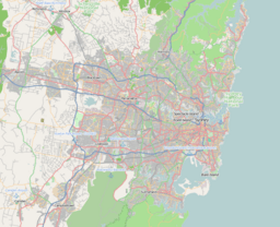
Prospect Hill is a special hill in Pemulwuy and Prospect, located in western Sydney, New South Wales, Australia. It's about 30 kilometers (19 miles) west of central Sydney. This hill is Sydney's biggest area of igneous rock, which is rock formed from cooled lava.
Prospect Hill stands taller than the flat lands around it. Its highest point today is 117 meters (384 feet) above sea level. However, it used to be even taller, reaching 131 meters (430 feet), before parts of its top were removed by quarrying.
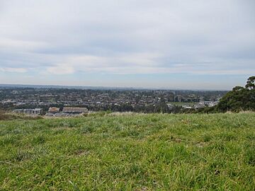
This hill is like a "central point" in the Cumberland Plain. From its top, you can see far away to the Blue Mountains in the west and the city buildings of Sydney in the east. People have walked on and around Prospect Hill for 30,000 years. They have always seen it as an important landmark, a place to meet, and a boundary.
Today, Prospect Hill is important for its history, its natural beauty, and its commercial value. It is owned by Boral Limited and CSIRO. The site was added to the New South Wales State Heritage Register on 17 October 2003, meaning it's protected for its special value.
The hill is oval-shaped and has a rich history. It was one of the first places in the early Colony of New South Wales where convicts who had finished their sentences were given land to farm. The settlements around Prospect Hill also saw many disagreements between the Aboriginal people and the European settlers in the 1790s. For over 180 years, people have been quarrying (digging up) the igneous rock from the hill. This rock, mostly called teschenite, was used for building roads and other structures.
Prospect Hill began to form about 200 million years ago. This happened when hot, melted rock (magma) from deep inside the Earth pushed upwards. It then spread sideways into the layers of shale rock that make up the Cumberland Plain Woodland.
Contents
Exploring Prospect Hill's Past
First Peoples' Stories
The area around Prospect Hill and Prospect Reservoir has been home to Aboriginal people for a very long time. They found good places to camp along the creeks and on the higher lands to the south. Even after Europeans arrived, Aboriginal people continued to live here. Archaeologists have found old tools made of both stone and glass, showing this continued presence. European settlers started arriving in this area around 1789.
European Explorers Arrive
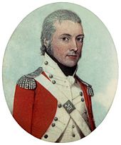
Soon after the first European settlement, on 26 April 1788, Governor Phillip led an exploration party west. They climbed Prospect Hill. Governor Phillip wrote that from the hill, they saw the "Carmathen Hills" (which are the Blue Mountains) for the first time. Prospect Hill became a very important spot for the new settlers. It helped them figure out distances and became a key reference point for other explorers.
In 1789, Captain-Lieutenant Watkin Tench made another trip west. He started his journey by looking towards Prospect Hill, which offered a great view of the mountains. A runaway convict named George Bruce even used Prospect Hill as a hiding spot in the mid-1790s. Watkin Tench and his group were the first colonists recorded climbing the hill on 26 June 1789. It is believed that Tench was the one who named it "Prospect Hill." He might have been reminded of a "goodly prospect" (a beautiful view) from a famous poem.
The name "Prospect Hill" was definitely being used by April 1790. Governor Phillip and Lieutenant Philip Gidley King mentioned it after a walk from Parramatta. In July 1791, Governor Phillip gave land grants to many men on the eastern and southern slopes of Prospect Hill. The soil there was richer, making it better for farming. These land grants, usually about 30 acres (12 hectares), surrounded the hill.
Early Conflicts and Peace
When the first European settlers arrived, it led to the first organized resistance from Aboriginal people. Pemulwuy and his Bidjigal clan were central to these conflicts. Eventually, Aboriginal people started a peace process, with their women and a settler named John Kennedy helping to negotiate.
On 1 May 1801, Governor King issued an order for Aboriginal people around Parramatta, Prospect Hill, and Georges River to be "driven back" from settler homes. After Pemulwuy, a main resistance leader, died in 1802, Aboriginal resistance near Parramatta slowly decreased.
However, in 1805, local Aboriginal groups suggested a meeting to the Reverend Samuel Marsden. They wanted to find a way to end the harsh treatment they received from soldiers and settlers. This important meeting happened on 3 May 1805, near Prospect Hill. Aboriginal women and a young settler, John Kennedy, helped as go-betweens. This meeting helped bring an end to the conflict for the Aboriginal clans in the area.
How the Land Was Used
In 1791, Governor Phillip began giving land plots to convicts who had earned their freedom. Thirteen such grants were made at Prospect Hill in July 1791. Farming started early and continued for many years. By the 1820s, much of the land was cleared, and livestock grazing was common. Governor Macquarie visited in 1810 and was impressed by the comfortable farms.
Early grazing meant that all the trees on the hill were cleared. Quarrying began in the 1820s. The famous naturalist Charles Darwin visited Prospect Hill in January 1836 to study its geology. By the late 1800s, different types of rock were being dug up from the western and northern sides of the hill. The land was farmed until 1888, when the Prospect Reservoir was built. By the 1870s, with less grain being grown, the Prospect Hill area was mostly used for livestock.
Modern Times at Prospect Hill
By the early 1900s, quarrying companies bought land on Prospect Hill. They wanted to expand their operations because the hill was a valuable source of rock. From 1925 to 1945, a private railway line, the Widemere Quarry Line, served the quarry.
In 1946, the Commonwealth government bought most of the land that is now the CSIRO site. The CSIRO (Commonwealth Scientific and Industrial Research Organisation) started its research work there in the early 1950s, using sheep for studies. For many years, Prospect Hill was the main source of rock for building Sydney's roads.
In 1998, Boral, a quarrying company, started planning for future development as its quarry was nearing the end of its life. The CSIRO site, which is 57.15 hectares (141 acres), remains an important research center. Because Prospect Hill has been used for farming and grazing for so long, it still holds historical clues and archaeological potential.
Geography of Prospect Hill
Prospect Hill is a stand-alone hill that you can see from the junction of Blacktown Road and the Great Western Highway. You can reach the top from Reconciliation Rise, Clunies Ross Street, and Durawi Street, though some gates have been closed since 2017. A road, now called Butu Wargun Drive, cuts through a ridge connecting the hill to Marrong Reserve.
The hill was a popular place for picnics in the 1920s. It is 112 meters (367 feet) above sea level. Prospect Hill is also a very important place for the Aboriginal community during NAIDOC Week and Reconciliation Day. It's also a popular spot for school excursions.
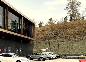
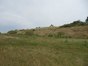
Located in the middle of the Cumberland Plain, Prospect Hill is Sydney's largest body of igneous rock. It rises to 117 meters (384 feet) above sea level. The hill sits between the CSIRO research site and the Boral Resources quarry. The CSIRO part of the hill is mostly cleared for pasture, with some native plants along a creek. The Boral part has some trees and has been used for brick-making.
The first settlements in 1791 were on the eastern and southern slopes of Prospect Hill. However, no buildings from the 1700s or 1800s remain above ground. You can still see some of the original land boundaries from Prospect Hill when looking east across the CSIRO site. On the northern slope of the hill, there's an old quarry from the late 1800s. The site has been used for many things over time, including farms, quarries, and research.
How Prospect Hill Was Formed
In the Sydney Basin, there was some volcanic activity about 210 million years ago, during the Early Jurassic period. This activity created the Prospect dolerite intrusion, which clearly shows that Prospect Hill has a volcanic origin.
About 80 million years ago, Australia started to break away from the supercontinent Gondwana. This movement might have caused volcanic activity along the east coast. The pulling apart of the land created deep cracks, allowing hot magma to rise from below the Earth's surface.
The hill we see today is what's left of that volcanic core. It has been worn down over millions of years to become a small bump in the generally flat lands of western Sydney. This dome-shaped rock formation is called a doleritic laccolith. For over 60 million years, rainwater has slowly worn away the layers of rock above it. This process eventually exposed the edges of the volcanic and metamorphic rocks that make up the hill.
The hill has a thin, cooled edge of fine-grained basalt rock. Most of the hill is made of picrite and dolerite. The volcanic rocks here are mainly mafic, meaning they are rich in magnesium and iron. In the 1960s, a small amount of gold was found in a sample, but no more has been discovered since then.
Why Prospect Hill is a Heritage Site
As of 19 February 2001, Prospect Hill was recognized as very important to the state of New South Wales. This is because it has a special mix of being a significant landscape feature, a potential archaeological site, and connected to important historical events.
Prospect Hill is a unique geological feature, rising 117 meters (384 feet) high. It offers wide views across the Cumberland Plain. It was a major reference point for early explorers starting in 1788. It was also the location of some of the very first farms in New South Wales, established in 1791.
The hill is also linked to Aboriginal frontier conflicts in the early days of the colony. It was the site of one of the first meetings between Aboriginal people and Europeans to discuss peace in 1805. This meeting involved Samuel Marsden and local Aboriginal groups.
Because the site has been used for farming and grazing for so long, it might still hold archaeological evidence of early farming methods and settlements. Prospect Hill is likely one of the few remaining rural areas in the region that has kept its long-term farming use since the colony's early days.
Why It's Special
Prospect Hill was added to the New South Wales State Heritage Register on 17 October 2003 because it met several important standards:
- It shows the history of New South Wales: Prospect Hill is historically important because it was home to some of the first farms in New South Wales. Governor Phillip settled former convicts here in 1791. It was also a key landmark for early explorers from 1788. The hill played a role in the early exploration of Australia's east coast. It's also connected to an important time of contact between Aboriginal people and Europeans. This includes Pemulwuy's resistance between 1797 and 1802, and the peace meeting in 1805 with Samuel Marsden.
- It has beautiful features: Prospect Hill is beautiful because it's Sydney's largest body of igneous rock, rising 117 meters high. It offers amazing views across the Cumberland Plain. This large rock formation is a rare geological and landmark feature in the middle of the Cumberland Plain. Because it has been used for farming for so long, the landscape still feels rural, which is rare in this area now.
- It has strong connections to people: The CSIRO research center at the foot of Prospect Hill has been used for research for over 40 years. It is important to the employees and scientists who have worked there, especially for their contributions to Australia's history.
- It can teach us new things: Because Prospect Hill has been used for farming and grazing since 1791, it could still provide archaeological evidence. This evidence could help us understand early historical settlements or farming techniques.
- It is rare and unique: Prospect Hill is unique as an important landmark. It shows historical connections to early European exploration and settlement, as well as Aboriginal conflict and reconciliation. The landscape has kept its continuous farming use since the early days of the colony.
More to Explore
- Prospect, a nearby suburb
- Prospect Nature Reserve, a hill west of this summit
- Prospect Reservoir, a nearby reservoir
- Lower Prospect Canal Reserve
- Geography of Sydney
 | Frances Mary Albrier |
 | Whitney Young |
 | Muhammad Ali |


