Prospect Creek (New South Wales) facts for kids
Quick facts for kids Prospect Creek |
|
|---|---|

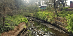
Prospect Creek, as it flows in Fairfield.
|
|
|
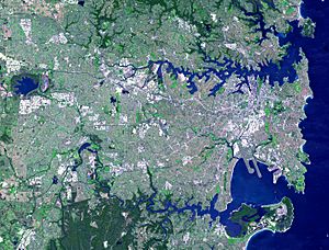
NASA satellite view of Greater Metropolitan Sydney, with the Prospect Creek mouth location, as marked
|
|
| Country | Australia |
| State | New South Wales |
| Region | Sydney Basin (IBRA), Greater Western Sydney, Canterbury-Bankstown, Southern Sydney |
| LGAs | Blacktown, Cumberland, Fairfield, Liverpool, Canterbury-Bankstown |
| Physical characteristics | |
| Main source | Prospect Reservoir north of Bulls Hill, Prospect 33°50′2″S 150°53′20″E / 33.83389°S 150.88889°E |
| River mouth | confluence with the Georges River Dhurawal Bay, Georges Hall 33°54′35″S 150°58′25″E / 33.90972°S 150.97361°E |
| Length | 26 km (16 mi) |
| Basin features | |
| River system | Sydney Basin catchment |
| Basin size | 98 km2 (38 sq mi) |
| Dam / Reservoir | Prospect Reservoir |
Prospect Creek is an important waterway in Sydney, New South Wales, Australia. It's like a long, flowing stream that helps drain water from a large area. This creek is part of the bigger Georges River system.
The creek is about 26 kilometers (16 miles) long. It starts at the Prospect Reservoir and flows all the way to the Georges River at Georges Hall. Because Prospect Reservoir helps supply water to Sydney, the amount of water flowing in the creek is controlled by Sydney Water.
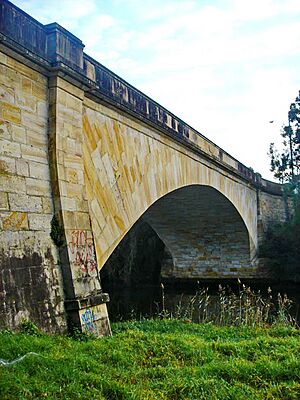
In 2020, there was a plan to change a 6-kilometer (4-mile) part of Prospect Creek to be called Lennox River. This idea came from a community advocate and local politicians. The new name would honor David Lennox, who designed the Lansdowne Bridge that crosses the creek.
Where Prospect Creek Flows
Prospect Creek begins near the Prospect Reservoir in an area called Prospect. From there, it generally flows towards the southeast. It passes through several local government areas, including Blacktown, Fairfield, Liverpool, and Canterbury-Bankstown. Finally, it joins the Georges River at Georges Hall, flowing into Dhurawal Bay.
The area that collects water for Prospect Creek is about 98 square kilometers (38 square miles). Most of this area is developed with homes, businesses, and places for fun.
Rules and Safety for the Creek
It's important to know that fishing in Prospect Creek is not allowed with recreational fishing traps. There are rules about fishing, and you can get in trouble if you don't follow them.
You might be surprised to learn that Bull sharks can sometimes be found in the creek! This is because the Georges River, which Prospect Creek connects to, has tides that go quite far upstream. Because of this, it's not a good idea to swim in Prospect Creek.
Fun Things to Do Along the Creek
Prospect Creek flows through many lovely parks and natural areas. Some of the well-known spots include:
- Gipps Road Sporting Complex
- Rosford Street Reserve
- Long Street Park in Smithfield
- Fairfield Park Precinct
- Cawarra Park in Fairfield
- Fairfield Road Park in Yennora
- Makepeace Oval in Fairfield
- Henry Lawson Reserve in Georges Hall
The creek also runs near Fairfield High School and a famous old tree called Bland Oak.
You can enjoy walking or cycling along paths that follow the creek. One long path starts near Widmere Road in Wetherill Park and goes all the way to Fairfield Road Park in Yennora. These paths let you experience the Australian bushland, with native trees like eucalyptus all around you.
 | Stephanie Wilson |
 | Charles Bolden |
 | Ronald McNair |
 | Frederick D. Gregory |


