
Georges Hall facts for kids
Quick facts for kids Georges HallSydney, New South Wales |
|||||||||||||||
|---|---|---|---|---|---|---|---|---|---|---|---|---|---|---|---|

Lake Gillawarna
|
|||||||||||||||

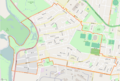
Georges Hall suburb boundary
|
|||||||||||||||
| Population | 9,038 (2016 census) | ||||||||||||||
| • Density | 2,660/km2 (6,900/sq mi) | ||||||||||||||
| Established | 1924 | ||||||||||||||
| Postcode(s) | 2198 | ||||||||||||||
| Elevation | 17 m (56 ft) | ||||||||||||||
| Area | 3.4 km2 (1.3 sq mi) | ||||||||||||||
| Location | 24 km (15 mi) south-west of Sydney CBD | ||||||||||||||
| LGA(s) | City of Canterbury-Bankstown | ||||||||||||||
| State electorate(s) |
|
||||||||||||||
| Federal Division(s) | Blaxland | ||||||||||||||
|
|||||||||||||||
Georges Hall is a suburb in Sydney, New South Wales, Australia. It's about 24 kilometres south-west of the main city area. This suburb is part of the City of Canterbury-Bankstown local government area.
The Georges River forms the western border of Georges Hall. To the south, you'll find Bankstown Aerodrome. The suburbs of Bass Hill are to the north, and Condell Park is to the east.
Contents
Exploring Georges Hall's Past
Georges Hall was once part of the larger area known as Bankstown. It was also close to the land that became Bankstown Airport.
Early Explorers and Land Grants
In 1795, two famous explorers, George Bass and Matthew Flinders, went on an adventure. They used a small boat called the Tom Thumb. They sailed into Botany Bay and explored the Georges River. They went much further than anyone before them.
Because of his exploration, George Bass received a land grant in 1798. This land was near today's Hazel Street and Flinders Road. The nearby suburb of Bass Hill is named after him. Matthew Flinders also received land close by.
The Johnston Family and 'Georges Hall' Farm
Lieutenant-Colonel George Johnston built his first home here in 1798. It was a farmhouse on 172 acres of land. He named his farm 'Georges Hall'. This farm was located near where Henry Lawson Drive is today.
The suburb of Georges Hall gets its name from this historic farm. George Johnston's third son, David, later became a farmer on this property. In 1809, the farmhouse was even used to help count the people living in the colony. Soldiers were stationed there to keep Lt Colonel Johnston safe during this important task. This is how Garrison Point got its name. Today, Garrison Point is a popular spot for Australia Day celebrations.
In 1837, the Johnston family built another home. This one was called 'The Homestead'. It was built on higher ground in Bankstown to avoid floods. This house is one of the oldest in the area. It had a simple but elegant design with wide verandahs. The Johnston family is also remembered by Johnston Road.
Honoring War Heroes
Some street names in Georges Hall remember soldiers from the First World War. Birdwood Avenue is named after Lord Birdwood. Haig Avenue is named after another important soldier, Haig.
Special Places and Parks
Georges Hall has some great outdoor spaces to explore.
Garrison Point and Lake Gillawarna
Garrison Point is a park located where the Georges River and Prospect Creek meet. Right next to it is Lake Gillawarna. This is a man-made lake. It's a very important place for native birds to breed and raise their young.
Garrison Point and Lake Gillawarna are part of a bigger area called Mirambeena Regional Park. This park stretches into the nearby suburb of Lansvale. A little further south, you'll find Kentucky Reserve. This is another park with views of the Georges River.
Who Lives in Georges Hall?
After World War II, many people moved to Georges Hall. A lot of these new residents were refugees from Eastern Europe. They came to Australia in the late 1940s and 1950s and built homes here.
According to the 2016 census, 9,038 people lived in Georges Hall. Most residents (64.3%) were born in Australia. Other countries of birth included Lebanon (6.5%), Vietnam (4.5%), and Italy (1.7%). About 46.3% of people spoke only English at home. Other languages spoken included Arabic (21.4%) and Vietnamese (6.5%).
Many people in Georges Hall own their homes. About 42.7% owned their home outright, and 36.6% were paying off a mortgage.
Local Schools
Georges Hall has several schools for students:
- Calvary Chapel Christian School
- Georges Hall Public School
- St. Mary's, Queen of Heaven Primary School
- Georges River Grammar (This school's mailing address is Georges Hall, but it's actually located in Bankstown Aerodrome.)
Important Landmarks
Here are some well-known places in Georges Hall:
- Bankstown Airport – a busy airport for the Sydney area.
- Dunc Gray Velodrome – a special track for bicycle racing.
- The Reservoir – a large water storage facility.
- Mirambeena Reserve – a large park area.
- Lake Gillawarna – a lake with an island often full of Ibis birds.
- The Homestead, Lionel Street – a historic house built in 1837 by David Johnston. It's listed as an important heritage site.
Images for kids
-

Lake Gillawarna
-
Georges Hall suburb boundary
