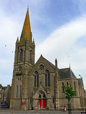
County of Nairn facts for kids
Quick facts for kids
County of Nairn
|
|
|---|---|
 |
|
| Country | Scotland |
| County town | Nairn |
| Area | |
| • Total | 200 sq mi (518 km2) |
| Ranked 31st of 34 | |
| Chapman code |
NAI
|
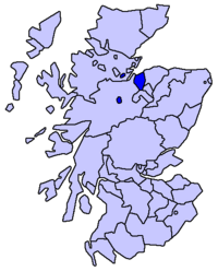
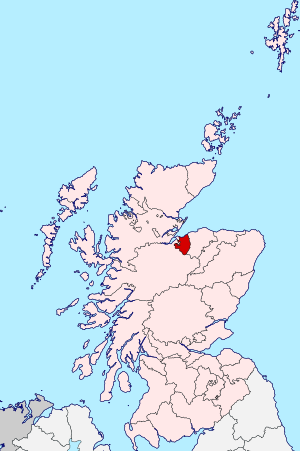
The County of Nairn, also known as Nairnshire (Scottish Gaelic: Siorrachd Inbhir Narann), is a historic area in Scotland. It used to be a county with its own local government. The main town and center of the county was Nairn.
Nairnshire is located on the coast of the Moray Firth. It shares borders with Inverness-shire to the west and south, and Moray to the east.
Contents
Exploring Nairnshire's Geography
Nairnshire is about 35 kilometers (22 miles) long and 24 kilometers (15 miles) wide. It covers an area of about 518 square kilometers (200 square miles).
The county has a flat coastal area where most people live. Further inland, it becomes hilly with fewer people. These hills rise towards the Grampian Mountains in the south. The highest point is Carn nam Bain-tighearna, reaching 634 meters (2,080 feet).
The coast forms a curved shape with two main peninsulas: Whiteness Head in the west and The Bar in the east. The main rivers are the River Nairn and the River Findhorn. Both rivers cut deep paths as they flow north.
Nairnshire also has several lochs, which are Scottish lakes. These include Loch Loy, Cran Loch, Clunas Reservoir, Loch of Boath, and Loch Kirkcaldy. You can even see Nairn from distant places like Ben Rinnes.
What Nairnshire Means Today
Today, Nairn (Scottish Gaelic: Inbhir Narann) is still important for land records. It is known as a registration county.
It is also a lieutenancy area. This means it's a special area where the King's or Queen's representative, called a Lord-Lieutenant, carries out duties.
However, since 1996, Nairnshire no longer has its own local government. It is now part of a larger council area.
How Local Government Changed
Early Changes in the 1800s
Before 1891, Nairnshire had some unusual parts. These were small areas of the county that were separated from the main part. Some were even inside other counties, like Inverness-shire or County of Ross.
In 1889, a new law changed these borders. All the separated parts became part of the counties they were located in. This made the county boundaries much clearer.
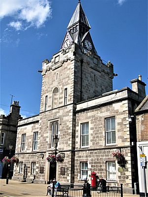
In 1890, the Nairn County Council was created. This council was in charge of local services. It was based at the Nairn Town and County Buildings. However, in 1930, Nairn County Council joined with Moray County Council to handle most of their shared tasks.
Changes in the 1900s
In 1927, Nairnshire received its own special design, called a coat of arms. This design had a red chevron, two water-bougets, and a stag's head. It also had a motto: UNITE AND BE MINDFUL.
In 1975, another law changed local government again. The Nairn County Council was replaced. The area of Nairn became a district within a larger region called Highland. This meant some services, like education, were handled by the region. Other services, like housing, were handled by the district.
Then, in 1996, the local government changed once more. The Highland region became a single, large council area. This meant the Nairn district was merged into the bigger Highland Council.
Nairn Today in Local Government
Today, Nairn is one of the 22 areas, or "wards," within the Highland Council. Each ward elects councillors to represent its people. Nairn ward elects four of the council's 80 members.
The Nairn ward is located near the border with the Moray council area. Within the Highland area, it borders the Badenoch and Strathspey ward and the Inverness South ward to the south. To the west, it borders the Culloden and Ardersier ward.
Local Parishes
Even though Nairnshire no longer has its own council, its old "civil parishes" are still used for some statistics. This helps compare population numbers over many years.
The historic county included the royal burgh of Nairn. It also had four full parishes: Ardclach, Auldearn, Dyke & Moy, and Nairn. Parts of other parishes, like Cawdor and Croy, were also included.
Who Represents Nairnshire?
For the UK Parliament, Nairn is part of the Inverness, Nairn, Badenoch and Strathspey area. The current Member of Parliament (MP) is Drew Hendry.
For the Scottish Parliament, Nairn is part of the Inverness and Nairn area. The current Member of the Scottish Parliament (MSP) is Fergus Ewing.
Getting Around Nairnshire
The Aberdeen–Inverness railway line runs through the northern part of the county. It travels from west to east.
Towns and Villages
Here are some of the towns and villages you can find in Nairnshire:
- Ardclach
- Auldearn
- Cawdor
- Clephanton
- Culcharry
- Delnies
- Ferness
- Firhall
- Geddes
- Glenferness
- Littlemill
- Nairn
- Piperhill
- Regoul
 | Lonnie Johnson |
 | Granville Woods |
 | Lewis Howard Latimer |
 | James West |


