Creswell, North Carolina facts for kids
Quick facts for kids
Creswell, North Carolina
|
|
|---|---|

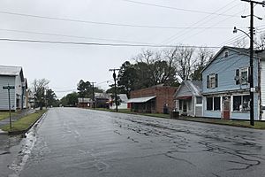
Downtown Creswell
|
|

Location of Creswell, North Carolina
|
|
| Country | United States |
| State | North Carolina |
| County | Washington |
| Area | |
| • Total | 0.57 sq mi (1.47 km2) |
| • Land | 0.57 sq mi (1.47 km2) |
| • Water | 0.00 sq mi (0.00 km2) |
| Elevation | 7 ft (2 m) |
| Population
(2020)
|
|
| • Total | 207 |
| • Density | 365.72/sq mi (141.22/km2) |
| Time zone | UTC-5 (Eastern (EST)) |
| • Summer (DST) | UTC-4 (EDT) |
| ZIP code |
27928
|
| Area code(s) | 252 |
| FIPS code | 37-15420 |
| GNIS feature ID | 2406336 |
Creswell is a small town in Washington County, North Carolina, United States. It's a quiet place with a friendly community. In 2020, about 207 people lived here.
Contents
Geography
Creswell is located in the eastern part of North Carolina. This area is known as the Inner Banks. It sits on a peninsula, which is a piece of land almost surrounded by water.
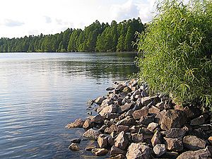
The town is also found along the western side of the Scuppernong River. This river is a beautiful natural feature of the area. The total area of Creswell is about 0.57 square miles (1.47 square kilometers), and all of it is land.
People and Population
| Historical population | |||
|---|---|---|---|
| Census | Pop. | %± | |
| 1880 | 145 | — | |
| 1890 | 202 | 39.3% | |
| 1900 | 224 | 10.9% | |
| 1910 | 329 | 46.9% | |
| 1920 | 393 | 19.5% | |
| 1930 | 350 | −10.9% | |
| 1940 | 459 | 31.1% | |
| 1950 | 425 | −7.4% | |
| 1960 | 402 | −5.4% | |
| 1970 | 633 | 57.5% | |
| 1980 | 426 | −32.7% | |
| 1990 | 361 | −15.3% | |
| 2000 | 278 | −23.0% | |
| 2010 | 276 | −0.7% | |
| 2020 | 207 | −25.0% | |
| U.S. Decennial Census | |||

In 2000, there were 278 people living in Creswell. These people made up 118 households and 86 families. The town's population density was about 666 people per square mile.
About 28% of the households had children under 18 living with them. The average household had about 2.36 people. The average family had about 2.77 people.
The town's population included people of different ages. About 22.3% were under 18 years old. Around 24.1% were 65 years or older. The average age in Creswell was 43 years.
History of Creswell
Creswell became an official town in 1874. It was named after John Angel James Creswell. He was the United States Postmaster General at that time.
The buildings in downtown Creswell are very special. They are some of the best examples of old town architecture in North Carolina. These buildings show what towns looked like in the late 1800s.
Several important places in Creswell are listed on the National Register of Historic Places. This means they are protected because of their historical value. These places include:
- Belgrade and St. David's Church
- Creswell Historic District
- Davenport House
- Somerset Place State Historic Site
Getting Around Creswell
Roads and Highways
You can reach Creswell easily by car. U.S. Highway 64 runs east and west. North Carolina Highway 94 goes north and south.
Creswell is also close to many other towns and cities. Here are some nearby places:
- Columbia (9 miles away)
- Edenton (21 miles away)
- Plymouth (23 miles away)
- Elizabeth City (45 miles away)
- Manteo (46 miles away)
- Nags Head (54 miles away)
- Washington (55 miles away)
- Greenville (69 miles away)
- Norfolk, Virginia (83 miles away)
- Virginia Beach, Virginia (93 miles away)
- Raleigh (139 miles away)
Airports
If you need to fly, the closest airports are:
- Norfolk International Airport (ORF) in Norfolk, Virginia
- Pitt-Greenville Airport (PGV) in Greenville, North Carolina
See also
 In Spanish: Creswell (Carolina del Norte) para niños
 | Shirley Ann Jackson |
 | Garett Morgan |
 | J. Ernest Wilkins Jr. |
 | Elijah McCoy |

