Nags Head, North Carolina facts for kids
Quick facts for kids
Nags Head, North Carolina
|
|||
|---|---|---|---|

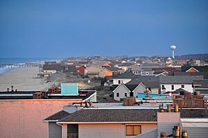
Nags Head in 2013
|
|||
|
|||

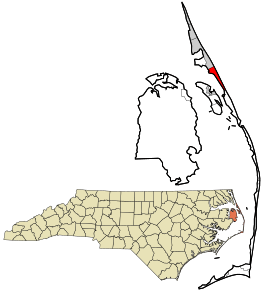
Location in Dare County and the U.S. state of North Carolina
|
|||
| Country | United States | ||
| State | North Carolina | ||
| County | Dare | ||
| Incorporated | 1923 and 1961 | ||
| Named for | Tied lanterns around the necks of ponies | ||
| Area | |||
| • Total | 6.68 sq mi (17.31 km2) | ||
| • Land | 6.62 sq mi (17.14 km2) | ||
| • Water | 0.07 sq mi (0.17 km2) | ||
| Elevation | 3 ft (1 m) | ||
| Population
(2020)
|
|||
| • Total | 3,168 | ||
| • Density | 478.69/sq mi (184.84/km2) | ||
| Time zone | UTC-5 (Eastern (EST)) | ||
| • Summer (DST) | UTC-4 (EDT) | ||
| ZIP Code |
27959
|
||
| Area code(s) | 252 | ||
| FIPS code | 37-45880 | ||
| GNIS feature ID | 1021599 | ||
Nags Head is a fun town located in Dare County, North Carolina, in the United States. It's a very popular place for vacations! People love its beautiful beaches and amazing sand dunes, especially Jockey's Ridge. In 2020, about 3,146 people lived there.
Contents
Discovering Nags Head's Past
Long ago, maps showed Nags Head as a piece of land with tall sand dunes. You could see these dunes from far out at sea! No one is completely sure how the town got its name. It might have been named after other places called Nag's Head on the English coast.
There's a cool story about the name. It says that bad guys, called wreckers, would tie lights to the heads of mules or horses (sometimes called "nags"). They did this to trick ships into thinking the lights were from safe harbors. The ships would then crash, and the wreckers would steal their treasures. The town's symbol even shows one of these horses!
Around the 1830s, Nags Head became known as a great place for vacations. This grew even more in 1855. A doctor named W. G. Pool bought a large piece of land by the ocean. He divided it into smaller parts and sold them to his friends. This led to many more homes being built in the area.
Today, Jockey's Ridge is one of the last big sand dunes left from those early days. Most of the area is now developed with buildings. Nags Head officially became a town in 1961.
Modernizing Energy and Design
In May 2021, Nags Head was chosen for a special project. It was one of 11 communities picked by the United States Department of Energy. This project helps towns like Nags Head improve their electricity systems. It also helps them be ready for natural disasters and power outages.
Nags Head received money to get 48 to 72 hours of backup power for emergency services. This is important because the town can be affected by bad weather and rising sea levels. They are also looking into using renewable energy and finding ways to use energy more wisely.
The town also got another grant from the American Institute of Architects. This money helps them design buildings that save energy and water. These projects help Nags Head be more prepared and environmentally friendly.
Where is Nags Head?
Nags Head is located at 35°55′55″N 75°36′54″W / 35.93194°N 75.61500°W.
The town covers a total area of about 6.68 square miles (17.3 square kilometers). Most of this area is land, with a small part being water.
Nags Head's Population
| Historical population | |||
|---|---|---|---|
| Census | Pop. | %± | |
| 1970 | 414 | — | |
| 1980 | 1,020 | 146.4% | |
| 1990 | 1,838 | 80.2% | |
| 2000 | 2,700 | 46.9% | |
| 2010 | 2,757 | 2.1% | |
| 2020 | 3,146 | 14.1% | |
| 2021 (est.) | 3,182 | 15.4% | |
| U.S. Decennial Census | |||
In 2020, there were 3,168 people living in Nags Head. There were 1,302 households and 861 families.
Who Lives in Nags Head?
| Group | Number | Percentage |
|---|---|---|
| White (not Hispanic) | 2,891 | 91.26% |
| Black or African American (not Hispanic) | 23 | 0.73% |
| Native American | 5 | 0.16% |
| Asian | 25 | 0.79% |
| Other/Mixed | 108 | 3.41% |
| Hispanic or Latino | 116 | 3.66% |
Fun Things to Do in Nags Head
Nags Head is home to Jockey's Ridge State Park, which has the largest sand dune on the East Coast! This huge dune moves over time because of the strong coastal winds. It has even buried a miniature golf course in the past! Jockey's Ridge is super popular for hang-gliders. It even has the world's biggest hang gliding school. People also love to fly kites here.
The park has a visitor center with a museum. You can learn about sand, weather, and the animals that live there. You might see different birds, foxes, mice, squirrels, and sometimes even deer and rabbits.
One cool thing about Jockey's Ridge is that it's always changing. Sometimes, small pools of water appear, and the sand shifts. This means every visit is a new adventure! From the top of the Ridge, you can see both the ocean and the sound. Jockey's Ridge also has a beach on the Roanoke Sound side where you can swim.
The Nags Head Woods Ecological Preserve is a large protected area of about 1,092 acres. It's north of Jockey's Ridge and east of Roanoke Sound. This special place was named a National Natural Landmark in 1974.
Of course, the ocean and beaches are huge attractions! You can swim, sunbathe, and try many water sports. There are also old, historic cottages along the beach. If you like fishing, there are three popular piers: Nags Head Pier, Jennette's Pier, and Outer Banks Pier. Jennette's Pier was badly damaged by a hurricane in 2003. It was bought and rebuilt by the North Carolina Aquariums and reopened in 2011. The town also has miniature golf courses and small amusement centers with go-karts and bumper cars for family fun.
Historic Places to Visit
Nags Head and the surrounding area have several places listed on the National Register of Historic Places. These are important sites that tell us about the past.
| Landmark Name | Image | Date Listed | Location | Notes |
|---|---|---|---|---|
| Bodie Island Lifesaving and Coast Guard Station |  |
February 9, 1979 | South of Nags Head on NC 12 35°50′11″N 75°33′33″W / 35.83639°N 75.55917°W |
|
| Bodie Island Light Station |  |
July 4, 2003 | Off NC 12 35°49′12″N 75°33′49″W / 35.82000°N 75.56361°W |
|
| First Colony Inn |  |
January 21, 1993 | 6720 S. Virginia Dare Trail 35°55′6″N 75°36′13″W / 35.91833°N 75.60361°W |
|
| Markham-Albertson-Stinson Cottage |  |
January 13, 2006 | 4300 W. Soundside Rd. 35°56′45.51″N 75°37′45.93″W / 35.9459750°N 75.6294250°W |
Was destroyed by Hurricane Irene |
| Mattie Midgett Store and House |  |
December 23, 2004 | 4008 S. Virginia Dare Trail 35°57′23″N 75°37′28″W / 35.95639°N 75.62444°W |
|
| Nags Head Beach Cottages Historic District |  |
August 19, 1977 | U.S. 158 35°57′50″N 75°35′49″W / 35.96389°N 75.59694°W |
|
| Sea Foam Motel |  |
December 23, 2004 | 7111 S. Virginia Dare Trail 35°54′37″N 75°35′47″W / 35.91028°N 75.59639°W |
|
| USS Huron (1875) | November 15, 1991 | Address restricted | Shipwrecked in the area in 1877 |
Nags Head's Weather
Nags Head has a humid subtropical climate. This means it has hot and humid summers, cool winters, and rain throughout the year. In summer, a cool sea breeze often blows in the afternoon. But sometimes, it can get very hot and humid.
Nags Head can be hit by hurricanes, especially from June to November. The busiest time for hurricanes is late August through September. In winter, it can get cold and windy. The average snowfall is very low, less than 2 inches per year.
| Climate data for Nags Head, NC (1981–2010 averages) | |||||||||||||
|---|---|---|---|---|---|---|---|---|---|---|---|---|---|
| Month | Jan | Feb | Mar | Apr | May | Jun | Jul | Aug | Sep | Oct | Nov | Dec | Year |
| Mean daily maximum °F (°C) | 51.3 (10.7) |
53.1 (11.7) |
58.6 (14.8) |
66.9 (19.4) |
74.3 (23.5) |
81.8 (27.7) |
85.5 (29.7) |
84.4 (29.1) |
79.9 (26.6) |
71.6 (22.0) |
63.5 (17.5) |
55.3 (12.9) |
68.9 (20.5) |
| Daily mean °F (°C) | 44.3 (6.8) |
46.0 (7.8) |
51.1 (10.6) |
59.3 (15.2) |
67.2 (19.6) |
75.6 (24.2) |
79.7 (26.5) |
78.8 (26.0) |
74.4 (23.6) |
65.5 (18.6) |
56.7 (13.7) |
48.3 (9.1) |
62.3 (16.8) |
| Mean daily minimum °F (°C) | 37.3 (2.9) |
38.8 (3.8) |
43.5 (6.4) |
51.7 (10.9) |
60.1 (15.6) |
69.4 (20.8) |
73.9 (23.3) |
73.2 (22.9) |
69.0 (20.6) |
59.3 (15.2) |
49.8 (9.9) |
41.4 (5.2) |
55.7 (13.2) |
| Average precipitation inches (mm) | 4.35 (110) |
3.74 (95) |
3.73 (95) |
3.37 (86) |
3.68 (93) |
4.28 (109) |
5.12 (130) |
6.09 (155) |
5.63 (143) |
3.94 (100) |
3.83 (97) |
3.88 (99) |
51.64 (1,312) |
| Average relative humidity (%) | 69.6 | 69.5 | 67.2 | 67.4 | 70.3 | 73.4 | 75.3 | 74.7 | 73.8 | 70.9 | 72.1 | 71.2 | 71.3 |
| Average dew point °F (°C) | 35.0 (1.7) |
36.6 (2.6) |
40.6 (4.8) |
48.5 (9.2) |
57.2 (14.0) |
66.5 (19.2) |
71.2 (21.8) |
70.1 (21.2) |
65.5 (18.6) |
55.8 (13.2) |
47.8 (8.8) |
39.4 (4.1) |
52.9 (11.6) |
| Source: PRISM | |||||||||||||
| Climate data for Duck, NC, ocean water temperature (21 NW Nags Head) | |||||||||||||
|---|---|---|---|---|---|---|---|---|---|---|---|---|---|
| Month | Jan | Feb | Mar | Apr | May | Jun | Jul | Aug | Sep | Oct | Nov | Dec | Year |
| Daily mean °F (°C) | 45 (7) |
44 (7) |
46 (8) |
59 (15) |
67 (19) |
74 (23) |
71 (22) |
74 (23) |
75 (24) |
69 (21) |
59 (15) |
52 (11) |
61 (16) |
| Source: NOAA | |||||||||||||
Nature and Plants
Nags Head has a type of natural plant life called Live oak/Sea Oats. This means you would mostly see live oak trees and sea oats plants. The area is also known for its Coastal Prairie landscape.
Schools in Nags Head
Students in Nags Head go to schools in the Dare County Schools system. The local elementary school is Nags Head Elementary School. For middle school, students attend Manteo Middle School. High school students go to Manteo High School.
Nags Head Elementary School opened in August 2005. Before that, younger students went to First Flight Elementary School in Kill Devil Hills. Middle school students went to First Flight Middle School, also in Kill Devil Hills.
See also
 In Spanish: Nags Head (Carolina del Norte) para niños
 | Charles R. Drew |
 | Benjamin Banneker |
 | Jane C. Wright |
 | Roger Arliner Young |


