
Kill Devil Hills, North Carolina facts for kids
Quick facts for kids
Kill Devil Hills, North Carolina
|
|||
|---|---|---|---|

Kill Devil Hill, Wright Brothers National Memorial
|
|||
|
|||
| Nickname(s):
Birthplace of Aviation
|
|||

Location in Dare County and the U.S. state of North Carolina.
|
|||
| Country | United States | ||
| State | North Carolina | ||
| County | Dare | ||
| Incorporated | 1953 | ||
| Named for | Unwholesome rum | ||
| Area | |||
| • Total | 5.66 sq mi (14.67 km2) | ||
| • Land | 5.61 sq mi (14.53 km2) | ||
| • Water | 0.06 sq mi (0.14 km2) | ||
| Elevation | 7 ft (2 m) | ||
| Population
(2020)
|
|||
| • Total | 7,656 | ||
| • Density | 1,365.19/sq mi (527.08/km2) | ||
| Time zone | UTC-5 (Eastern (EST)) | ||
| • Summer (DST) | UTC-4 (EDT) | ||
| ZIP code |
27948
|
||
| Area code(s) | 252 | ||
| FIPS code | 37-35720 | ||
| GNIS feature ID | 1025849 | ||
| Website | kdhnc.com | ||


Kill Devil Hills is a town located in Dare County, North Carolina, United States. It's a special place because it's where the Wright brothers made their very first successful airplane flights!
In 2020, about 7,633 people lived here. Kill Devil Hills is the biggest town in Dare County and on the Outer Banks of North Carolina. Even though the Wright brothers flew their plane here in 1903, the town itself didn't officially become a town until 1953. The nearby town of Kitty Hawk is often mistakenly thought of as the flight location, but the actual spot was Kill Devil Hills.
Contents
History of Flight and Town
Kill Devil Hills is famous as the site of the Wright Brothers National Memorial. This memorial celebrates the four amazing flights made by the Wright brothers in their Wright Flyer airplane on December 17, 1903. They chose this spot because of its good winds, which were perfect for testing their flying machines.
Orville Wright even came back in 1911. On October 25, he set a new world record for gliders! He stayed in the air for 10 minutes and 34 seconds, using the wind to soar with very little forward movement.
Besides the famous memorial, another important place in town is Sam's Diner. It's listed on the National Register of Historic Places, which means it's a special historic spot.
Where is Kill Devil Hills?
Kill Devil Hills is located on the Outer Banks, which are long, thin barrier islands off the coast of North Carolina. Its exact location is 36°1′32″N 75°40′12″W / 36.02556°N 75.67000°W.
The town covers about 5.5 square miles (14.2 square kilometers) of land. Only a tiny part of it is water. Because of its beautiful beaches and nice weather, many more people visit Kill Devil Hills and other Outer Banks towns during the summer. The population grows a lot when tourists arrive!
-
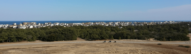
This picture was taken from the Wright Brothers National Memorial.
-
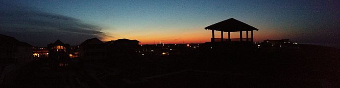
A night view of Kill Devil Hills.


Weather in Kill Devil Hills
Kill Devil Hills has a warm and humid climate. Summers are hot and sticky, while winters are cool. It rains throughout the year.
In summer, a cool sea breeze often blows in the afternoon, which helps to cool things down. However, it can get very hot and humid sometimes. Kill Devil Hills can also be affected by hurricanes, especially from June through November. In winter, it can get quite cold and windy. Snowfall is usually very light, less than 2 inches (5 cm) per year.
| Climate data for Kill Devil Hills, NC (1981-2010 Averages) | |||||||||||||
|---|---|---|---|---|---|---|---|---|---|---|---|---|---|
| Month | Jan | Feb | Mar | Apr | May | Jun | Jul | Aug | Sep | Oct | Nov | Dec | Year |
| Mean daily maximum °F (°C) | 50.8 (10.4) |
52.6 (11.4) |
58.1 (14.5) |
66.5 (19.2) |
73.9 (23.3) |
81.5 (27.5) |
85.4 (29.7) |
84.2 (29.0) |
79.5 (26.4) |
71.2 (21.8) |
63.0 (17.2) |
54.6 (12.6) |
68.5 (20.3) |
| Daily mean °F (°C) | 44.1 (6.7) |
45.7 (7.6) |
50.8 (10.4) |
59.0 (15.0) |
67.0 (19.4) |
75.4 (24.1) |
79.7 (26.5) |
78.9 (26.1) |
74.3 (23.5) |
65.3 (18.5) |
56.6 (13.7) |
48.0 (8.9) |
62.1 (16.7) |
| Mean daily minimum °F (°C) | 37.4 (3.0) |
38.9 (3.8) |
43.5 (6.4) |
51.6 (10.9) |
60.2 (15.7) |
69.3 (20.7) |
74.1 (23.4) |
73.5 (23.1) |
69.1 (20.6) |
59.4 (15.2) |
50.2 (10.1) |
41.3 (5.2) |
55.8 (13.2) |
| Average precipitation inches (mm) | 4.28 (109) |
3.54 (90) |
3.84 (98) |
3.44 (87) |
3.75 (95) |
4.31 (109) |
4.96 (126) |
5.98 (152) |
5.29 (134) |
3.79 (96) |
3.70 (94) |
3.76 (96) |
50.64 (1,286) |
| Average relative humidity (%) | 70.2 | 69.5 | 66.9 | 66.6 | 69.3 | 72.4 | 73.8 | 73.0 | 73.0 | 70.1 | 71.8 | 72.0 | 70.7 |
| Average dew point °F (°C) | 35.0 (1.7) |
36.3 (2.4) |
40.2 (4.6) |
47.9 (8.8) |
56.6 (13.7) |
65.9 (18.8) |
70.6 (21.4) |
69.5 (20.8) |
65.1 (18.4) |
55.3 (12.9) |
47.6 (8.7) |
39.4 (4.1) |
52.5 (11.4) |
| Source: PRISM | |||||||||||||
| Climate data for Duck, NC Ocean Water Temperature (12 NW Kill Devil Hills) | |||||||||||||
|---|---|---|---|---|---|---|---|---|---|---|---|---|---|
| Month | Jan | Feb | Mar | Apr | May | Jun | Jul | Aug | Sep | Oct | Nov | Dec | Year |
| Daily mean °F (°C) | 45 (7) |
44 (7) |
46 (8) |
59 (15) |
67 (19) |
74 (23) |
71 (22) |
74 (23) |
75 (24) |
69 (21) |
59 (15) |
52 (11) |
61 (16) |
| Source: NOAA | |||||||||||||
Who Lives Here?
| Historical population | |||
|---|---|---|---|
| Census | Pop. | %± | |
| 1960 | 268 | — | |
| 1970 | 357 | 33.2% | |
| 1980 | 1,796 | 403.1% | |
| 1990 | 4,238 | 136.0% | |
| 2000 | 5,897 | 39.1% | |
| 2010 | 6,683 | 13.3% | |
| 2020 | 7,633 | 14.2% | |
| 2021 (est.) | 7,777 | 16.4% | |
| sources: | |||
The number of people living in Kill Devil Hills has grown a lot over the years. In 1960, there were only 268 people, but by 2020, the population had reached 7,656!
People in 2020
In 2020, there were 7,656 people living in Kill Devil Hills. These people made up 3,170 households and 1,809 families. Most of the people living there were White (84.61%). There were also smaller numbers of Black or African American, Native American, Asian, and people of mixed races. About 8.61% of the population was Hispanic or Latino.
Sports and Fun
Kill Devil Hills is home to a baseball team called the Outer Banks Daredevils. They play in the Tidewater Summer League, which is a league for college baseball players during the summer. The Daredevils play their games at the First Flight Baseball Complex in Kill Devil Hills. The team started in 1997 and began playing in Kill Devil Hills in 2005.
Schools in Town
Students in Kill Devil Hills go to schools that are part of Dare County Schools.
- First Flight Elementary School and First Flight Middle School are both located in Kill Devil Hills, just south of the Wright Brothers National Memorial.
- Older students attend First Flight High School. This high school opened in 2004. Before that, high school students from Kill Devil Hills went to Manteo High School.
Some parts of Kill Devil Hills are zoned for Nags Head Elementary School instead of First Flight Elementary. The school boundaries changed in 2005 when Nags Head Elementary opened.
The town also has a branch of the Dare County Library, where you can find books and other resources.
Getting Around
.jpg)
First Flight Airport (airport codes: FFA, KFFA) is a public airport located just one mile west of Kill Devil Hills. It's owned by the National Park Service.
The airport covers 40 acres and is about 13 feet above sea level. It has one runway that is 3,000 feet long and 60 feet wide. This airport is very important because it's where the Wright brothers did many of their gliding experiments before their first powered flight. In 2003, the U.S. Centennial of Flight Commission chose First Flight Airport as a stop for the National Air Tour, celebrating 100 years of flight!
See also
 In Spanish: Kill Devil Hills (Carolina del Norte) para niños
