Cricket Mountains facts for kids
Quick facts for kids Cricket Mountains |
|
|---|---|

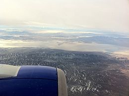
(view due-west)-Overlooking Cricket Mountains and Sevier Lake
bordering west: House Range; bordering westward, north lies Tule Valley, south, Wah Wah Valley, then Confusion Range. The larger Ferguson Desert lies on the horizon. |
|
| Highest point | |
| Peak | Headlight Mountain ((extreme southwest)-Cricket Mountains) |
| Elevation | 5,999 ft (1,828 m) |
| Dimensions | |
| Length | 35 mi (56 km) SW x NE |
| Width | 12 mi (19 km) |
| Geography | |
| Country | United States |
| State | Utah |
| Region | ((southwest)-Great Basin Desert) (southwest)-Sevier Desert |
| County | Millard |
| Settlement | Black Rock |
| Borders on | Sevier Lake-W (House Range-W) Sevier Desert-W, N & E Utah State Route 257-E & SE Black Rosk, UT-SE San Francisco Mountains-SW |
The Cricket Mountains are a mountain range in Utah, United States. They are about 35 miles (56 km) long. You can find them in central Millard County. They are also on the east side of Sevier Lake, which is in the Great Basin Desert.
To the southwest, the Cricket Mountains connect with the smaller San Francisco Mountains. These mountains are near the southern edge of Sevier Lake and east of Wah Wah Valley.
Exploring the Cricket Mountains
The Cricket Mountains have peaks that reach high into the sky. The lowest peaks are around 6,000 feet (1,829 meters) tall. The very highest point is called Headlight Mountain. It stands at 6,749 feet (2,057 meters) tall. Headlight Mountain is located in the far southwest part of the range.
The mountains are surrounded by the Sevier Desert. This desert is to the east, north, and west of the range. The Sevier River flows through this desert. It moves west and then southwest into Sevier Lake, which is right on the western side of the mountains.
How the Mountains Formed
The southwest part of the Cricket Mountains joins with the northeast part of the San Francisco Mountains. Both of these mountain ranges stretch from the southwest to the northeast. Scientists believe they were formed by a process called Basin and Range block faulting. This is when large blocks of the Earth's crust move up and down, creating mountains and valleys.
Graymont Lime Plant
A company called Graymont Lime has a large factory in the Cricket Mountains. This plant is about 35 miles (56 km) southwest of Delta. It is one of the ten biggest factories in the United States that makes lime.
Lime is a material made from limestone. It is used in many things, like building materials, agriculture, and treating water. The plant was once owned by a company called Continental Lime. Graymont Lime later bought that company.
 | Roy Wilkins |
 | John Lewis |
 | Linda Carol Brown |


