Cuiabá facts for kids
Quick facts for kids
Cuiabá
|
|||
|---|---|---|---|
|
Municipality
|
|||
| Municipality of Cuiabá | |||
|
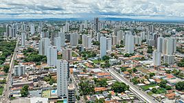
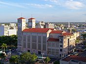
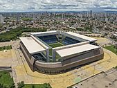
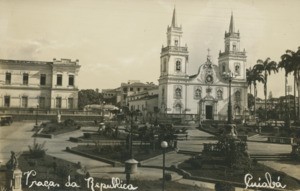
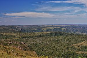
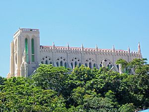
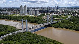
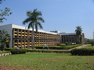
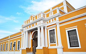
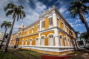
From the top, from left to right: panoramic view of Cuiabá; telecommunications tower; Cathedral Basilica of the Good Lord Jesus; Sergio Motta Bridge; Church of Nossa Senhora do Bom Despacho; Geodesic Center of South America; Arena Pantanal.
|
|||
|
|||
| Nickname(s):
Cidade Verde ("Green City")
|
|||
| Motto(s):
Capital da Amazônia Meridional (Capital of the Southern Amazon)
|
|||
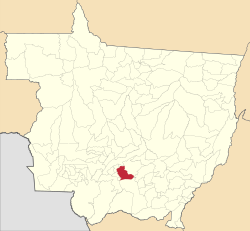
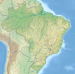
Location in Mato Grosso
|
|||
| Country | |||
| Region | Central-West | ||
| State | |||
| Founded | April 8, 1719 | ||
| Area | |||
| • Municipality | 3,291 km2 (1,271 sq mi) | ||
| Elevation | 165 m (541 ft) | ||
| Population
(2020)
|
|||
| • Municipality | 618,124 | ||
| • Density | 187.823/km2 (486.46/sq mi) | ||
| • Metro | 927,362 | ||
| Demonym(s) | cuiabano | ||
| Racial makeup (2022) | |||
| • Pardo | 54.92% | ||
| • White | 30.71% | ||
| • Black | 13.59% | ||
| • Yellow | 0.54% | ||
| • Indigenous | 0.23% | ||
| Time zone | UTC-4 (UTC-4) | ||
| Postal code |
from 78000-001 to 78109-999
|
||
| Area code | +55 65 | ||
| HDI (2010) | 0.785 – high | ||
Cuiabá is the capital city of the Brazilian state of Mato Grosso. It is located very close to the center of South America. Cuiabá and the nearby city of Várzea Grande form a large urban area together.
The city's name comes from an old Bororo word. It means 'arrow-fishing'. Cuiabá was founded in 1719 during a time when people were rushing to find gold. It has been the state capital since 1818. Today, it is an important trading hub for farming and cattle raising. Cuiabá is one of the fastest-growing cities in Brazil. This growth is linked to the rise of agribusiness in Mato Grosso. The city was also one of the places that hosted games for the 2014 FIFA World Cup.
Cuiabá is home to the Federal University of Mato Grosso. It also has the biggest football stadium in the state, called Arena Pantanal. The city has a rich mix of cultures. These include European, African, and Native American influences. You can see this in its many museums. Cuiabá is also famous for its delicious cuisine, lively dance, unique music, and beautiful craftwork. People often call it the "Southern gate to the Amazon". Cuiabá has a hot and humid tropical climate.
Contents
Cuiabá's Story: A Look Back in Time
How Cuiabá Began: The Colonial Period
The first Portuguese explorers to reach the Cuiabá area were called bandeirantes. These were explorers and fortune hunters from the São Paulo region. They helped Brazil expand westward. This included the Mato Grosso region.
One bandeirante, Manoel de Campos Bicudo, visited the area in 1673 and 1682. He started the first small village there. It was where the Coxipó River flows into the Cuiabá River. He named it São Gonçalo Beira-Rio.
Later, in 1718, another bandeirante named Pascoal Moreira Cabral arrived. He found the village empty. He went up the Coxipó River to find and enslave local people. He fought a battle with the Coxiponé Indians and lost. But when the bandeirantes returned, they found gold! They then enslaved local people to mine for gold.
Cabral told the São Paulo leaders about his discovery on April 8, 1719. He asked to be the "guardian and supervisor" of the mines. A "gold rush" quickly followed his letter. Many gold seekers came from São Paulo. Cabral managed the mines until he died in 1724.
Cuiabá was officially founded on January 1, 1727. It was named Vila Real do Senhor Bom Jesus de Cuiabá. This name came from a district started two years earlier. The Church of Our Lady of the Rosary was built in the town center. It marked a place where a lot of gold was found. In 1746, an earthquake destroyed much of the town.
Cuiabá in the 1800s
Cuiabá became a township in 1818. In 1835, it became the capital of the Province of Mato Grosso. It replaced Vila Bela da Santíssima Trindade. Many people moved from the old capital to Cuiabá.
From the late 1700s until the Paraguayan War (1864-1870), Cuiabá stayed small. The war, however, brought some improvements. It also brought a short time of economic growth. Cuiabá supplied food and wood to Brazilian soldiers. After the war, the city was mostly forgotten. The government even used it to send away politicians who caused trouble. Because it was so isolated, Cuiabá kept many old Brazilian traditions for a long time.
Cuiabá in the 1900s and 2000s
Starting in 1930, Cuiabá became less isolated. New roads were built, and then airplanes arrived. The town grew quickly from 1960 onwards. This happened after Brasília, the new Brazilian capital, was built.
In the 1970s and 1980s, Cuiabá grew even faster. Farming became more modern. Roads were used to transport soybeans and rice to be sold overseas. The city grew from 50,000 people in 1960 to over 250,000 by 1980.
Since 1990, the population growth has slowed down. Other towns in the state started attracting more people. Tourism has also become important for Cuiabá's economy. In 2023, a UN study said Cuiabá was one of the ten best cities in Brazil to live in. It was also called the second Brazilian city that improved the most in the last ten years.
Exploring Cuiabá's Geography
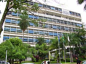
Cuiabá shares borders with several towns. These include Chapada dos Guimarães, Campo Verde, Santo Antônio do Leverger, Várzea Grande, Jangada, and Acorizal. The city is a meeting point for many important roads and rivers. However, sand banks in the river mean that large ships cannot use the waterways anymore.
Cuiabá has the third most important airport in Brazil's Mid-West region. The city is also a key center for a rich farming area. It is known throughout Brazil as one of the country's hottest cities. Temperatures often go above 40°C (104°F).
In central Cuiabá, there is an obelisk. This monument marks what was once thought to be the exact center of the South American continent. This calculation was made in 1909. However, newer measurements in the 1990s found the true center. It is about 45 km (28 mi) northeast of Cuiabá, near Chapada dos Guimarães.
The city is in a special area where three major Brazilian ecosystems meet. These are the Amazon, Cerrado, and Pantanal. Cuiabá is also near the Chapada dos Guimarães mountain range. This range blocks cold air, which helps cause the very hot weather. Cuiabá is also known as the "Southern gate to the Amazon."
The city's area includes part of the Rio da Casca Ecological Station. This is a protected natural area.
Cuiabá's Climate
Cuiabá has a tropical savanna climate. This means it's usually hot and humid. It is famous for its intense heat. Temperatures can sometimes drop to 10°C (50°F) in winter. This is unusual and happens when cold air comes from the south. These cooler days usually last only one or two days.
Most of the rain falls from October to April. From May to September, the air is dry. This stops rain from forming. The average yearly rainfall is about 1,454.5 mm (57.26 in). The most rain falls from December to March. The average high temperature is about 33°C (91°F). But it can reach 40°C (104°F) or more in the hottest months. On rainy days, the high temperature is usually around 28°C (82°F). The average low in July, the coldest month, is 17.1°C (62.8°F).
| Climate data for Cuiaba (1981–2010) | |||||||||||||
|---|---|---|---|---|---|---|---|---|---|---|---|---|---|
| Month | Jan | Feb | Mar | Apr | May | Jun | Jul | Aug | Sep | Oct | Nov | Dec | Year |
| Record high °C (°F) | 38.2 (100.8) |
37.4 (99.3) |
37.6 (99.7) |
38.1 (100.6) |
36.4 (97.5) |
37.0 (98.6) |
38.4 (101.1) |
41.8 (107.2) |
44 (111) |
44.2 (111.6) |
41.1 (106.0) |
42.4 (108.3) |
44.2 (111.6) |
| Mean daily maximum °C (°F) | 32.6 (90.7) |
32.8 (91.0) |
32.9 (91.2) |
33.0 (91.4) |
31.4 (88.5) |
31.3 (88.3) |
32.0 (89.6) |
34.1 (93.4) |
34.3 (93.7) |
34.3 (93.7) |
33.6 (92.5) |
32.9 (91.2) |
33.0 (91.4) |
| Daily mean °C (°F) | 27.0 (80.6) |
26.9 (80.4) |
26.8 (80.2) |
26.6 (79.9) |
24.7 (76.5) |
23.5 (74.3) |
23.4 (74.1) |
25.3 (77.5) |
26.8 (80.2) |
27.9 (82.2) |
27.5 (81.5) |
27.2 (81.0) |
26.1 (79.0) |
| Mean daily minimum °C (°F) | 23.6 (74.5) |
23.4 (74.1) |
23.3 (73.9) |
22.7 (72.9) |
20.1 (68.2) |
18.0 (64.4) |
17.1 (62.8) |
18.6 (65.5) |
21.1 (70.0) |
23.2 (73.8) |
23.4 (74.1) |
23.5 (74.3) |
21.5 (70.7) |
| Record low °C (°F) | 20.5 (68.9) |
19.2 (66.6) |
15.4 (59.7) |
13.8 (56.8) |
9.1 (48.4) |
7.4 (45.3) |
4.8 (40.6) |
7.6 (45.7) |
10.5 (50.9) |
13.3 (55.9) |
14.7 (58.5) |
16.2 (61.2) |
4.8 (40.6) |
| Average precipitation mm (inches) | 247.5 (9.74) |
220.4 (8.68) |
217.5 (8.56) |
117.8 (4.64) |
50.4 (1.98) |
19.4 (0.76) |
16.0 (0.63) |
22.1 (0.87) |
51.3 (2.02) |
114.0 (4.49) |
172.9 (6.81) |
205.2 (8.08) |
1,454.5 (57.26) |
| Average precipitation days (≥ 1.0 mm) | 17 | 14 | 15 | 10 | 4 | 1 | 1 | 2 | 4 | 8 | 11 | 15 | 102 |
| Average relative humidity (%) | 81.7 | 82.4 | 82.7 | 80.0 | 78.1 | 73.8 | 68.5 | 61.3 | 63.7 | 70.3 | 75.7 | 78.1 | 74.7 |
| Mean monthly sunshine hours | 155.6 | 149.6 | 179.5 | 209.0 | 216.7 | 200.7 | 241.8 | 226.7 | 163.4 | 188.4 | 181.9 | 157.6 | 2,270.9 |
| Source: Instituto Nacional de Meteorologia | |||||||||||||
Plants and Green Spaces
Cuiabá has several important green areas. The Massairo Okamura State Park is a green space in the city center. It has plants typical of the cerrado region. This park helps protect the sources of the Barbado and Moinho streams.
The Zé Bolo Flô State Park is in the Grande Coxipó district. The city also has the Mãe Bonifácia State Park. This park was created in 2000 and also features typical cerrado trees.
The "cerrado" is a type of savanna. It has twisted trees with thick bark and stiff leaves. Many plants have deep roots to store water. The thick bark and roots help these plants survive fires. These adaptations allow them to grow back after a fire.
How Far is Cuiabá?
- From São Paulo: 1,690 km (1,050 mi)
- From Rio de Janeiro: 2,090 km (1,300 mi)
- From Brasília: 1,130 km (700 mi)
Cuiabá's Economy: How the City Makes Money
Cuiabá's economy mainly focuses on trade, services, and industry. The trade and service businesses in Cuiabá are important for the entire state. This is because many people from smaller farming towns travel to the capital. They come to get services and buy things they can't find elsewhere.
The industrial part of the economy is mostly about agribusiness. This means processing food products. Many factories are located in the Industrial District of Cuiabá (DIICC), which started in 1978. Even though Mato Grosso is a big farming state, Cuiabá itself mostly has small vegetable farms. These are often run by families or groups.
In 2003, Cuiabá's GDP (the total value of goods and services produced) was 4.75 billion reals. This was about 22% of the state's total GDP. The greater Cuiabá area has four large shopping centers. It also has eight smaller shopping galleries. In 2006, the GDP for the city was R$7,189,521,000. The average income per person in the city was R$13,244 in 2006.
Learning in Cuiabá: Education
English is taught in high schools as part of the official lessons.
Here are some of the main higher education places:
- IFMT - Instituto Federal de Educação, Ciência e Tecnologia de Mato Grosso (Public)
- Universidade Federal de Mato Grosso (UFMT) (Public)
- Universidade de Cuiabá (Unic) (Private)
- And many other private schools.
Cuiabá's Culture: Art, Music, and Traditions
Cuiabá has a rich local culture. It is a mix of Portuguese, African, and Native American influences. This can be seen in its unique food, dance, crafts, and music. Traditionally, local dance and music were linked to worshipping Catholic saints. Saint Benedict is the patron saint of Cuiabá.
Museums to Visit
Cuiabá has many museums where you can learn about its history and culture:
- Museum Hill of the Old Cistern
- Memorial of Mato Grosso
- Museum of the Image and Sound of Cuiabá
- Artisan's home
- Museum of Rio Cuiabá and Municipal Aquarius
- Memorial of the Waters
- Museum of Education and Teatro Maria of Arruda Müller
- Museum of Sacred Art of Cuiabá
- Museum Couto Magalhães
- Memorial to Pope John Paul II
- Historical and Geographical Institute of Mato Grosso
- Mato Grosso Academy of Letters (located at the House of the Baron of Melgaço)
- Institute of the Historical and Environmental Patrimony National–Cuiabá
- Palace of the Instruction
- Museum of the History of Mato Grosso
- Museum of the Movies (located in the Cine Teatro of Cuiabá)
- Arsenal de Guerra de Cuiabá (now SESC Arsenal and Museum of the Swampland)
Carnival Fun
Carnaval in Brazil is a four-day celebration before Lent. Like other big cities in Brazil, Cuiabá has many parties. These are known as "bailes do Carnaval." Cuiabá also has an off-season Carnaval. It is called "Carnaval fora de época" or "micareta." In Cuiabá, it's known as "micarecuia."
Old Buildings and Protected Areas
Cuiabá has many old buildings from the 1700s and 1800s. Many of these are protected as national, state, and city monuments. The Historic Center of Cuiabá became a national monument in 1993.
Some of the specially protected buildings include:
- Church of Our Lady of the Rosary and Saint Benedict
- Presbyterian Church of Cuiabá
- Fountain of Mundéu
Getting Around Cuiabá: Transportation
International Airport
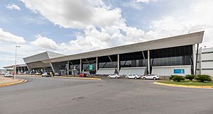
The Marechal Rondon International Airport connects Cuiabá to many Brazilian cities. It also has some international flights. The airport's runway opened in 1956. In 1975, Infraero took over the airport. They made many improvements to the airport.
In 1996, Marechal Rondon Airport started receiving international flights. It is about 10 km (6 mi) from the city center. Today, it serves over 900,000 passengers each year. The airport has one main building with two levels. The lower level has all the check-in counters. The upper level has shops, restaurants, and an observation lounge.
Highways
Cuiabá is connected to the Pacific Ocean by the Interoceanic Highway. It is also connected to the Atlantic Ocean by the BR-364 Highway.
Light Rail Project
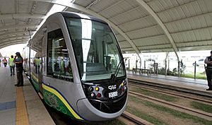
A 22 km (14 mi) light rail line was planned. It was meant to connect Cuiabá with Várzea Grande and the international airport. It was supposed to be ready for the 2014 FIFA World Cup. However, due to problems, construction stopped. The line was never completed or used.
Pipeline for Energy
Thermal and hydroelectric power plants near Cuiabá grew in 2000. This happened after the Pantanal Pipeline was finished. This natural gas pipeline runs between Mato Grosso and Bolivia.
Sports in Cuiabá
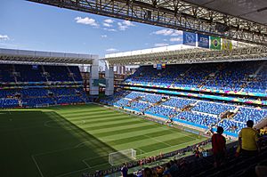
Cuiabá was one of 12 cities chosen to host games for the 2014 FIFA World Cup. The games were played at the Arena Pantanal. This stadium was finished in April 2014. It can hold 42,968 people. The stadium hosted four group matches during the tournament.
The Arena Pantanal replaced the old Estádio José Fragelli (Verdão). Verdão was the city's main football stadium. It was torn down in 2010 to make way for the new stadium. The architects focused on making the new stadium sustainable. It has plants and trees in its four corner areas. The Arena Pantanal is now the home stadium for local teams Mixto EC and Cuiabá EC. Next to the football stadium is the Tocantins Gymnasium.
The stadium has a car park with 15,000 spaces. The local team Mixto holds the record for most state titles. They have won the Campeonato Mato-Grossense 24 times. Mixto is also the only club from Mato Grosso to have played in Brazil's top football league, the Brasileirão, in 1976 and 1986.
Sister Cities
 Kyzyl, Tuva, Russia
Famous People from Cuiabá
- Felipe Lima, a swimmer who was a World Championship runner-up.
- David Moura, a judoka (judo athlete) who was a World Championship runner-up.
- Igor Queiroz, a Greco-Roman wrestler.
- Lenísio, a futsal player and world champion.
- Vinicius, a futsal player and world champion.
- Eurico Gaspar Dutra, a former president of Brazil.
See also
In Spanish: Cuiabá para niños
 | John T. Biggers |
 | Thomas Blackshear |
 | Mark Bradford |
 | Beverly Buchanan |


