
Cumberland County, Illinois facts for kids
Quick facts for kids
Cumberland County
|
|
|---|---|

|
|

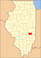
Location within the U.S. state of Illinois
|
|
 Illinois's location within the U.S. |
|
| Country | |
| State | |
| Founded | 1823 |
| Named for | Cumberland Road |
| Seat | Toledo |
| Largest city | Neoga |
| Area | |
| • Total | 347 sq mi (900 km2) |
| • Land | 346 sq mi (900 km2) |
| • Water | 1.0 sq mi (3 km2) 0.3% |
| Population
(2020)
|
|
| • Total | 10,450 |
| • Density | 30.12/sq mi (11.628/km2) |
| Congressional district | 12th |
Cumberland County is a place in Illinois, a state in the United States. In 2020, about 10,450 people lived here. The main town, called the county seat, is Toledo.
Cumberland County is part of a larger area that includes the towns of Charleston and Mattoon.
Contents
History of Cumberland County
Cumberland County was created a long time ago, on March 2, 1823. It was formed from parts of another county called Coles County.
The county got its name from the National Road, also known as the Cumberland Road. This important road was planned to go right through the area.
Geography and Nature
Cumberland County covers about 347 square miles. Most of this area, about 346 square miles, is land. A small part, about 1 square mile, is water.
Weather in Cumberland County
| Weather chart for Toledo, Illinois | |||||||||||||||||||||||||||||||||||||||||||||||
|---|---|---|---|---|---|---|---|---|---|---|---|---|---|---|---|---|---|---|---|---|---|---|---|---|---|---|---|---|---|---|---|---|---|---|---|---|---|---|---|---|---|---|---|---|---|---|---|
| J | F | M | A | M | J | J | A | S | O | N | D | ||||||||||||||||||||||||||||||||||||
|
2
33
17
|
2.1
39
21
|
3.1
50
32
|
3.8
62
42
|
4
73
53
|
4.2
83
63
|
4.2
86
66
|
3.3
84
64
|
3.1
78
56
|
3
66
45
|
3.7
51
33
|
2.8
38
22
|
||||||||||||||||||||||||||||||||||||
| temperatures in °F precipitation totals in inches source: The Weather Channel |
|||||||||||||||||||||||||||||||||||||||||||||||
|
Metric conversion
|
|||||||||||||||||||||||||||||||||||||||||||||||
The weather in Toledo, the county seat, changes a lot throughout the year. In January, the average temperature is around 17°F (which is very cold!). In July, it gets much warmer, with average temperatures around 86°F.
The coldest temperature ever recorded was -23°F in January 1985. The hottest was 111°F in July 1954. The county also gets rain, with the most rain usually falling in June.
Neighboring Counties
Cumberland County shares borders with several other counties:
- Coles County to the north
- Clark County to the east
- Jasper County to the south
- Effingham County to the southwest
- Shelby County to the west
Main Roads and Transportation
Several important roads pass through Cumberland County, making it easy to travel.
 Interstate 57
 Interstate 70
 U.S. Route 40
 U.S. Route 45
 Illinois Route 49
 Illinois Route 121
 Illinois Route 130
The county also has public transportation provided by the Rides Mass Transit District.
People of Cumberland County
| Historical population | |||
|---|---|---|---|
| Census | Pop. | %± | |
| 1850 | 3,718 | — | |
| 1860 | 8,311 | 123.5% | |
| 1870 | 12,223 | 47.1% | |
| 1880 | 13,759 | 12.6% | |
| 1890 | 15,443 | 12.2% | |
| 1900 | 16,124 | 4.4% | |
| 1910 | 14,281 | −11.4% | |
| 1920 | 12,858 | −10.0% | |
| 1930 | 10,419 | −19.0% | |
| 1940 | 11,698 | 12.3% | |
| 1950 | 10,496 | −10.3% | |
| 1960 | 9,936 | −5.3% | |
| 1970 | 9,772 | −1.7% | |
| 1980 | 11,062 | 13.2% | |
| 1990 | 10,670 | −3.5% | |
| 2000 | 11,253 | 5.5% | |
| 2010 | 11,048 | −1.8% | |
| 2020 | 10,450 | −5.4% | |
| 2023 (est.) | 10,261 | −7.1% | |
| U.S. Decennial Census 1790-1960 1900-1990 1990-2000 2010 |
|||

In 2010, there were 11,048 people living in Cumberland County. Most of the people (about 98.3%) were white. A small number were from other racial backgrounds. About 0.7% of the population was of Hispanic or Latino origin.
Many families live in the county. In 2010, about 31.3% of households had children under 18 living with them. The average age of people in the county was about 40.9 years old.
Towns and Villages
Cumberland County has several communities where people live.
Cities
- Neoga
- Casey (most of this city is in Clark County)
Villages
- Greenup
- Jewett
- Montrose (most of this village is in Effingham County)
- Toledo (this is the county seat, the main town)
Townships
The county is also divided into eight smaller areas called townships:
- Cottonwood
- Crooked Creek
- Greenup
- Neoga
- Spring Point
- Sumpter
- Union
- Woodbury
Other Communities
There are also many smaller, unincorporated communities in the county. This means they don't have their own local government like cities or villages do.
Schools and Education
Cumberland County has two main school districts that serve the students living there:
- Neoga Community Unit School District 3
- Cumberland Community Unit School District 77
Images for kids
-
Cumberland County at the time of its creation in 1823

See also
 In Spanish: Condado de Cumberland (Illinois) para niños
