Effingham County, Illinois facts for kids
Quick facts for kids
Effingham County
|
||
|---|---|---|

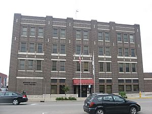
Effingham County Government Center and Jail in Effingham
|
||
|
||

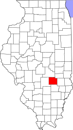
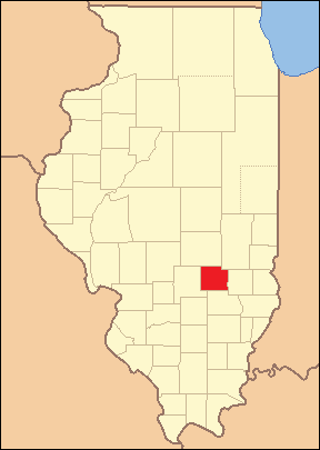
Location within the U.S. state of Illinois
|
||
 Illinois's location within the U.S. |
||
| Country | ||
| State | ||
| Founded | 1831 | |
| Named for | Thomas Howard, 3rd Earl of Effingham | |
| Seat | Effingham | |
| Largest city | Effingham | |
| Area | ||
| • Total | 480 sq mi (1,200 km2) | |
| • Land | 479 sq mi (1,240 km2) | |
| • Water | 1.2 sq mi (3 km2) 0.3% | |
| Population
(2020)
|
||
| • Total | 34,668 | |
| • Density | 72.2/sq mi (27.89/km2) | |
| Time zone | UTC−6 (Central) | |
| • Summer (DST) | UTC−5 (CDT) | |
| Congressional district | 12th | |
Effingham County is a county in the south central part of Illinois, a U.S. state. In 2020, about 34,668 people lived here. The main city and county seat is Effingham.
Other towns in Effingham County include Altamont, Teutopolis, Beecher City, Montrose, Dieterich, Shumway, Watson, Mason, and Edgewood. Effingham County is part of the Effingham, IL Micropolitan Statistical Area.
Contents
History of Effingham County
Effingham County was created in 1831. It was formed from parts of Fayette and Crawford counties.
The county might have been named after Thomas Howard, 3rd Earl of Effingham. He was a British general who refused to fight against the American Colonies in 1775. The name "Effingham" comes from an old English word meaning "Effa's house." Some new information suggests it was named after a surveyor named Effingham. However, there is no clear written proof about which "Effingham" the county was named after.
Geography and Landscape
Effingham County covers about 480 square miles. Most of this area, about 479 square miles, is land. Only a small part, about 1.2 square miles, is water.
Near Effingham, along Interstate 70, stands a very tall white cross. It is 198 feet high and is one of the tallest crosses in the world. About 35,000 vehicles pass by it every day. It took over 200 tons of steel to build this large cross.
Weather and Climate in Effingham
| Weather chart for Effingham, Illinois | |||||||||||||||||||||||||||||||||||||||||||||||
|---|---|---|---|---|---|---|---|---|---|---|---|---|---|---|---|---|---|---|---|---|---|---|---|---|---|---|---|---|---|---|---|---|---|---|---|---|---|---|---|---|---|---|---|---|---|---|---|
| J | F | M | A | M | J | J | A | S | O | N | D | ||||||||||||||||||||||||||||||||||||
|
2.4
35
18
|
2.5
41
22
|
3.6
52
32
|
4.1
64
42
|
4.5
74
52
|
4.3
83
62
|
4.5
87
66
|
2.9
85
63
|
3
78
55
|
3
67
43
|
4.1
52
34
|
3.3
40
23
|
||||||||||||||||||||||||||||||||||||
| temperatures in °F precipitation totals in inches source: The Weather Channel |
|||||||||||||||||||||||||||||||||||||||||||||||
|
Metric conversion
|
|||||||||||||||||||||||||||||||||||||||||||||||
The weather in Effingham County changes throughout the year. In January, the average low temperature is about 18°F. In July, the average high temperature is about 87°F. The coldest temperature ever recorded was -29°F in January 1915. The hottest was 111°F in July 1954.
The county gets rain and snow throughout the year. The driest month is usually January, with about 2.38 inches of precipitation. July is often the wettest, with about 4.51 inches.
Neighboring Counties
Effingham County shares borders with these other counties:
- Cumberland County - to the northeast
- Jasper County - to the east
- Clay County - to the south
- Fayette County - to the west
- Shelby County - to the northwest
Main Roads and Highways
Several important roads pass through Effingham County:
 Interstate 57
 Interstate 70
 U.S. Route 40
 U.S. Route 45
 Illinois Route 32
 Illinois Route 33
 Illinois Route 37
 Illinois Route 128
Public Transportation
- Effingham station
- List of intercity bus stops in Illinois
People of Effingham County (Demographics)
| Historical population | |||
|---|---|---|---|
| Census | Pop. | %± | |
| 1840 | 1,675 | — | |
| 1850 | 3,799 | 126.8% | |
| 1860 | 7,816 | 105.7% | |
| 1870 | 15,653 | 100.3% | |
| 1880 | 18,920 | 20.9% | |
| 1890 | 19,358 | 2.3% | |
| 1900 | 20,465 | 5.7% | |
| 1910 | 20,055 | −2.0% | |
| 1920 | 19,556 | −2.5% | |
| 1930 | 19,013 | −2.8% | |
| 1940 | 22,034 | 15.9% | |
| 1950 | 21,675 | −1.6% | |
| 1960 | 23,107 | 6.6% | |
| 1970 | 24,608 | 6.5% | |
| 1980 | 30,944 | 25.7% | |
| 1990 | 31,704 | 2.5% | |
| 2000 | 34,264 | 8.1% | |
| 2010 | 34,242 | −0.1% | |
| 2020 | 34,668 | 1.2% | |
| 2023 (est.) | 34,331 | 0.3% | |
| U.S. Decennial Census 1790-1960 1900-1990 1990-2000 2010-2013 |
|||
In 2010, there were 34,242 people living in Effingham County. Most people (97.6%) were white. A small number were Asian (0.4%), Black (0.2%), or American Indian (0.1%). About 1.7% of the population was of Hispanic or Latino background.
Many people in the county have German (41.6%), Irish (10.0%), American (9.3%), or English (8.8%) family backgrounds. The average age of people in the county was about 39.2 years old.
Communities in Effingham County
Cities
Town
Villages
Townships
Effingham County is divided into fifteen smaller areas called townships:
- Banner
- Bishop
- Douglas
- Jackson
- Liberty
- Lucas
- Mason
- Moccasin
- Mound
- St. Francis
- Summit
- Teutopolis
- Union
- Watson
- West
Unincorporated Communities
These are smaller communities that are not officially part of a city, town, or village:
- Dexter
- Elliottstown
- Funkhouser
- Gilmore
- Heartville
- Moccasin
See also
 In Spanish: Condado de Effingham (Illinois) para niños
 | William Lucy |
 | Charles Hayes |
 | Cleveland Robinson |


