Curlew Valley facts for kids
Quick facts for kids Curlew Valley |
|
|---|---|
| Length | 23 mi (37 km) |
| Width | 10 mi (16 km) |
| Geography | |
| Location | Utah & Idaho |
| Population centers | |
| Borders on | Great Salt Lake-S (Hogup Mountains-SSW) Raft River Mountains-W Curlew National Grassland-NNE Hansel Mountains-E & SE Locomotive Springs Wildlife Management Area-SSW |
| Rivers | Deep Creek, Great Salt Lake |
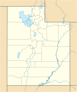
The Curlew Valley is a long valley that stretches about 23 miles (37 km). It's found on the northern edge of the Great Salt Lake in Utah and goes up into southern Idaho. In Utah, the valley meets the Locomotive Springs Wildlife Management Area. It also touches a large, flat area of salt near the Great Salt Lake.
What is the Curlew Valley like?
The Curlew Valley runs from the southwest to the northeast. A stream called Deep Creek flows along the western side of the valley. As you go northeast, Deep Creek turns east and then north into Idaho. It passes by the small community of Stone. Stone is also near the southern edge of the Curlew National Grassland.
Close to Stone, but a bit south, is the town of Snowville in Utah. Interstate 84 cuts across the valley. It comes from the northwest (Idaho) and goes southeast. This road passes between the Hansel Mountains to the south and the North Hansel Mountains. It then continues through the Blue Creek Valley and on to Brigham City.
The middle of the Curlew Valley is a bit southeast of a place called Coyote Springs. This area is right on Deep Creek. To the east, you can see Cedar Hill, a mountain peak that is about 5,181 feet (1,579 meters) tall. To the west, near Coyote Springs, is another peak called Wildcat Hills, which is about 5,077 feet (1,547 meters) high.
Rose Ranch Reservoir
At the northeast end of the valley, the Stone Hills make Deep Creek turn east. Here, about 3 to 5 miles (5 to 8 km) west and southwest of Snowville, you'll find the Rose Ranch Reservoir. This reservoir was created on Deep Creek.
History of Curlew Valley

The Curlew Valley gets its name from the curlew bird. These birds are a type of snipe that like to build their nests there.
The first white explorers known to visit the valley were a group of trappers led by Peter Skene Ogden. They camped on Deep Creek on December 27, 1828.
Later, on September 18, 1848, some members of the Mormon Battalion camped on Deep Creek. They were on their way home from California to Salt Lake City. They also camped in a cave about 1 mile (1.6 km) east, which was called Hollow Rock.
Deep Creek starts from a large spring in Holbrook. This spring flows through the middle of the valley and has always had water, even during dry years. About 1 mile (1.6 km) southwest of the spring is a spot called Rocky Ford. Pioneers could cross the creek here because of the solid rock bottom.
In 1869, William Robbins, Thomas Showell, and William M. Harris settled at a place called the Curlew Sinks. This is about 10 miles (16 km) west of the spring, where Deep Creek disappears into the ground. The old pioneer trail and the stagecoach line used to pass right through their ranch.
The first town in the Curlew Valley was Snowville. It was started because Brigham Young asked for it. The town was named to honor Lorenzo Snow. He was an important leader in The Church of Jesus Christ of Latter-day Saints at the time. He later became the fifth President of the Church from 1898 to 1901. Snowville was officially planned out on August 14, 1878.
 | Claudette Colvin |
 | Myrlie Evers-Williams |
 | Alberta Odell Jones |


