
Raft River Mountains facts for kids
Quick facts for kids Raft River Mountains |
|
|---|---|

Raft River Mountains from the southeast
|
|
| Highest point | |
| Peak | Bull Mountain |
| Elevation | 9,925 ft (3,025 m) |
| Dimensions | |
| Length | 40 mi (64 km) E/W |
| Width | 35 mi (56 km) N/S |
| Area | 765 sq mi (1,980 km2) |
| Geography | |
| Country | United States |
| State | Utah |
| Parent range | Basin and Range Province |
The Raft River Mountains are a cool mountain range found in northern Utah, in a place called Box Elder County. These mountains are part of the Sawtooth National Forest, which is a big protected area.
The tallest point in this range is Bull Mountain. It stands super tall at 9,925 ft (3,025 m)! You can also find the old ghost town of Yost on the northern side of these mountains.
Water from the northern parts of the Raft River Mountains flows into the Raft River. This river then joins the Snake River, which eventually leads to the mighty Columbia River and finally the Pacific Ocean. On the other hand, water from the southern slopes drains into the famous Great Salt Lake.
Contents
Exploring the Raft River Mountains
These mountains are located inside the Sawtooth National Forest. The forest areas here are surrounded by drier lands like steppes and deserts.
The Raft River Mountains stretch from east to west. They are part of a larger area called the Basin and Range Province. This area also includes the Great Basin, which has cool features like the Bonneville Salt Flats.

Rocks and Geology of the Mountains
The main part of the Raft River Mountains is made of very old Precambrian metamorphic rocks. These rocks have been changed by heat and pressure over millions of years.
You can see a type of rock called Elba Quartzite, mixed with schist, on the southern slopes. Similar rocks are also found in the Grouse Creek Mountains nearby. Another type of quartzite from the Cambrian period (also very old!) is found in the western parts of the range. This quartzite is often used as building stone because it's strong and thinly layered.
Plants and Animals: Flora and Fauna
The Raft River Mountains are home to many different plants and animals. You can find pine trees and various rodents here. These species are typical for the Northern Basin & Range ecoregion, which is part of the larger Columbia Plateau.
Fun Activities and Camping
If you love the outdoors, the Raft River Mountains offer some great activities! The Bull Flat trail is a popular path that leads to Bull Flat, Bull Lake, and Bull Mountain. Along this trail, you might even pass by some old mines. There's also a campground near the start of the trail, perfect for a night under the stars.
Tallest Points: Peaks of the Raft River Mountains
The Raft River Mountains have many peaks, with Bull Mountain being the highest. Here's a list of some of the notable peaks:
| Mountain Peak | Elevation | Prominence | Isolation | Location |
|---|---|---|---|---|
| Bull Mountain | 9,925 ft 3025 m |
3,725 ft 1135 m |
24.3 mi 39.2 km |
41°54′42″N 113°21′55″W / 41.9117°N 113.3654°W |
| George Peak | 9,601 ft 2926 m |
581 ft 177 m |
6.21 mi 9.99 km |
41°53′21″N 113°28′59″W / 41.8893°N 113.4831°W |
| Peak 9,335 | 9,335 ft 2845 m |
515 ft 157 m |
3.14 mi 5.05 km |
41°55′47″N 113°25′16″W / 41.9296°N 113.4211°W |
| Peak 8,402 | 8,402 ft 2561 m |
582 ft 177 m |
2.03 mi 3.27 km |
41°54′51″N 113°30′14″W / 41.9143°N 113.5039°W |
| Mahagony Peaks | 8,340 ft 2542 m |
480 ft 146 m |
4.93 mi 7.93 km |
41°52′51″N 113°35′18″W / 41.8809°N 113.5884°W |
| Peak 8,220 East | 8,220 ft 2505 m |
320 ft 98 m |
2.80 mi 4.51 km |
41°51′54″N 113°32′18″W / 41.8649°N 113.5384°W |
| Peak 8,220 West | 8,220 ft 2505 m |
320 ft 98 m |
1.85 mi 2.98 km |
41°51′44″N 113°33′46″W / 41.8621°N 113.5628°W |
| Peak 8,140 | 8,140 ft 2481 m |
738 ft 225 m |
2.45 mi 3.94 km |
41°52′21″N 113°38′09″W / 41.8724°N 113.6357°W |
| Bally Mountains High Point | 8,060 ft 2457 m |
671 ft 205 m |
3.59 mi 5.78 km |
41°57′50″N 113°28′25″W / 41.9638°N 113.4737°W |
| Peak 7,980 | 7,980 ft 2432 m |
440 ft 134 m |
6.32 mi 10.17 km |
41°53′51″N 113°14′39″W / 41.8976°N 113.2443°W |
| Peak 7,875 | 7,875 ft 2400 m |
336 ft 102 m |
2.94 mi 4.73 km |
41°52′10″N 113°21′05″W / 41.8694°N 113.3515°W |
| Crystal Peak | 7,780 ft 2371 m |
354 ft 108 m |
1.69 mi 2.72 km |
41°55′08″N 113°13′40″W / 41.9188°N 113.2278°W |
| Bald Knoll | 7,484 ft 2281 m |
474 ft 144 m |
2.84 mi 4.57 km |
41°51′51″N 113°16′36″W / 41.8643°N 113.2766°W |
| Black Hills High Point | 7,100 ft 2164 m |
400 ft 122 m |
2.07 mi 3.33 km |
41°50′01″N 113°33′01″W / 41.8337°N 113.5503°W |
Images for kids
-
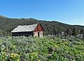
An old Forest Service Cabin in the Raft River Mountains
-
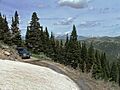
A road along a snowbank in the Raft River Mountains


