Bull Mountain (Box Elder County, Utah) facts for kids
Quick facts for kids Bull Mountain |
|
|---|---|

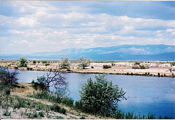
Bull Mountain and the Raft River Range
|
|
| Highest point | |
| Elevation | 9,938 ft (3,029 m) NAVD 88 |
| Prominence | 3,725 ft (1,135 m) |
| Listing | Utah county high points #25 |
| Geography | |
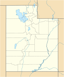
| Location | Box Elder County, Utah, U.S. |
| Parent range | Raft River Mountains |
| Topo map | USGS Standrod |
| Climbing | |
| Easiest route | 4-wheel drive road |
Bull Mountain is a tall peak in northern Utah, U.S.. It stands at about 9,938 feet (3,029 meters) high. Even though it's called Bull Mountain, it doesn't have an official name on maps. It's the highest point in the Raft River Mountains and in Box Elder County.
About Bull Mountain
Where is Bull Mountain located?
Bull Mountain is found in a part of the Sawtooth National Forest. This area is called the Raft River Division of the Minidoka Ranger District. The mountain is southeast of a town called Yost. It is also west of Snowville and south of Malta, Idaho.
What's it like on Bull Mountain?
The northern side of Bull Mountain has streams that flow into the Raft River. The Raft River then joins the Snake River. On the southern side, water from the mountain flows into the Great Salt Lake.
You can reach the top of Bull Mountain in a couple of ways. One way is by taking a long trail from the east side. Another way is by using a special road for 4-wheel drive vehicles from the west. The very top of the mountain is wide and flat. From there, you can see other mountain ranges. These include the Albion, Black Pine, and Wasatch mountains.
 | Jackie Robinson |
 | Jack Johnson |
 | Althea Gibson |
 | Arthur Ashe |
 | Muhammad Ali |


